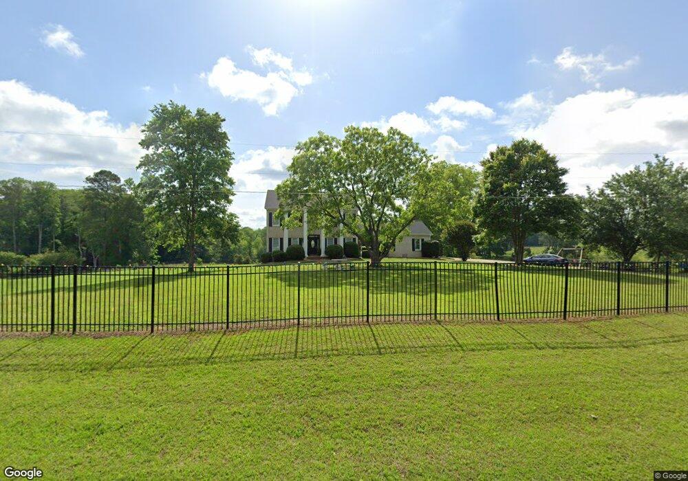
1178 Plowshare Rd Carrollton, GA 30117
Estimated Value: $326,700 - $354,000
3
Beds
2
Baths
1,377
Sq Ft
$246/Sq Ft
Est. Value
About This Home
This home is located at 1178 Plowshare Rd, Carrollton, GA 30117 and is currently estimated at $338,925, approximately $246 per square foot. 1178 Plowshare Rd is a home located in Carroll County with nearby schools including Mt. Zion Elementary School, Mt. Zion Middle School, and Mt. Zion High School.
Ownership History
Date
Name
Owned For
Owner Type
Purchase Details
Closed on
Dec 29, 2022
Sold by
Milligan Tonya
Bought by
Deepest Depths Llc
Current Estimated Value
Purchase Details
Closed on
Jul 26, 2021
Sold by
Phillips Weston W
Bought by
Google Bear Tr
Home Financials for this Owner
Home Financials are based on the most recent Mortgage that was taken out on this home.
Original Mortgage
$265,000
Interest Rate
3%
Mortgage Type
New Conventional
Purchase Details
Closed on
Sep 27, 2002
Sold by
Jackson Virginia Cum
Bought by
Phillips Weston W and Phillips Sheilah
Purchase Details
Closed on
Sep 19, 2001
Bought by
Jackson Virginia Cum
Create a Home Valuation Report for This Property
The Home Valuation Report is an in-depth analysis detailing your home's value as well as a comparison with similar homes in the area
Home Values in the Area
Average Home Value in this Area
Purchase History
| Date | Buyer | Sale Price | Title Company |
|---|---|---|---|
| Deepest Depths Llc | -- | -- | |
| Google Bear Tr | $265,000 | -- | |
| Phillips Weston W | $135,000 | -- | |
| Jackson Virginia Cum | -- | -- |
Source: Public Records
Mortgage History
| Date | Status | Borrower | Loan Amount |
|---|---|---|---|
| Previous Owner | Google Bear Tr | $265,000 |
Source: Public Records
Tax History Compared to Growth
Tax History
| Year | Tax Paid | Tax Assessment Tax Assessment Total Assessment is a certain percentage of the fair market value that is determined by local assessors to be the total taxable value of land and additions on the property. | Land | Improvement |
|---|---|---|---|---|
| 2024 | $2,924 | $107,020 | $44,314 | $62,706 |
| 2023 | $2,924 | $101,357 | $44,315 | $57,042 |
| 2022 | $2,197 | $75,281 | $44,315 | $30,966 |
| 2021 | $2,070 | $70,913 | $44,315 | $26,598 |
| 2020 | $1,985 | $67,931 | $44,315 | $23,616 |
| 2019 | $1,958 | $66,385 | $44,315 | $22,070 |
| 2018 | $1,939 | $64,817 | $44,315 | $20,502 |
| 2017 | $1,950 | $64,817 | $44,315 | $20,502 |
| 2016 | $1,667 | $64,817 | $44,315 | $20,502 |
| 2015 | $1,431 | $46,315 | $24,094 | $22,222 |
| 2014 | $1,437 | $46,315 | $24,094 | $22,222 |
Source: Public Records
Map
Nearby Homes
- 113 Natures Pointe Trail
- 304 Kodiak Rd
- 113 Richmond Dr
- 190 Marvin Gray Rd
- 1202 Mount Zion Rd
- 442 Plowshare Rd
- 132 Pinnacle Way
- 101 Bonnie Lynn Ln
- 2070 Lovvorn Rd
- 1423 Beulah Church Rd
- The Joey Plan at Hidden Hills
- The Daniel Plan at Hidden Hills
- 2994 Mount Zion Rd
- 2994 Mount Zion Rd Unit 1
- 2994 Mount Zion Rd Unit 3
- 85 Eureka Church Rd Unit 152
- 000 Beulah Church Rd
- 1178 Plowshare Rd
- 1178 Plowshare Rd
- 1178 Plowshare Rd
- 1178 Plowshare Rd
- 1195 Plowshare Rd
- 1183 Plowshare Rd
- 149 Harpers Way
- 1153 Plowshare Rd
- 1250 Plowshare Rd
- 1140 Plowshare Rd
- 145 Harpers Way
- 98 Harpers Run
- 1233 Plowshare Rd
- 139 Harpers Way
- 1127 Plowshare Rd
- 1127 Plowshare Rd
- 138 Harpers Way
- 86 Harpers Run
- 135 Harpers Way
- 78 Harpers Run