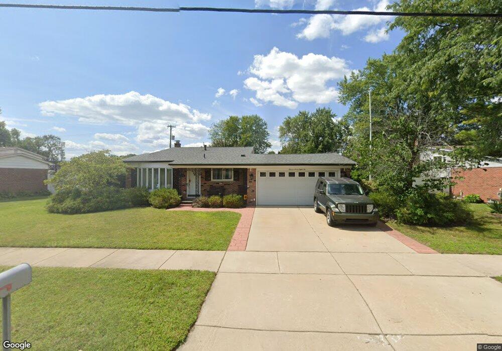
11786 Pardee Rd Taylor, MI 48180
Estimated Value: $220,335 - $266,000
Studio
1
Bath
1,595
Sq Ft
$154/Sq Ft
Est. Value
About This Home
This home is located at 11786 Pardee Rd, Taylor, MI 48180 and is currently estimated at $245,584, approximately $153 per square foot. 11786 Pardee Rd is a home located in Wayne County with nearby schools including Bernice Mcdowell Elementary School, Robert J. West Middle School, and Taylor High School.
Ownership History
Date
Name
Owned For
Owner Type
Purchase Details
Closed on
Jan 18, 2018
Sold by
Brumfield Laura W and Andrews Theresa C
Bought by
Andrews Jeffrey
Current Estimated Value
Home Financials for this Owner
Home Financials are based on the most recent Mortgage that was taken out on this home.
Original Mortgage
$106,250
Outstanding Balance
$89,639
Interest Rate
3.93%
Mortgage Type
Purchase Money Mortgage
Estimated Equity
$155,945
Purchase Details
Closed on
May 12, 2011
Sold by
Wukitsh Ruby J
Bought by
Wukitsh Ruby J
Create a Home Valuation Report for This Property
The Home Valuation Report is an in-depth analysis detailing your home's value as well as a comparison with similar homes in the area
Home Values in the Area
Average Home Value in this Area
Purchase History
| Date | Buyer | Sale Price | Title Company |
|---|---|---|---|
| Andrews Jeffrey | $125,000 | None Available | |
| Wukitsh Ruby J | -- | None Available |
Source: Public Records
Mortgage History
| Date | Status | Borrower | Loan Amount |
|---|---|---|---|
| Open | Andrews Jeffrey | $106,250 |
Source: Public Records
Tax History
| Year | Tax Paid | Tax Assessment Tax Assessment Total Assessment is a certain percentage of the fair market value that is determined by local assessors to be the total taxable value of land and additions on the property. | Land | Improvement |
|---|---|---|---|---|
| 2025 | $2,618 | $109,000 | $0 | $0 |
| 2024 | $2,535 | $106,300 | $0 | $0 |
| 2023 | $3,091 | $94,400 | $0 | $0 |
| 2022 | $2,304 | $78,100 | $0 | $0 |
| 2021 | $2,595 | $74,300 | $0 | $0 |
| 2020 | $2,789 | $70,500 | $0 | $0 |
| 2019 | $255,825 | $61,300 | $0 | $0 |
| 2018 | $1,979 | $54,300 | $0 | $0 |
| 2017 | $1,178 | $53,200 | $0 | $0 |
| 2016 | $2,504 | $51,800 | $0 | $0 |
| 2015 | $4,470 | $50,700 | $0 | $0 |
| 2013 | $4,450 | $46,200 | $0 | $0 |
| 2012 | $1,946 | $44,900 | $13,300 | $31,600 |
Source: Public Records
Map
Nearby Homes
- 11801 Moran St
- 11187 Pardee Rd
- 22155 Maplelawn Ave
- 22675 Goddard Rd
- 11119 Dudley St
- 11724 Syracuse St
- 6445 Pardee Rd
- 23722 Brest
- 11725 Cornell St
- 11078 Pine St
- 10769 Birch St
- 22901 Woodcreek Dr Unit 61
- 12312 Cornell St
- Telegraph Telegraph Rd
- 000 Pine Lot A St
- 000 Beechdaly
- 000 Pine Lot B St
- 23970 Northstone Village Dr Unit 6
- 13450 Pardee Rd
- 22243 Kinyon St Unit 3
- 11800 Pardee Rd
- 11714 Pardee Rd
- 11671 Moran St
- 11817 Moran St
- 11820 Pardee Rd
- 11700 Pardee Rd
- 11663 Moran St
- 11883 Moran St
- 11791 Pardee Rd
- 11590 Pardee Rd
- 11647 Moran St
- 11802 Moran St
- 11680 Moran St
- 11818 Moran St
- 11717 Pardee Rd
- 11825 Pardee Rd
- 11666 Moran St
- 11834 Moran St
- 11524 Pardee Rd
- 11631 Moran St
Your Personal Tour Guide
Ask me questions while you tour the home.