Estimated Value: $176,000 - $212,506
3
Beds
2
Baths
1,398
Sq Ft
$142/Sq Ft
Est. Value
About This Home
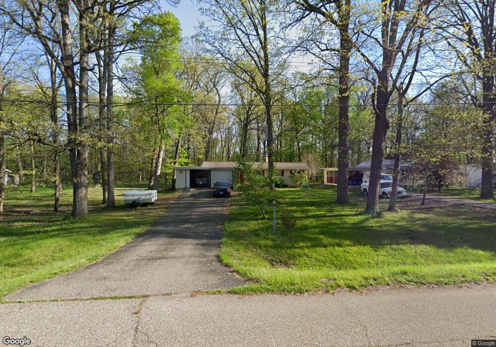
This home is located at 1179 Ransom Dr, Flint, MI 48507 and is currently estimated at $198,627, approximately $142 per square foot. 1179 Ransom Dr is a home located in Genesee County with nearby schools including Anderson Elementary School, McGrath Elementary School, and Grand Blanc West Middle School.
Ownership History
Date
Name
Owned For
Owner Type
Purchase Details
Closed on
Nov 22, 2010
Sold by
Triple Lee Properties Llc
Bought by
Bailey Katie J
Current Estimated Value
Purchase Details
Closed on
Jul 8, 2009
Sold by
Sutliff Kirk E
Bought by
Federal National Mortgage Association
Purchase Details
Closed on
Mar 7, 2003
Sold by
Conseco Finance Servicing Corp
Bought by
Sutliff Kirk E
Purchase Details
Closed on
Jul 25, 2001
Sold by
Ely Michael J and Ely Deborah L
Bought by
Conseco Finance Servicing Corp and Green Tree Financial Servicing Corp
Create a Home Valuation Report for This Property
The Home Valuation Report is an in-depth analysis detailing your home's value as well as a comparison with similar homes in the area
Home Values in the Area
Average Home Value in this Area
Purchase History
| Date | Buyer | Sale Price | Title Company |
|---|---|---|---|
| Bailey Katie J | $51,000 | Devon Title Agency | |
| Federal National Mortgage Association | $89,808 | None Available | |
| Sutliff Kirk E | $105,000 | Multiple | |
| Conseco Finance Servicing Corp | $125,692 | -- |
Source: Public Records
Tax History
| Year | Tax Paid | Tax Assessment Tax Assessment Total Assessment is a certain percentage of the fair market value that is determined by local assessors to be the total taxable value of land and additions on the property. | Land | Improvement |
|---|---|---|---|---|
| 2025 | $2,333 | $77,900 | $0 | $0 |
| 2024 | $1,333 | $75,500 | $0 | $0 |
| 2023 | $1,272 | $69,200 | $0 | $0 |
| 2022 | $2,099 | $65,800 | $0 | $0 |
| 2021 | $2,068 | $64,000 | $0 | $0 |
| 2020 | $1,165 | $59,100 | $0 | $0 |
| 2019 | $1,148 | $53,600 | $0 | $0 |
| 2018 | $1,876 | $50,700 | $0 | $0 |
| 2017 | $1,793 | $49,700 | $0 | $0 |
| 2016 | $1,772 | $42,500 | $0 | $0 |
| 2015 | $1,728 | $44,900 | $0 | $0 |
| 2012 | -- | $46,300 | $46,300 | $0 |
Source: Public Records
Map
Nearby Homes
- 1226 Harding Dr
- 0 Jefferson Blvd
- 0 Harding Dr Unit 20251056693
- 1110 Washington Dr
- 1075 E Hill Rd
- 1642 Wagon Wheel Ln
- 0 E Hill Rd Unit 20261004433
- 00 Mckinley Blvd
- 000 Mckinley Blvd
- 5400 Ali Dr
- 0000 Mckinley Blvd
- 0000 Coolidge Dr
- 1329 Arrowwood Ln
- 00 Coolidge Dr
- 000 Coolidge Dr
- 1045 Leisure Dr Unit 7
- 1142 Leisure Dr
- 5308 Sandalwood Ct
- 5128 Sandalwood Cir Unit 20
- 5152 Sandalwood Cir
- 1189 Ransom Dr Unit Bldg-Unit
- 1189 Ransom Dr
- 1199 Ransom Dr
- 1165 Ransom Dr
- 1157 Ransom Dr
- 1215 Ransom Dr
- 1149 Ransom Dr
- 1160 Ransom Dr
- 1174 Ransom Dr
- 1166 Ransom Dr
- 1139 Ransom Dr
- 1172 Harding Dr
- 1166 Harding Dr
- 1129 Ransom Dr
- 1140 Ransom Dr
- 1152 Ransom Dr
- 1188 Harding Dr
- 1198 Harding Dr
- 1150 Harding Dr
- 1154 Harding Dr
Your Personal Tour Guide
Ask me questions while you tour the home.