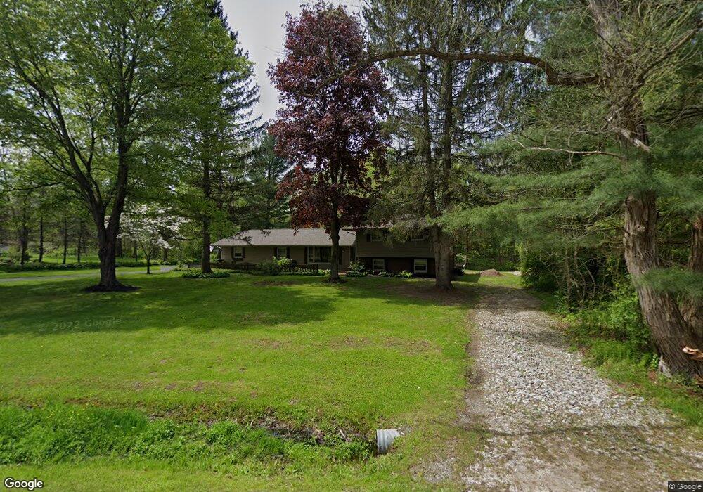
11790 Heath Rd Chesterland, OH 44026
Estimated Value: $366,000 - $391,000
4
Beds
2
Baths
2,275
Sq Ft
$165/Sq Ft
Est. Value
About This Home
This home is located at 11790 Heath Rd, Chesterland, OH 44026 and is currently estimated at $375,773, approximately $165 per square foot. 11790 Heath Rd is a home located in Geauga County with nearby schools including West Geauga High School and St Anselm School.
Ownership History
Date
Name
Owned For
Owner Type
Purchase Details
Closed on
May 27, 2025
Sold by
Peterson Scott C and Peterson Elisabeth L
Bought by
Peterson Family Trust and Peterson
Current Estimated Value
Purchase Details
Closed on
Nov 7, 1996
Sold by
Burgess N Jamey
Bought by
Peterson Scott C and Peterson Elizabeth L
Home Financials for this Owner
Home Financials are based on the most recent Mortgage that was taken out on this home.
Original Mortgage
$126,000
Interest Rate
8.26%
Mortgage Type
New Conventional
Purchase Details
Closed on
Feb 17, 1994
Sold by
Mccullough Michael H
Bought by
Burgess N Jamey
Create a Home Valuation Report for This Property
The Home Valuation Report is an in-depth analysis detailing your home's value as well as a comparison with similar homes in the area
Home Values in the Area
Average Home Value in this Area
Purchase History
| Date | Buyer | Sale Price | Title Company |
|---|---|---|---|
| Peterson Family Trust | -- | None Listed On Document | |
| Peterson Family Trust | -- | None Listed On Document | |
| Peterson Scott C | $186,000 | -- | |
| Burgess N Jamey | $150,000 | -- |
Source: Public Records
Mortgage History
| Date | Status | Borrower | Loan Amount |
|---|---|---|---|
| Previous Owner | Peterson Scott C | $126,000 |
Source: Public Records
Tax History Compared to Growth
Tax History
| Year | Tax Paid | Tax Assessment Tax Assessment Total Assessment is a certain percentage of the fair market value that is determined by local assessors to be the total taxable value of land and additions on the property. | Land | Improvement |
|---|---|---|---|---|
| 2024 | $4,741 | $109,770 | $19,220 | $90,550 |
| 2023 | $4,741 | $109,770 | $19,220 | $90,550 |
| 2022 | $3,650 | $72,450 | $16,100 | $56,350 |
| 2021 | $3,638 | $72,450 | $16,100 | $56,350 |
| 2020 | $3,782 | $72,450 | $16,100 | $56,350 |
| 2019 | $352 | $65,100 | $16,100 | $49,000 |
| 2018 | $3,489 | $65,100 | $16,100 | $49,000 |
| 2017 | $3,518 | $65,100 | $16,100 | $49,000 |
| 2016 | $3,699 | $64,720 | $16,100 | $48,620 |
| 2015 | $3,538 | $64,720 | $16,100 | $48,620 |
| 2014 | $3,425 | $64,720 | $16,100 | $48,620 |
| 2013 | $3,450 | $64,720 | $16,100 | $48,620 |
Source: Public Records
Map
Nearby Homes
- 9610 Wilson Mills Rd
- 9710 Wilson Mills Rd
- 12084 Heath Rd
- 11865 Africa Acres Dr
- 10036 Wilson Mills Rd
- 9753 Mulberry Rd
- V/L Heath Rd
- 11785 Stonegate Dr
- 9723 Thwing Rd
- 9448 Mayfield Rd
- 9475 Mayfield Rd
- 12790 Heath Rd
- 10504 Mulberry Rd
- 0 Merrie Ln
- VL Palomino Trail
- 8494 Sharp Ln
- 8371 Cranwood Dr
- 0 Fowlers Mill Rd Unit 5140846
- 11955 Fowlers Mill Rd
- 8701 Mayfield Rd Unit 194
- 11810 Heath Rd
- 11770 Heath Rd
- 11742 Hervie Dr
- 11830 Heath Rd
- 11820 Hervie Dr
- 11805 Heath Rd
- 11845 Hervie Dr
- 11850 Heath Rd
- 11801 Heath Rd
- 11727 Heath Rd
- 11755 Heath Rd
- 9480 Wilson Mills Rd
- 11867 Hervie Dr
- 11770 Legend Creek Dr
- 9450 Wilson Mills Rd
- 9432 Wilson Mills Rd
- 11775 Legend Creek Dr
- 11880 Sandgate Dr
- 11665 Heath Rd
- 11695 Heath Rd