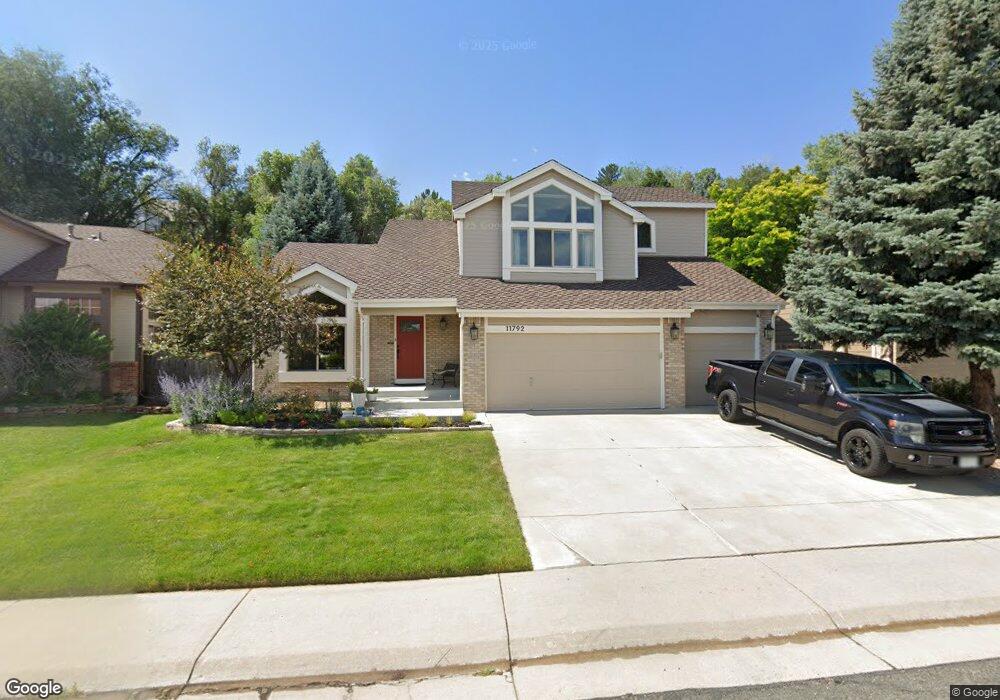
11792 W 56th Cir Arvada, CO 80002
Rainbow Ridge NeighborhoodEstimated Value: $688,250 - $811,000
4
Beds
3
Baths
2,221
Sq Ft
$334/Sq Ft
Est. Value
About This Home
This home is located at 11792 W 56th Cir, Arvada, CO 80002 and is currently estimated at $742,813, approximately $334 per square foot. 11792 W 56th Cir is a home located in Jefferson County with nearby schools including Vanderhoof Elementary School, Drake Junior High School, and Arvada West High School.
Ownership History
Date
Name
Owned For
Owner Type
Purchase Details
Closed on
Sep 20, 2021
Sold by
Jones Todd K and The Reed A Jones Revocable Tru
Bought by
Lefevre Gregory O and Lefevre Katherine Phoenix
Current Estimated Value
Home Financials for this Owner
Home Financials are based on the most recent Mortgage that was taken out on this home.
Original Mortgage
$539,100
Outstanding Balance
$487,322
Interest Rate
2.8%
Mortgage Type
New Conventional
Estimated Equity
$255,491
Purchase Details
Closed on
Jun 17, 2021
Sold by
Jones Reed A
Bought by
Jones Todd K and Reed A Jones Revocable Trust
Purchase Details
Closed on
Oct 4, 1993
Sold by
Sheffield Homes
Bought by
Jones Reed A
Home Financials for this Owner
Home Financials are based on the most recent Mortgage that was taken out on this home.
Original Mortgage
$100,000
Interest Rate
7.11%
Create a Home Valuation Report for This Property
The Home Valuation Report is an in-depth analysis detailing your home's value as well as a comparison with similar homes in the area
Home Values in the Area
Average Home Value in this Area
Purchase History
| Date | Buyer | Sale Price | Title Company |
|---|---|---|---|
| Lefevre Gregory O | $599,000 | Land Title Guarantee Company | |
| Jones Todd K | -- | None Available | |
| Jones Reed A | $165,800 | -- |
Source: Public Records
Mortgage History
| Date | Status | Borrower | Loan Amount |
|---|---|---|---|
| Open | Lefevre Gregory O | $539,100 | |
| Previous Owner | Jones Reed A | $100,000 |
Source: Public Records
Tax History
| Year | Tax Paid | Tax Assessment Tax Assessment Total Assessment is a certain percentage of the fair market value that is determined by local assessors to be the total taxable value of land and additions on the property. | Land | Improvement |
|---|---|---|---|---|
| 2024 | $4,016 | $41,399 | $18,513 | $22,886 |
| 2023 | $4,016 | $41,399 | $18,513 | $22,886 |
| 2022 | $3,550 | $36,247 | $14,057 | $22,190 |
| 2021 | $2,917 | $37,290 | $14,461 | $22,829 |
| 2020 | $2,478 | $32,831 | $11,879 | $20,952 |
| 2019 | $2,445 | $32,831 | $11,879 | $20,952 |
| 2018 | $2,317 | $30,860 | $7,988 | $22,872 |
| 2017 | $2,121 | $30,860 | $7,988 | $22,872 |
| 2016 | $2,091 | $29,936 | $6,661 | $23,275 |
| 2015 | $2,598 | $29,936 | $6,661 | $23,275 |
| 2014 | $2,598 | $25,657 | $6,625 | $19,032 |
Source: Public Records
Map
Nearby Homes
- 11463 W 53rd Place
- 5378 Routt St Unit B
- 5358 Routt St Unit B
- 5240 Routt Ct Unit B
- 11232 W 53rd Dr
- 5218 Routt St Unit A
- 5383 Quail St
- 5327 Quail Way
- 11958 W 57th Place
- 5365 Quail St
- 11237 W 55th Ln
- 5192 Rob Way
- 11890 W 52nd Ave
- 5182 Rob Way
- 5737 Union St
- 11944 W 57th Dr
- 5779 Taft St
- 5188 Rob Way
- 12270 W 57th Ave
- 5715 Van Gordon Way
- 11802 W 56th Cir
- 11782 W 56th Cir
- 11812 W 56th Cir
- 11793 W 56th Cir
- 11772 W 56th Cir
- 11773 W 56th Cir
- 11803 W 56th Cir
- 11822 W 56th Cir
- 11787 W 54th Place
- 11813 W 56th Cir
- 11777 W 54th Place
- 11753 W 56th Cir
- 5612 Tabor Ct
- 11762 W 56th Cir
- 11823 W 56th Cir
- 11767 W 54th Place
- 11832 W 56th Cir
- 11797 W 54th Place
- 5613 Tabor Ct
- 11733 W 56th Cir
Your Personal Tour Guide
Ask me questions while you tour the home.