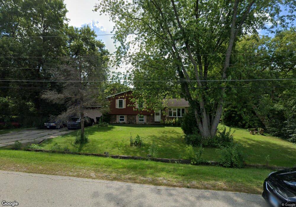
11795 W 11th St Zion, IL 60099
Shore Acres NeighborhoodEstimated Value: $226,000 - $339,000
3
Beds
2
Baths
1,196
Sq Ft
$241/Sq Ft
Est. Value
About This Home
This home is located at 11795 W 11th St, Zion, IL 60099 and is currently estimated at $287,718, approximately $240 per square foot. 11795 W 11th St is a home located in Lake County with nearby schools including Kenneth Murphy School, Beach Park Middle School, and Zion-Benton Township High School.
Ownership History
Date
Name
Owned For
Owner Type
Purchase Details
Closed on
Oct 1, 1997
Sold by
Cusimano Dennis F and Cusimano Chardell R
Bought by
Cusimano Dennis F
Current Estimated Value
Purchase Details
Closed on
Feb 24, 1994
Sold by
Cusimano Dennis F
Bought by
Cusimano Dennis F and Cusimano Chardell R
Home Financials for this Owner
Home Financials are based on the most recent Mortgage that was taken out on this home.
Original Mortgage
$80,000
Interest Rate
7.1%
Create a Home Valuation Report for This Property
The Home Valuation Report is an in-depth analysis detailing your home's value as well as a comparison with similar homes in the area
Home Values in the Area
Average Home Value in this Area
Purchase History
| Date | Buyer | Sale Price | Title Company |
|---|---|---|---|
| Cusimano Dennis F | -- | -- | |
| Cusimano Dennis F | -- | -- |
Source: Public Records
Mortgage History
| Date | Status | Borrower | Loan Amount |
|---|---|---|---|
| Closed | Cusimano Dennis F | $80,000 |
Source: Public Records
Tax History Compared to Growth
Tax History
| Year | Tax Paid | Tax Assessment Tax Assessment Total Assessment is a certain percentage of the fair market value that is determined by local assessors to be the total taxable value of land and additions on the property. | Land | Improvement |
|---|---|---|---|---|
| 2024 | $3,132 | $80,883 | $13,859 | $67,024 |
| 2023 | $3,680 | $72,249 | $13,379 | $58,870 |
| 2022 | $3,680 | $69,058 | $13,130 | $55,928 |
| 2021 | $3,902 | $58,598 | $12,796 | $45,802 |
| 2020 | $4,013 | $55,919 | $12,211 | $43,708 |
| 2019 | $4,181 | $53,054 | $11,585 | $41,469 |
| 2018 | $4,549 | $58,376 | $14,233 | $44,143 |
| 2017 | $4,700 | $54,916 | $13,389 | $41,527 |
| 2016 | $4,793 | $52,281 | $12,747 | $39,534 |
| 2015 | $5,804 | $47,946 | $11,690 | $36,256 |
| 2014 | $5,668 | $49,741 | $17,173 | $32,568 |
| 2012 | $5,722 | $51,690 | $17,846 | $33,844 |
Source: Public Records
Map
Nearby Homes
- 1304 Pelican Ct
- 3707 Willow Crest Dr
- 1531 Southport Ct
- 3717 Willow Crest Dr
- 1521 Southport Ct
- 1405 Lewis Ave
- 0 9th St
- 4014 Ridge Rd
- 1417 Westside Trail
- 3616 Creekside Ct
- 1302 Lorelei Dr
- 42908 N Lewis Ave
- 908 Countrywood Dr
- 1703 Hermon Ave
- 1817 Joppa Ave
- 43100 N Lewis Ave
- 1814 Jethro Ave
- 3106 13th St
- 1807 Horeb Ave
- 429 Megan Place
- 11761 W 11th St
- 11796 W 11th St
- 42262 N Thorpe Ave
- 42281 N Thorpe Ave
- 42237 N Hayner Ave
- 42282 N Thorpe Ave
- 42215 N Hayner Ave
- 11722 W 11th St
- 11839 W Dodson St
- 11778 W 12th St
- 42263 N Broecker Ave
- 42177 N Hayner Ave
- 42166 N Hayner Ave
- 42314 N Hayner Ave
- 42281 N Broecker Ave
- 42238 N Hanks Ave
- 42163 N Hayner Ave
- 42216 N Hanks Ave
- 42276 N Hanks Ave
- 42313 N Hayner Ave