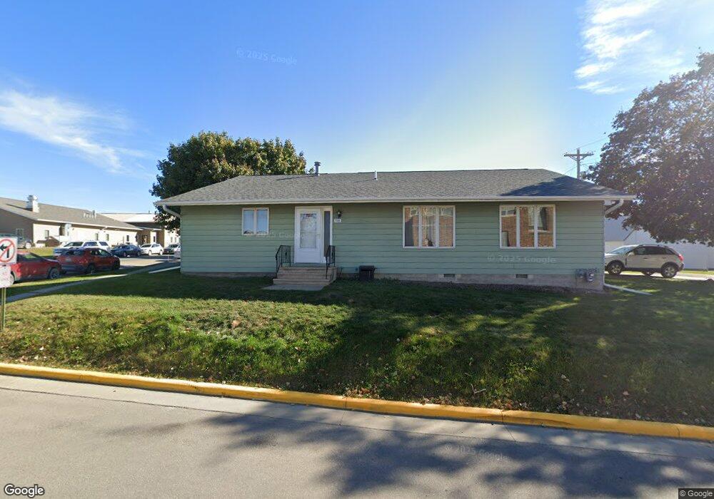
118 2nd Ave NW Spring Grove, MN 55974
Estimated Value: $186,000 - $218,000
2
Beds
3
Baths
1,380
Sq Ft
$146/Sq Ft
Est. Value
About This Home
This home is located at 118 2nd Ave NW, Spring Grove, MN 55974 and is currently estimated at $201,000, approximately $145 per square foot. 118 2nd Ave NW is a home located in Houston County with nearby schools including Spring Grove Elementary School and Spring Grove Secondary School.
Ownership History
Date
Name
Owned For
Owner Type
Purchase Details
Closed on
May 31, 2025
Sold by
Connelly Rinda
Bought by
Connelly Rinda and Perkins Roberta K
Current Estimated Value
Purchase Details
Closed on
Jun 2, 2021
Sold by
Meyer Kermit M and Meyer Colleen A
Bought by
Harvey Carol M
Home Financials for this Owner
Home Financials are based on the most recent Mortgage that was taken out on this home.
Original Mortgage
$100,000
Interest Rate
2.9%
Mortgage Type
New Conventional
Purchase Details
Closed on
Apr 12, 2011
Sold by
Wells Fargo Financial Wisconsin Inc
Bought by
Meyer Kermit Melvin and Meyer Colleen Ann
Purchase Details
Closed on
Apr 14, 2010
Sold by
Bohr Jeffrey H and Bohr Brenda M
Bought by
Wells Fargo Financial Wisconsin Inc
Create a Home Valuation Report for This Property
The Home Valuation Report is an in-depth analysis detailing your home's value as well as a comparison with similar homes in the area
Purchase History
| Date | Buyer | Sale Price | Title Company |
|---|---|---|---|
| Connelly Rinda | -- | None Listed On Document | |
| Harvey Carol M | $120,000 | None Available | |
| Meyer Kermit Melvin | $32,500 | None Available | |
| Wells Fargo Financial Wisconsin Inc | $78,974 | None Available |
Source: Public Records
Mortgage History
| Date | Status | Borrower | Loan Amount |
|---|---|---|---|
| Previous Owner | Harvey Carol M | $100,000 |
Source: Public Records
Tax History
| Year | Tax Paid | Tax Assessment Tax Assessment Total Assessment is a certain percentage of the fair market value that is determined by local assessors to be the total taxable value of land and additions on the property. | Land | Improvement |
|---|---|---|---|---|
| 2025 | $2,426 | $178,800 | $22,400 | $156,400 |
| 2024 | $2,486 | $175,300 | $22,400 | $152,900 |
| 2023 | $2,000 | $160,400 | $7,300 | $153,100 |
| 2022 | $1,988 | $136,200 | $6,900 | $129,300 |
| 2021 | $2,156 | $129,000 | $6,900 | $122,100 |
| 2020 | $2,208 | $112,600 | $6,900 | $105,700 |
| 2019 | $2,134 | $112,600 | $6,900 | $105,700 |
| 2018 | $2,008 | $99,700 | $6,900 | $92,800 |
| 2017 | $2,008 | $92,600 | $7,900 | $84,700 |
| 2016 | $2,144 | $92,600 | $7,900 | $84,700 |
| 2015 | $1,906 | $97,900 | $8,300 | $89,600 |
| 2014 | $1,906 | $88,500 | $7,500 | $81,000 |
Source: Public Records
Map
Nearby Homes
- TBD County 8
- TBD-C County 8
- 237 S Robert St
- 241 S Robert St
- 44331 State Hwy 44
- 206 N Maple St
- 215 W Fillmore Ave
- 315 Newburg Ave W
- 209 Oak St S
- 3805 County Road W40
- 126 Bissen St
- 12384 Green Acres Dr
- 19708 Camp Winnebago Rd
- 18256 State Hwy 43
- 418 E Monroe St
- 720 S Badger St
- xxx E Twin Ridge Rd
- 118 W Grove St
- 510 E Madison St
- 115 E Main St
- 118 118 2nd-Avenue-nw
- 153 1st St NW
- 149 1st St NW
- 143 1st St NW
- 212 1st St NW
- 154 1st St NW
- 208 W Main St
- 202 1st St NW
- 150 1st St NW
- 194 W Main St
- 139 1st St NW
- 233 233 W Main St
- 233 233 W Main-Street-
- 131 1st St NW
- 212 2nd Ave NW
- 211 2nd Ave NW
- 216 1st Ave NW
- 233 W Main St
- 233 W Main St
- 216 1st St NW
Your Personal Tour Guide
Ask me questions while you tour the home.