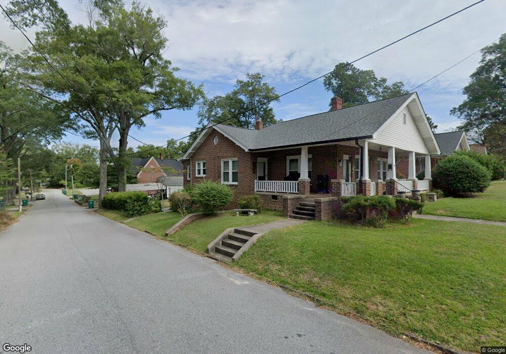
118 Andrews Ave Greenwood, SC 29646
Estimated Value: $177,000 - $227,000
4
Beds
2
Baths
1,870
Sq Ft
$109/Sq Ft
Est. Value
About This Home
This home is located at 118 Andrews Ave, Greenwood, SC 29646 and is currently estimated at $203,143, approximately $108 per square foot. 118 Andrews Ave is a home located in Greenwood County with nearby schools including Lakeview Elementary School, Westview Middle School, and Emerald High School.
Ownership History
Date
Name
Owned For
Owner Type
Purchase Details
Closed on
Aug 11, 2020
Sold by
Gass Jennifer Mae
Bought by
Luna Garrett Austin and Luna Kennedy Doby
Current Estimated Value
Home Financials for this Owner
Home Financials are based on the most recent Mortgage that was taken out on this home.
Original Mortgage
$137,464
Outstanding Balance
$121,713
Interest Rate
2.9%
Mortgage Type
FHA
Estimated Equity
$81,430
Purchase Details
Closed on
Jun 22, 2017
Sold by
Strickland Jack E and Strickland Sarah L
Bought by
Gass Jennifer Mae
Home Financials for this Owner
Home Financials are based on the most recent Mortgage that was taken out on this home.
Original Mortgage
$107,255
Interest Rate
3.95%
Mortgage Type
New Conventional
Create a Home Valuation Report for This Property
The Home Valuation Report is an in-depth analysis detailing your home's value as well as a comparison with similar homes in the area
Home Values in the Area
Average Home Value in this Area
Purchase History
| Date | Buyer | Sale Price | Title Company |
|---|---|---|---|
| Luna Garrett Austin | $140,000 | None Available | |
| Gass Jennifer Mae | $112,900 | None Available |
Source: Public Records
Mortgage History
| Date | Status | Borrower | Loan Amount |
|---|---|---|---|
| Open | Luna Garrett Austin | $137,464 | |
| Previous Owner | Gass Jennifer Mae | $107,255 |
Source: Public Records
Tax History Compared to Growth
Tax History
| Year | Tax Paid | Tax Assessment Tax Assessment Total Assessment is a certain percentage of the fair market value that is determined by local assessors to be the total taxable value of land and additions on the property. | Land | Improvement |
|---|---|---|---|---|
| 2024 | $1,623 | $5,520 | $0 | $0 |
| 2023 | $1,623 | $5,520 | $0 | $0 |
| 2022 | $1,586 | $5,520 | $0 | $0 |
| 2021 | $1,586 | $5,520 | $0 | $0 |
| 2020 | $1,350 | $4,520 | $0 | $0 |
| 2019 | $1,346 | $4,520 | $0 | $0 |
| 2018 | $3,140 | $113,000 | $10,000 | $103,000 |
| 2017 | $412 | $113,000 | $10,000 | $103,000 |
| 2016 | $412 | $78,300 | $10,000 | $68,300 |
| 2015 | $404 | $78,300 | $10,000 | $68,300 |
| 2014 | $404 | $3,130 | $0 | $0 |
| 2010 | -- | $72,100 | $10,000 | $62,100 |
Source: Public Records
Map
Nearby Homes
- 49 Acres Bypass 72 W
- 305 Jackson Ave
- 410 Durst Ave W
- 433 Calhoun Ave
- 0 S Hwy 178 Unit 134648
- 104 Farnum Rd
- 210 Burberry Circle Lot 60
- 209 Farnum Rd
- 102 Farnum Rd
- 203 Oristo Dr
- 106 Farnum Rd
- 108 Ero Dr
- 109 Burberry Circle Lot 20
- 111 Burberry Circle Lot 21
- 107 Burberry Circle Lt 19
- 126
- 106 Ero Dr
- 110 Ero Dr
- Birch Plan at Bronson Ridge
- Tupelo Plan at Bronson Ridge
- 118 Andrews Ave N
- 116 Andrews Ave N
- 202 Andrews Ave
- 204 Andrews Ave N
- 115 Andrews Ave N
- 415 Grove St
- 201 Andrews Ave N
- 113 Andrews Ave N
- 421 Grove St
- 106 Andrews Ave
- 426 Grove St
- 426 Grove St
- 111 Andrews Ave
- 205 Andrews Ave N
- 300 Grove St
- 202 Duncan Ave
- 204 Duncan Ave
- 434 Grove St
- 206 Duncan Ave
- 109 Andrews Ave N