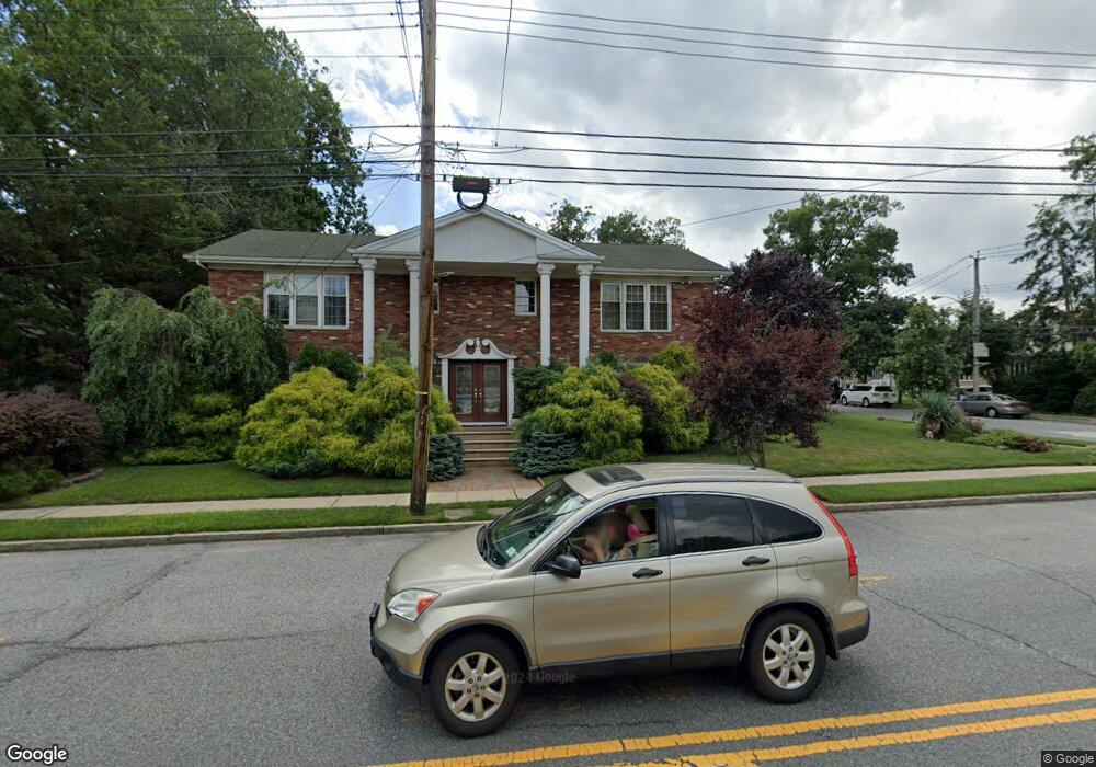
118 Barlow Ave Staten Island, NY 10308
Great Kills NeighborhoodEstimated Value: $1,209,000 - $1,445,000
4
Beds
4
Baths
3,200
Sq Ft
$409/Sq Ft
Est. Value
About This Home
This home is located at 118 Barlow Ave, Staten Island, NY 10308 and is currently estimated at $1,307,695, approximately $408 per square foot. 118 Barlow Ave is a home located in Richmond County with nearby schools including P.S. 32 The Gifford School, I.S. 075 Frank D. Paulo, and Susan E Wagner High School.
Ownership History
Date
Name
Owned For
Owner Type
Purchase Details
Closed on
Jan 25, 2002
Sold by
Rotondo Louise P and Minutoli Louise P
Bought by
Kitsis Isak and Kitsis Anna
Current Estimated Value
Home Financials for this Owner
Home Financials are based on the most recent Mortgage that was taken out on this home.
Original Mortgage
$300,700
Outstanding Balance
$124,512
Interest Rate
7.08%
Estimated Equity
$1,183,183
Create a Home Valuation Report for This Property
The Home Valuation Report is an in-depth analysis detailing your home's value as well as a comparison with similar homes in the area
Home Values in the Area
Average Home Value in this Area
Purchase History
| Date | Buyer | Sale Price | Title Company |
|---|---|---|---|
| Kitsis Isak | $530,000 | -- |
Source: Public Records
Mortgage History
| Date | Status | Borrower | Loan Amount |
|---|---|---|---|
| Open | Kitsis Isak | $300,700 | |
| Closed | Kitsis Isak | $54,300 |
Source: Public Records
Tax History Compared to Growth
Tax History
| Year | Tax Paid | Tax Assessment Tax Assessment Total Assessment is a certain percentage of the fair market value that is determined by local assessors to be the total taxable value of land and additions on the property. | Land | Improvement |
|---|---|---|---|---|
| 2025 | $11,564 | $72,060 | $16,951 | $55,109 |
| 2024 | $10,426 | $76,920 | $15,181 | $61,739 |
| 2023 | $11,015 | $55,637 | $15,455 | $40,182 |
| 2022 | $10,191 | $57,960 | $19,800 | $38,160 |
| 2021 | $10,516 | $55,680 | $19,800 | $35,880 |
| 2020 | $10,586 | $61,560 | $19,800 | $41,760 |
| 2019 | $12,396 | $53,520 | $19,800 | $33,720 |
| 2018 | $9,154 | $46,364 | $18,750 | $27,614 |
| 2017 | $8,617 | $43,740 | $19,800 | $23,940 |
| 2016 | $8,254 | $42,840 | $18,925 | $23,915 |
| 2015 | $7,813 | $42,840 | $15,400 | $27,440 |
| 2014 | $7,813 | $42,300 | $16,500 | $25,800 |
Source: Public Records
Map
Nearby Homes
- 98 Kennington St
- 52 Barlow Ave
- 47 Jumel St
- 59 Gibson Ave
- 147 Howton Ave
- 12 Lexington Ln
- 4 Country Woods Ln
- 200 Giffords Ln
- 66 Gibson Ave
- 72 Eric Ln
- 52 Sandalwood Dr
- 305 Corbin Ave
- 87 Pemberton Ave
- 132 Elkhart St
- 414 Elverton Ave
- 17 Greaves Ct
- 43 Country Woods Ln
- 15 Woodland Ave
- 271 Doane Ave
- 19 Nutwood Ct
- 299 Miles Ave
- 112 Barlow Ave
- 295 Miles Ave
- 108 Barlow Ave
- 113 Jumel St
- 291 Miles Ave
- 119 Barlow Ave
- 104 Barlow Ave
- 115 Barlow Ave
- 134 Barlow Ave
- 296 Miles Ave
- 294 Miles Ave
- 292 Miles Ave
- 100 Barlow Ave
- 107 Jumel St
- 290 Miles Ave
- 322 Miles Ave Unit 322
- 322 Miles Ave Unit B
- 322 Miles Ave Unit A
- 329 Miles Ave