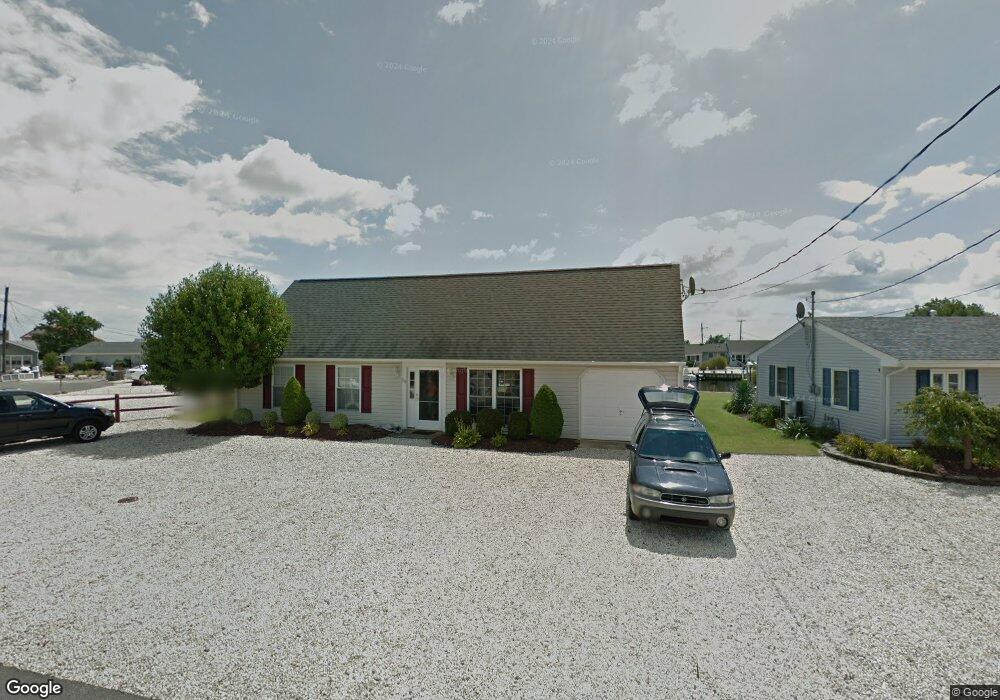
118 Bloomfield Rd Barnegat, NJ 08005
Estimated Value: $664,000 - $814,000
4
Beds
2
Baths
1,755
Sq Ft
$409/Sq Ft
Est. Value
About This Home
This home is located at 118 Bloomfield Rd, Barnegat, NJ 08005 and is currently estimated at $716,935, approximately $408 per square foot. 118 Bloomfield Rd is a home located in Ocean County with nearby schools including Waretown Elementary School and Frederic A. Priff Elementary School.
Ownership History
Date
Name
Owned For
Owner Type
Purchase Details
Closed on
Aug 30, 2016
Sold by
Hayes Joseph and Hayes Leslie
Bought by
Hayes Trust
Current Estimated Value
Purchase Details
Closed on
Oct 31, 2007
Sold by
Mcginty Robert B and Mcginty Kathryn
Bought by
Hayes Joseph and Hayes Leslie
Home Financials for this Owner
Home Financials are based on the most recent Mortgage that was taken out on this home.
Original Mortgage
$403,000
Interest Rate
6.43%
Mortgage Type
Purchase Money Mortgage
Purchase Details
Closed on
Jun 25, 2007
Sold by
Mcginty Michael Bryan and Mcginty Susan Elizabeth
Bought by
Mcginty Robert B and Mcginty Kathryn
Home Financials for this Owner
Home Financials are based on the most recent Mortgage that was taken out on this home.
Original Mortgage
$386,250
Interest Rate
6.54%
Mortgage Type
Purchase Money Mortgage
Purchase Details
Closed on
Dec 21, 2006
Sold by
Mcginty Robert B and Mcginty Kathryn
Bought by
Mcginty Robert B and Mc Ginty Kathryn
Create a Home Valuation Report for This Property
The Home Valuation Report is an in-depth analysis detailing your home's value as well as a comparison with similar homes in the area
Home Values in the Area
Average Home Value in this Area
Purchase History
| Date | Buyer | Sale Price | Title Company |
|---|---|---|---|
| Hayes Trust | -- | -- | |
| Hayes Joseph | $504,000 | Saint Michael Title Svcs Inc | |
| Mcginty Robert B | -- | Chicago Title Insurance Co | |
| Mcginty Robert B | -- | None Available |
Source: Public Records
Mortgage History
| Date | Status | Borrower | Loan Amount |
|---|---|---|---|
| Previous Owner | Hayes Joseph | $403,000 | |
| Previous Owner | Mcginty Robert B | $386,250 |
Source: Public Records
Tax History
| Year | Tax Paid | Tax Assessment Tax Assessment Total Assessment is a certain percentage of the fair market value that is determined by local assessors to be the total taxable value of land and additions on the property. | Land | Improvement |
|---|---|---|---|---|
| 2025 | $7,889 | $522,800 | $288,200 | $234,600 |
| 2024 | $7,784 | $522,800 | $288,200 | $234,600 |
Source: Public Records
Map
Nearby Homes
- 109 Caldwell Rd
- 125 Clifton Rd
- 230 Montclair Rd S
- 18 Mediterranean Ct
- 31 S Seas Ct
- 31 S South Seas Ct
- 24 S Seas Ct
- 35 S Seas Ct
- 5 Fresno St
- 148 Bayshore Dr Unit A
- 309 5th St
- 379 Bayshore Dr
- 13B Emerald Dr Unit B
- 92 Marine Rd
- 401 Bayshore Dr Unit 2A
- 115 Bonita Rd
- 18 High Tide Dr
- 29 Forest Park Dr
- 22 Forest Park Dr
- 20 Forest Park Dr
- 116 Bloomfield Rd
- 120 Bloomfield Rd
- 114 Bloomfield Rd
- 114 Bloomfield Rd
- 122 Bloomfield Rd
- 121 Bloomfield Rd
- 112 Bloomfield Rd
- 123 Bloomfield Rd
- 119 Bloomfield Rd
- 124 Bloomfield Rd
- 117 Bloomfield Rd
- 102 Newark Rd
- 127 Bloomfield Rd
- 115 Bloomfield Rd
- 110 Bloomfield Rd
- 100 Newark Rd
- 126 Bloomfield Rd
- 113 Bloomfield Rd
- 128 Bloomfield Rd
- 104 Newark Rd