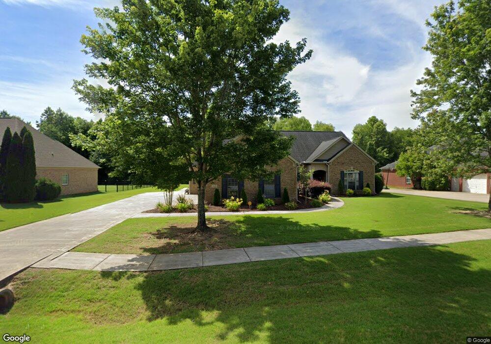
118 Bridge Arbor Ln Huntsville, AL 35811
Ryland NeighborhoodEstimated Value: $396,044 - $403,000
3
Beds
3
Baths
2,245
Sq Ft
$178/Sq Ft
Est. Value
About This Home
This home is located at 118 Bridge Arbor Ln, Huntsville, AL 35811 and is currently estimated at $399,511, approximately $177 per square foot. 118 Bridge Arbor Ln is a home located in Madison County with nearby schools including Mt Carmel Elementary School, Riverton Intermediate School, and Buckhorn Middle School.
Ownership History
Date
Name
Owned For
Owner Type
Purchase Details
Closed on
Apr 20, 2007
Sold by
Warren David V and Warren Andra M
Bought by
Hawthorne Michael and Hawthorne Brandy
Current Estimated Value
Home Financials for this Owner
Home Financials are based on the most recent Mortgage that was taken out on this home.
Original Mortgage
$200,800
Outstanding Balance
$120,473
Interest Rate
6.1%
Mortgage Type
New Conventional
Estimated Equity
$279,038
Purchase Details
Closed on
Nov 30, 2005
Sold by
Mark Harris Homes Llc
Bought by
Warren David V and Warren Andra M
Home Financials for this Owner
Home Financials are based on the most recent Mortgage that was taken out on this home.
Original Mortgage
$44,700
Interest Rate
6.04%
Mortgage Type
Credit Line Revolving
Create a Home Valuation Report for This Property
The Home Valuation Report is an in-depth analysis detailing your home's value as well as a comparison with similar homes in the area
Home Values in the Area
Average Home Value in this Area
Purchase History
| Date | Buyer | Sale Price | Title Company |
|---|---|---|---|
| Hawthorne Michael | -- | -- | |
| Warren David V | -- | -- |
Source: Public Records
Mortgage History
| Date | Status | Borrower | Loan Amount |
|---|---|---|---|
| Open | Hawthorne Michael | $200,800 | |
| Previous Owner | Warren David V | $44,700 |
Source: Public Records
Tax History Compared to Growth
Tax History
| Year | Tax Paid | Tax Assessment Tax Assessment Total Assessment is a certain percentage of the fair market value that is determined by local assessors to be the total taxable value of land and additions on the property. | Land | Improvement |
|---|---|---|---|---|
| 2024 | $1,311 | $36,540 | $7,000 | $29,540 |
| 2023 | $1,265 | $35,780 | $7,000 | $28,780 |
| 2022 | $2,137 | $59,200 | $8,000 | $51,200 |
| 2021 | $1,935 | $53,680 | $8,000 | $45,680 |
| 2020 | $1,747 | $48,520 | $8,000 | $40,520 |
| 2019 | $1,680 | $46,680 | $8,000 | $38,680 |
| 2018 | $1,589 | $44,180 | $0 | $0 |
| 2017 | $1,549 | $43,100 | $0 | $0 |
| 2016 | $1,549 | $43,100 | $0 | $0 |
| 2015 | $1,549 | $43,100 | $0 | $0 |
| 2014 | $755 | $22,340 | $0 | $0 |
Source: Public Records
Map
Nearby Homes
- 313 Merrydale Dr
- 145 Bridge Arbor Ln
- 296 Brevard Blvd
- 134 Alpha Ln
- 309 Wanto Ln
- 302 Wanto Ln
- 304 Wanto Ln
- 121 Headen Ln
- The Bennington Plan at Blue Ridge at Mount Carmel - Signature Series
- The Potomac Plan at Blue Ridge at Mount Carmel - Founders Series
- The Raleigh Plan at Blue Ridge at Mount Carmel - Signature Series
- The Charleston Plan at Blue Ridge at Mount Carmel - Signature Series
- The Cambridge Plan at Blue Ridge at Mount Carmel - Signature Series
- The Jamestown Plan at Blue Ridge at Mount Carmel - Founders Series
- The Shelburne Plan at Blue Ridge at Mount Carmel - Signature Series
- The Winston Plan at Blue Ridge at Mount Carmel - Signature Series
- The Franklin Plan at Blue Ridge at Mount Carmel - Founders Series
- The Manhattan Plan at Blue Ridge at Mount Carmel - Signature Series
- The Savannah Plan at Blue Ridge at Mount Carmel - Signature Series
- The Lincoln Plan at Blue Ridge at Mount Carmel - Signature Series
- 120 Bridge Arbor Ln
- 116 Bridge Arbor Ln
- 122 Bridge Arbor Ln
- 117 Bridge Arbor Ln
- 114 Bridge Arbor Ln
- 119 Bridge Arbor Ln
- 121 Bridge Arbor Ln
- 115 Bridge Arbor Ln
- 312 Merrydale Dr
- 329 Merrydale Dr
- 302 Merrydale Dr
- 306 Merrydale Dr
- 419 Tracer St
- 409 Tracer St
- 313 Temper St
- 314 Temper St
- 106 Mill Springs Ln
- 303 Merrydale Dr
- 249 Catalyst St
- 104 Cades Cove