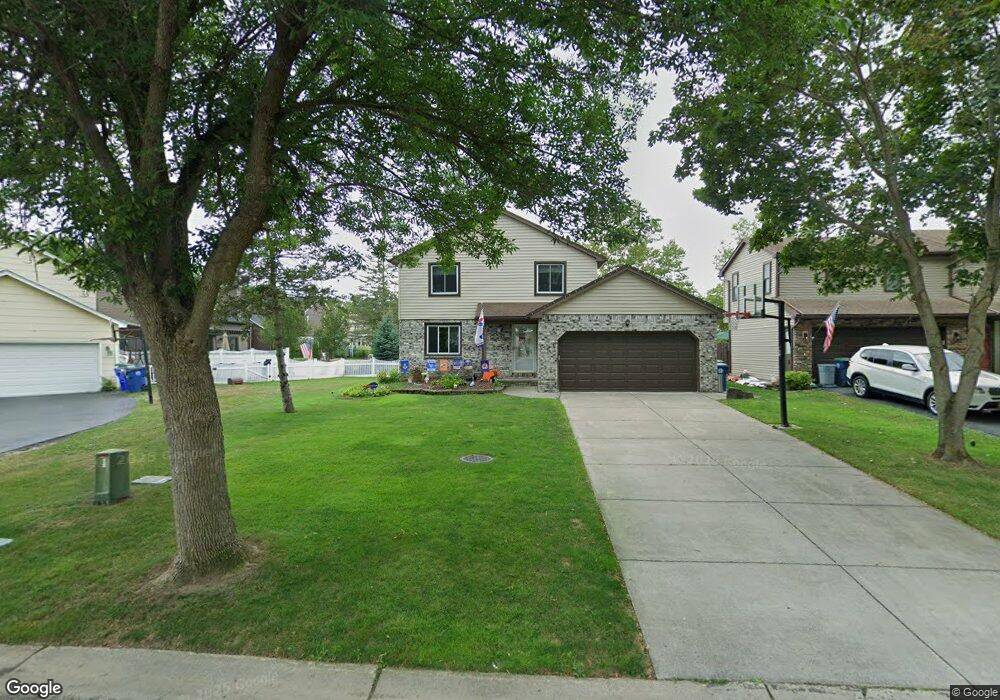
118 Brockmoore Dr East Amherst, NY 14051
East Amherst NeighborhoodEstimated Value: $338,000 - $370,000
3
Beds
2
Baths
1,331
Sq Ft
$267/Sq Ft
Est. Value
About This Home
This home is located at 118 Brockmoore Dr, East Amherst, NY 14051 and is currently estimated at $354,749, approximately $266 per square foot. 118 Brockmoore Dr is a home located in Erie County with nearby schools including Dodge Elementary School, Casey Middle School, and Williamsville North High School.
Ownership History
Date
Name
Owned For
Owner Type
Purchase Details
Closed on
May 11, 2009
Sold by
Baker Jonathan S and Baker Jill A
Bought by
Drzewucki Robert
Current Estimated Value
Home Financials for this Owner
Home Financials are based on the most recent Mortgage that was taken out on this home.
Original Mortgage
$155,138
Outstanding Balance
$98,283
Interest Rate
4.9%
Mortgage Type
FHA
Estimated Equity
$256,466
Purchase Details
Closed on
Aug 28, 2002
Sold by
Dunn Steven R and Dunn Angela L
Bought by
Baker Jonathan S and Baker Jill A
Home Financials for this Owner
Home Financials are based on the most recent Mortgage that was taken out on this home.
Original Mortgage
$116,800
Interest Rate
6.55%
Mortgage Type
Stand Alone First
Purchase Details
Closed on
Jul 17, 1996
Sold by
Fries Edward C
Bought by
Dunn Steven and Dunn Angela
Create a Home Valuation Report for This Property
The Home Valuation Report is an in-depth analysis detailing your home's value as well as a comparison with similar homes in the area
Home Values in the Area
Average Home Value in this Area
Purchase History
| Date | Buyer | Sale Price | Title Company |
|---|---|---|---|
| Drzewucki Robert | $158,000 | None Available | |
| Baker Jonathan S | $123,000 | -- | |
| Dunn Steven | $96,750 | -- |
Source: Public Records
Mortgage History
| Date | Status | Borrower | Loan Amount |
|---|---|---|---|
| Open | Drzewucki Robert | $155,138 | |
| Previous Owner | Baker Jonathan S | $116,800 |
Source: Public Records
Tax History Compared to Growth
Tax History
| Year | Tax Paid | Tax Assessment Tax Assessment Total Assessment is a certain percentage of the fair market value that is determined by local assessors to be the total taxable value of land and additions on the property. | Land | Improvement |
|---|---|---|---|---|
| 2024 | $6,113 | $280,000 | $33,000 | $247,000 |
| 2023 | $5,927 | $165,000 | $28,500 | $136,500 |
| 2022 | $5,560 | $165,000 | $28,500 | $136,500 |
| 2021 | $5,458 | $165,000 | $28,500 | $136,500 |
| 2020 | $4,689 | $165,000 | $28,500 | $136,500 |
| 2019 | $4,576 | $165,000 | $28,500 | $136,500 |
| 2018 | $4,488 | $165,000 | $28,500 | $136,500 |
| 2017 | $2,232 | $165,000 | $28,500 | $136,500 |
| 2016 | $4,786 | $158,000 | $27,600 | $130,400 |
| 2015 | -- | $158,000 | $27,600 | $130,400 |
| 2014 | -- | $158,000 | $27,600 | $130,400 |
Source: Public Records
Map
Nearby Homes
- 55 Brockmoore Dr
- 41 River Oak Ln
- 68 River Oak Ln
- 44 River Oak Ln
- 32 River Oak Ln
- 301 New Rd
- 59 Moorgate Ct
- 195 Autumn Meadows Ln
- 182 Autumn Meadows Ln
- 174 Autumn Meadows Ln
- 157 Autumn Meadows Ln
- 2080 Dodge Rd
- 10 Woodmoor Cir
- 354 Old Meadow Dr
- 194 Meadow Spring Ln
- 255 Old Meadow Dr
- 351 Charlesgate Cir
- 1052 Charlesgate Cir
- 118 Coriander Ct
- 133 Autumn Meadows Ln
- 126 Brockmoore Dr
- 62 Brockmoore Dr
- 134 Brockmoore Dr
- 94 Brockmoore Dr
- 142 Brockmoore Dr
- 46 Brockmoore Dr
- 38 Brockmoore Dr
- 119 Brockmoore Dr
- 111 Brockmoore Dr
- 127 Brockmoore Dr
- 152 Brockmoore Dr
- 103 Brockmoore Dr
- 30 Brockmoore Dr
- 135 Brockmoore Dr
- 95 Brockmoore Dr
- 262 Brockmoore Dr
- 270 Brockmoore Dr
- 87 Brockmoore Dr
- 143 Brockmoore Dr
- 278 Brockmoore Dr