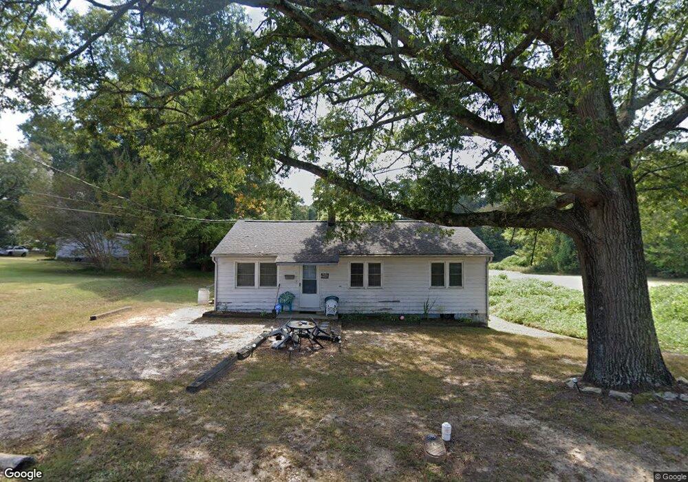
118 Bullock St Franklinton, NC 27525
Estimated Value: $197,000 - $279,000
3
Beds
1
Bath
960
Sq Ft
$252/Sq Ft
Est. Value
About This Home
This home is located at 118 Bullock St, Franklinton, NC 27525 and is currently estimated at $242,010, approximately $252 per square foot. 118 Bullock St is a home located in Franklin County with nearby schools including Franklinton Elementary School, Franklinton Middle School, and Franklinton High School.
Ownership History
Date
Name
Owned For
Owner Type
Purchase Details
Closed on
Jun 27, 2023
Sold by
Pruitt Rock Shannon
Bought by
Tuck Michael Andrew and Rios Tuck Lilliam
Current Estimated Value
Home Financials for this Owner
Home Financials are based on the most recent Mortgage that was taken out on this home.
Original Mortgage
$100,000
Interest Rate
5%
Mortgage Type
New Conventional
Purchase Details
Closed on
Nov 9, 2010
Sold by
Mcfarlane Steven H
Bought by
Davis Durwood
Create a Home Valuation Report for This Property
The Home Valuation Report is an in-depth analysis detailing your home's value as well as a comparison with similar homes in the area
Home Values in the Area
Average Home Value in this Area
Purchase History
| Date | Buyer | Sale Price | Title Company |
|---|---|---|---|
| Tuck Michael Andrew | $14,000 | None Listed On Document | |
| Davis Durwood | $152,000 | None Available |
Source: Public Records
Mortgage History
| Date | Status | Borrower | Loan Amount |
|---|---|---|---|
| Previous Owner | Tuck Michael Andrew | $100,000 |
Source: Public Records
Tax History Compared to Growth
Tax History
| Year | Tax Paid | Tax Assessment Tax Assessment Total Assessment is a certain percentage of the fair market value that is determined by local assessors to be the total taxable value of land and additions on the property. | Land | Improvement |
|---|---|---|---|---|
| 2024 | $3,380 | $252,480 | $121,870 | $130,610 |
| 2023 | $1,657 | $95,770 | $41,490 | $54,280 |
| 2022 | $1,637 | $95,770 | $41,490 | $54,280 |
| 2021 | $1,608 | $95,770 | $41,490 | $54,280 |
| 2020 | $1,610 | $95,770 | $41,490 | $54,280 |
| 2019 | $1,603 | $95,770 | $41,490 | $54,280 |
| 2018 | $1,384 | $87,640 | $41,490 | $46,150 |
| 2017 | $1,014 | $60,460 | $36,080 | $24,380 |
| 2016 | $1,032 | $60,460 | $36,080 | $24,380 |
| 2015 | $1,028 | $60,460 | $36,080 | $24,380 |
| 2014 | $996 | $60,460 | $36,080 | $24,380 |
Source: Public Records
Map
Nearby Homes
- 204 Bullock St
- 61.94 Acres Timberlake Rd
- 1.85 Acres Timberlake Rd
- 218 E College St
- 216 E College St
- 11 Elm St Unit 62
- 15 Gerrard St
- 0 Hawkins St
- 411 Mangum Way
- 604 S Chavis St
- 16 S Hillsborough St
- 0 Carver St Unit 10107506
- 705B E Green St
- 110 Allen Ave
- 17 Collins St
- 302 Allen Ave
- 315 Glenn St
- 335 Glenn St Unit Lot4
- 44 Whitaker St
- 605 Mitchell Ave
- 118 Bullock St Unit 1
- 202 Bullock St
- 203 Bullock St
- 204 Bowen St
- 205 Bullock St
- 205 Bullock St
- 206 Bowen St
- 206 Bullock St
- 110 Bullock St
- 109 Bullock St
- 303 Bowen St
- 208 Bowen St
- 210 Bullock St
- 207 Bullock St
- 108 Bullock St Unit 187
- 108 Bullock St
- 111 Bullock St
- 212 Bullock St
- 305 Bowen St
- 110 Cooke St