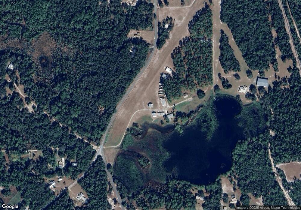
118 Cessna St Crescent City, FL 32112
Estimated Value: $304,000 - $856,939
3
Beds
2
Baths
1,801
Sq Ft
$322/Sq Ft
Est. Value
About This Home
This home is located at 118 Cessna St, Crescent City, FL 32112 and is currently estimated at $580,470, approximately $322 per square foot. 118 Cessna St is a home with nearby schools including Middleton-Burney Elementary School, George C. Miller Jr. Intermediate School, and Crescent City Junior/Senior High School.
Ownership History
Date
Name
Owned For
Owner Type
Purchase Details
Closed on
Aug 26, 2014
Sold by
Sauls Iveson N and Sauls Patricia Ann
Bought by
Sauls Family Revocable Living Trust
Current Estimated Value
Purchase Details
Closed on
Jun 10, 2003
Sold by
Sauls Anne E and Sauls Anne L
Bought by
Sauls Anne E and Sauls Iveson N
Purchase Details
Closed on
May 29, 2003
Sold by
Sauls Anne E and Sauls Anne L
Bought by
Sauls Anne E and Sauls Iveson N
Create a Home Valuation Report for This Property
The Home Valuation Report is an in-depth analysis detailing your home's value as well as a comparison with similar homes in the area
Home Values in the Area
Average Home Value in this Area
Purchase History
| Date | Buyer | Sale Price | Title Company |
|---|---|---|---|
| Sauls Family Revocable Living Trust | -- | Attorney | |
| Sauls Anne E | -- | -- | |
| Sauls Anne E | -- | -- |
Source: Public Records
Tax History Compared to Growth
Tax History
| Year | Tax Paid | Tax Assessment Tax Assessment Total Assessment is a certain percentage of the fair market value that is determined by local assessors to be the total taxable value of land and additions on the property. | Land | Improvement |
|---|---|---|---|---|
| 2024 | $5,622 | $354,250 | -- | -- |
| 2023 | $5,475 | $344,070 | $0 | $0 |
| 2022 | $5,220 | $334,110 | $0 | $0 |
| 2021 | $5,201 | $324,490 | $0 | $0 |
| 2020 | $5,230 | $320,040 | $0 | $0 |
| 2019 | $5,222 | $312,830 | $201,590 | $111,240 |
| 2018 | $5,210 | $306,850 | $248,350 | $58,500 |
| 2017 | $5,234 | $300,390 | $241,890 | $58,500 |
| 2016 | $5,037 | $294,040 | $0 | $0 |
| 2015 | $5,055 | $292,207 | $0 | $0 |
| 2014 | $5,081 | $289,497 | $0 | $0 |
Source: Public Records
Map
Nearby Homes
- 436 Huntington Shortcut Rd
- 438 Huntington Shortcut Rd
- 251 Taylor Fury Rd
- 243 Taylor Fury Rd
- 278 Huntington Shortcut Rd
- 113 Lake Como Point Rd
- 226 Huntington Shortcut Rd
- 260 Old Highway 17
- 106 Carter Whittaker Ln
- 250 Old Highway 17
- 104 Carter Whittaker Ln
- 106 Pennsylvania Ave
- 116 Pennsylvania Ave
- 155 Tompkins Rd
- 101 Trout Trail
- 0 Logan Ave
- 326 Ward Ave
- 318 Ward Ave
- 310 Ward Ave
- 316 Ward Ave
- 379 Huntington Shortcut Rd
- 379 Huntington Shortcut Rd
- 387 Huntington Shortcut Rd
- 140 Jayme Ln
- 387 Huntington Shortcut Rd
- 130 Tallow Rd
- 340 Huntington Shortcut Rd
- 105 Tallow Rd
- 124 Jayme Ln
- 341 Huntington Shortcut Rd
- 391 Huntington Shortcut Rd
- 112 Tailwind Dr
- 557 Lake Como Dr
- 107 Tallow Rd
- 554 Lake Como Dr
- 101 Trailsend
- 331 Huntington Shortcut Rd
- 109 Tallow Rd
- 126 Sunset Dr
- 128 Tallow Rd
