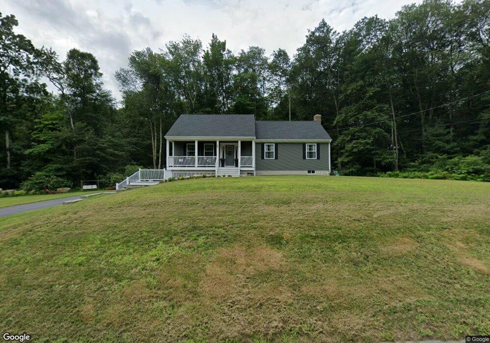
118 Chestnut St Douglas, MA 01516
Estimated Value: $610,770 - $652,000
3
Beds
2
Baths
2,030
Sq Ft
$315/Sq Ft
Est. Value
About This Home
This home is located at 118 Chestnut St, Douglas, MA 01516 and is currently estimated at $639,943, approximately $315 per square foot. 118 Chestnut St is a home located in Worcester County with nearby schools including Douglas Primary School, Douglas Middle School, and Douglas High School.
Ownership History
Date
Name
Owned For
Owner Type
Purchase Details
Closed on
Jun 2, 2016
Sold by
Thompson Tibisay J
Bought by
Coffey Kevin J and Coffey Carole A
Current Estimated Value
Purchase Details
Closed on
Oct 30, 2015
Sold by
Ellis Kyle A and Torres Diane E
Bought by
Thompson Tibisay J
Home Financials for this Owner
Home Financials are based on the most recent Mortgage that was taken out on this home.
Original Mortgage
$50,000
Interest Rate
3.92%
Mortgage Type
New Conventional
Create a Home Valuation Report for This Property
The Home Valuation Report is an in-depth analysis detailing your home's value as well as a comparison with similar homes in the area
Home Values in the Area
Average Home Value in this Area
Purchase History
| Date | Buyer | Sale Price | Title Company |
|---|---|---|---|
| Coffey Kevin J | $83,000 | -- | |
| Thompson Tibisay J | $70,000 | -- |
Source: Public Records
Mortgage History
| Date | Status | Borrower | Loan Amount |
|---|---|---|---|
| Previous Owner | Thompson Tibisay J | $50,000 |
Source: Public Records
Tax History
| Year | Tax Paid | Tax Assessment Tax Assessment Total Assessment is a certain percentage of the fair market value that is determined by local assessors to be the total taxable value of land and additions on the property. | Land | Improvement |
|---|---|---|---|---|
| 2025 | $69 | $523,700 | $100,800 | $422,900 |
| 2024 | $6,783 | $501,700 | $91,600 | $410,100 |
| 2023 | $6,601 | $459,700 | $91,600 | $368,100 |
| 2022 | $6,567 | $401,900 | $85,900 | $316,000 |
| 2021 | $6,405 | $383,100 | $81,900 | $301,200 |
| 2020 | $6,245 | $367,800 | $81,900 | $285,900 |
| 2019 | $5,667 | $323,800 | $81,900 | $241,900 |
| 2018 | $3,606 | $224,400 | $81,900 | $142,500 |
| 2017 | $1,042 | $62,300 | $62,300 | $0 |
| 2016 | $1,048 | $62,300 | $62,300 | $0 |
| 2015 | $1,025 | $62,300 | $62,300 | $0 |
Source: Public Records
Map
Nearby Homes
- 48 Walnut St
- 38 Hemlock St
- 32 Hemlock St
- 240 South St
- 59 Old Farm Rd
- 11 Old Farm Rd
- 10 Essex St
- 2535 Wallum Lake Rd
- 3 S East Main St
- 295 S East Main St Unit Lot 6
- 279 S East Main St Unit Lot 2
- 299 S East Main St Unit Lot 7
- 303 S East Main St Unit Lot 8
- 307 S East Main St Unit Lot 9
- Lot 27 Cedar St
- 13 Perry St
- 0 Wallum Lake Rd
- 296 Yew St
- 60 Webster St
- 99 Maple St
- 118 Chestnut St
- 118 Chestnut St
- 118 Chestnut St Unit 2
- LOT 8 146 Chestnut St
- 126 Chestnut St
- 130 Chestnut St
- 117 Chestnut St
- 127 Chestnut St
- 134 Chestnut St
- Lot 6 138 Chestnut St
- 133 Chestnut St
- 101 Chestnut St
- 138 Chestnut St
- 97 Chestnut St
- 142 Chestnut St
- 141 Chestnut St
- 93 Chestnut St
- 88 Walnut St
- 148 Chestnut St
- 76 Walnut St
Your Personal Tour Guide
Ask me questions while you tour the home.