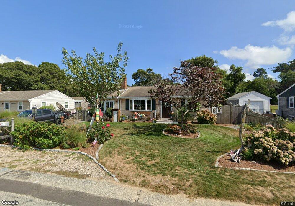
118 Cornell Dr Dennis Port, MA 02639
Dennis Port NeighborhoodEstimated Value: $634,000 - $755,000
3
Beds
2
Baths
1,249
Sq Ft
$571/Sq Ft
Est. Value
About This Home
This home is located at 118 Cornell Dr, Dennis Port, MA 02639 and is currently estimated at $713,081, approximately $570 per square foot. 118 Cornell Dr is a home located in Barnstable County with nearby schools including Dennis-Yarmouth Regional High School and St. Pius X. School.
Ownership History
Date
Name
Owned For
Owner Type
Purchase Details
Closed on
Jun 13, 2023
Sold by
Richardson Joel E
Bought by
Richardson Irt and Richardson
Current Estimated Value
Purchase Details
Closed on
Jun 25, 2013
Sold by
Richardson Joel E and Richardson Susan L
Bought by
Richardson Lt and Richardson
Purchase Details
Closed on
Jun 12, 2013
Sold by
Richardson Joel E and Richardson Susan L
Bought by
Richardson Lt and Richardson
Create a Home Valuation Report for This Property
The Home Valuation Report is an in-depth analysis detailing your home's value as well as a comparison with similar homes in the area
Home Values in the Area
Average Home Value in this Area
Purchase History
| Date | Buyer | Sale Price | Title Company |
|---|---|---|---|
| Richardson Irt | -- | None Available | |
| Richardson Joel E | -- | None Available | |
| Richardson Lt | -- | -- | |
| Richardson Lt | -- | -- | |
| Richardson Lt | -- | -- |
Source: Public Records
Tax History Compared to Growth
Tax History
| Year | Tax Paid | Tax Assessment Tax Assessment Total Assessment is a certain percentage of the fair market value that is determined by local assessors to be the total taxable value of land and additions on the property. | Land | Improvement |
|---|---|---|---|---|
| 2025 | $2,950 | $681,200 | $209,200 | $472,000 |
| 2024 | $2,811 | $640,400 | $201,100 | $439,300 |
| 2023 | $2,720 | $582,500 | $182,900 | $399,600 |
| 2022 | $2,608 | $465,800 | $164,700 | $301,100 |
| 2021 | $2,630 | $436,200 | $184,600 | $251,600 |
| 2020 | $2,379 | $390,000 | $161,500 | $228,500 |
| 2019 | $2,234 | $362,000 | $158,300 | $203,700 |
| 2018 | $2,135 | $336,800 | $150,700 | $186,100 |
| 2017 | $1,969 | $320,100 | $139,900 | $180,200 |
| 2016 | $1,604 | $245,600 | $150,700 | $94,900 |
| 2015 | $1,572 | $245,600 | $150,700 | $94,900 |
| 2014 | $1,423 | $224,100 | $129,200 | $94,900 |
Source: Public Records
Map
Nearby Homes
- 19 Standish Way
- 80 Michaels Ave
- 31 Easy St
- 22 Wixon Rd
- 4 Coffey Ln
- 71 Main St
- 125 Main St Unit 3
- 72 Bassett Ln
- 12 Spoonbill Rd
- 268 Main St
- 37 Ocean Dr Unit 2
- 64 Beaten Rd
- 15 Woodside Park Rd
- 22 Ferncliff Rd
- 37 Beach Hills Rd
- 37-A Beach Hills Rd
- 262 Old Wharf Rd Unit 67
- 262 Old Wharf Rd Unit 5
- 262 Old Wharf Rd Unit 5
- 262 Old Wharf Rd Unit 20