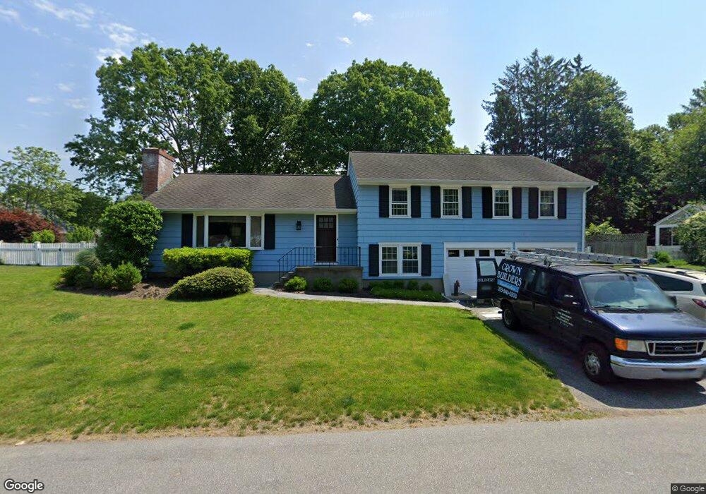
118 Daves Ln Southport, CT 06890
Estimated Value: $1,131,000 - $1,418,000
3
Beds
3
Baths
1,736
Sq Ft
$732/Sq Ft
Est. Value
About This Home
This home is located at 118 Daves Ln, Southport, CT 06890 and is currently estimated at $1,270,966, approximately $732 per square foot. 118 Daves Ln is a home located in Fairfield County with nearby schools including Mill Hill School, Roger Ludlowe Middle School, and Fairfield Ludlowe High School.
Ownership History
Date
Name
Owned For
Owner Type
Purchase Details
Closed on
Dec 30, 2004
Sold by
Sposato Deon J and Sposato Kristn A
Bought by
Cannor Thomas E and Cannor Kathy M
Current Estimated Value
Purchase Details
Closed on
Aug 10, 1998
Sold by
Humiston Edmund C
Bought by
Sposato Dean J and Sposato Kristin A
Purchase Details
Closed on
Jul 25, 1996
Sold by
Pezanko Lawrence J and Pezanko Saro O
Bought by
Humiston Edmund C and Humiston Kelly H
Purchase Details
Closed on
Aug 30, 1991
Sold by
Schafran Richard A and Schafran Amy S
Bought by
Pezanko Lawrence J and Pezanko Sara
Create a Home Valuation Report for This Property
The Home Valuation Report is an in-depth analysis detailing your home's value as well as a comparison with similar homes in the area
Home Values in the Area
Average Home Value in this Area
Purchase History
| Date | Buyer | Sale Price | Title Company |
|---|---|---|---|
| Cannor Thomas E | $699,900 | -- | |
| Cannor Thomas E | $699,900 | -- | |
| Sposato Dean J | $399,900 | -- | |
| Sposato Dean J | $399,900 | -- | |
| Humiston Edmund C | $360,000 | -- | |
| Humiston Edmund C | $360,000 | -- | |
| Pezanko Lawrence J | $305,000 | -- |
Source: Public Records
Mortgage History
| Date | Status | Borrower | Loan Amount |
|---|---|---|---|
| Open | Pezanko Lawrence J | $255,387 | |
| Open | Pezanko Lawrence J | $404,400 |
Source: Public Records
Tax History Compared to Growth
Tax History
| Year | Tax Paid | Tax Assessment Tax Assessment Total Assessment is a certain percentage of the fair market value that is determined by local assessors to be the total taxable value of land and additions on the property. | Land | Improvement |
|---|---|---|---|---|
| 2025 | $11,745 | $413,700 | $291,130 | $122,570 |
| 2024 | $11,542 | $413,700 | $291,130 | $122,570 |
| 2023 | $11,381 | $413,700 | $291,130 | $122,570 |
| 2022 | $11,269 | $413,700 | $291,130 | $122,570 |
| 2021 | $11,162 | $413,700 | $291,130 | $122,570 |
| 2020 | $10,965 | $409,290 | $288,120 | $121,170 |
| 2019 | $10,965 | $409,290 | $288,120 | $121,170 |
| 2018 | $10,789 | $409,290 | $288,120 | $121,170 |
| 2017 | $10,568 | $409,290 | $288,120 | $121,170 |
| 2016 | $10,416 | $409,290 | $288,120 | $121,170 |
| 2015 | $10,447 | $421,400 | $303,380 | $118,020 |
| 2014 | $10,282 | $421,400 | $303,380 | $118,020 |
Source: Public Records
Map
Nearby Homes
- 153 Pease Ave
- 2 Elmwood Dr Unit 2
- 125 Old Rd
- 844 Mill Hill Terrace
- 220 Lansdowne
- 646 Mill Hill Terrace
- 305 S Gate Ln
- 1 Coastal Ct
- 107 Old Rd
- 944 Pequot Ave
- 28 Mill Hill Rd Unit 28
- 7 High Gate Rd
- 476 Mill Hill Terrace
- 53 Hilltop Dr
- 36 Maple Ave S
- 1213 Cedar Rd
- 260 Willow St
- 1135 Mill Hill Rd
- 1001 Hulls Farm Rd
- 342 Greens Farms Rd