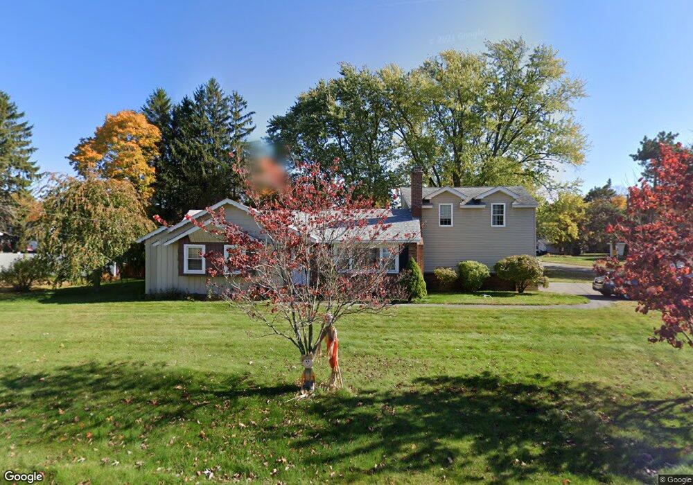
118 Deershorn Rd Lancaster, MA 01523
Estimated Value: $485,000 - $571,000
3
Beds
1
Bath
1,219
Sq Ft
$437/Sq Ft
Est. Value
About This Home
This home is located at 118 Deershorn Rd, Lancaster, MA 01523 and is currently estimated at $532,594, approximately $436 per square foot. 118 Deershorn Rd is a home located in Worcester County with nearby schools including Mary Rowlandson Elementary School, Luther Burbank Middle School, and Nashoba Regional High School.
Ownership History
Date
Name
Owned For
Owner Type
Purchase Details
Closed on
Jul 30, 2004
Sold by
Guay Alicia Lee
Bought by
Potter Christopher Dan and Hennessey Diane
Current Estimated Value
Home Financials for this Owner
Home Financials are based on the most recent Mortgage that was taken out on this home.
Original Mortgage
$231,920
Outstanding Balance
$117,517
Interest Rate
6.33%
Mortgage Type
Purchase Money Mortgage
Estimated Equity
$415,077
Purchase Details
Closed on
Nov 20, 2003
Sold by
Bailey George R and Bailey Robert M
Bought by
Guay Alicia L and Guay Anthony M
Home Financials for this Owner
Home Financials are based on the most recent Mortgage that was taken out on this home.
Original Mortgage
$95,000
Interest Rate
5.98%
Mortgage Type
Purchase Money Mortgage
Create a Home Valuation Report for This Property
The Home Valuation Report is an in-depth analysis detailing your home's value as well as a comparison with similar homes in the area
Home Values in the Area
Average Home Value in this Area
Purchase History
| Date | Buyer | Sale Price | Title Company |
|---|---|---|---|
| Potter Christopher Dan | $289,900 | -- | |
| Guay Alicia L | $292,500 | -- |
Source: Public Records
Mortgage History
| Date | Status | Borrower | Loan Amount |
|---|---|---|---|
| Open | Potter Christopher Dan | $231,920 | |
| Previous Owner | Guay Alicia L | $95,000 |
Source: Public Records
Tax History Compared to Growth
Tax History
| Year | Tax Paid | Tax Assessment Tax Assessment Total Assessment is a certain percentage of the fair market value that is determined by local assessors to be the total taxable value of land and additions on the property. | Land | Improvement |
|---|---|---|---|---|
| 2025 | $7,346 | $454,600 | $104,700 | $349,900 |
| 2024 | $7,464 | $427,500 | $97,400 | $330,100 |
| 2023 | $6,862 | $399,200 | $88,600 | $310,600 |
| 2022 | $6,383 | $328,200 | $91,900 | $236,300 |
| 2021 | $6,208 | $310,700 | $91,900 | $218,800 |
| 2020 | $6,717 | $338,400 | $91,900 | $246,500 |
| 2019 | $6,119 | $309,800 | $91,900 | $217,900 |
| 2018 | $5,578 | $279,200 | $91,900 | $187,300 |
| 2016 | $5,136 | $262,700 | $91,100 | $171,600 |
| 2015 | $4,853 | $258,700 | $91,100 | $167,600 |
| 2014 | $4,820 | $254,900 | $91,100 | $163,800 |
Source: Public Records
Map
Nearby Homes
- 54 S Meadow Rd
- 1116 George Hill Rd
- 290 Sterling St
- 19 Magnolia Ave
- 76 Sterling St
- 0 Parker Rd
- 20 Willow St
- 51 Rigby St
- 22 Forest Ave
- 23 Bennett Ln
- 85 Prescott St
- 92 Mill St
- 29 Bennett Ln
- 1 Grady St
- 136 Mill St
- 201-203 Stone St
- 201 Stone St Unit 203
- 132 Kilbourn Rd
- 55 Sterling St Unit 306
- 55 Sterling St Unit 314