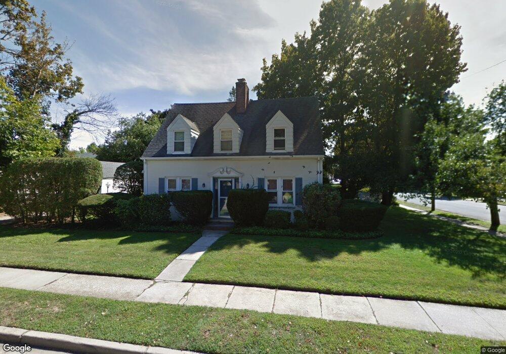
118 Dikeman St Hempstead, NY 11550
Estimated Value: $614,000 - $692,153
3
Beds
3
Baths
1,398
Sq Ft
$467/Sq Ft
Est. Value
About This Home
This home is located at 118 Dikeman St, Hempstead, NY 11550 and is currently estimated at $653,077, approximately $467 per square foot. 118 Dikeman St is a home located in Nassau County with nearby schools including California Avenue Elementary School, Lawrence Road Middle School, and Uniondale High School.
Ownership History
Date
Name
Owned For
Owner Type
Purchase Details
Closed on
Aug 25, 2017
Sold by
Wildeman Isabel A
Bought by
Lafontant Kevin and Lafontant Charles
Current Estimated Value
Home Financials for this Owner
Home Financials are based on the most recent Mortgage that was taken out on this home.
Original Mortgage
$384,899
Outstanding Balance
$325,391
Interest Rate
4.37%
Mortgage Type
FHA
Estimated Equity
$327,686
Create a Home Valuation Report for This Property
The Home Valuation Report is an in-depth analysis detailing your home's value as well as a comparison with similar homes in the area
Home Values in the Area
Average Home Value in this Area
Purchase History
| Date | Buyer | Sale Price | Title Company |
|---|---|---|---|
| Lafontant Kevin | $392,000 | None Available | |
| Wildeman Isabel A | -- | None Available |
Source: Public Records
Mortgage History
| Date | Status | Borrower | Loan Amount |
|---|---|---|---|
| Open | Lafontant Kevin | $384,899 |
Source: Public Records
Tax History Compared to Growth
Tax History
| Year | Tax Paid | Tax Assessment Tax Assessment Total Assessment is a certain percentage of the fair market value that is determined by local assessors to be the total taxable value of land and additions on the property. | Land | Improvement |
|---|---|---|---|---|
| 2025 | $7,118 | $411 | $147 | $264 |
| 2024 | $1,038 | $411 | $147 | $264 |
| 2023 | $5,908 | $411 | $147 | $264 |
| 2022 | $5,908 | $411 | $147 | $264 |
| 2021 | $8,095 | $392 | $140 | $252 |
| 2020 | $5,432 | $442 | $410 | $32 |
| 2019 | $970 | $442 | $384 | $58 |
| 2018 | $710 | $472 | $0 | $0 |
| 2017 | $1,974 | $501 | $387 | $114 |
| 2016 | $2,851 | $531 | $370 | $161 |
| 2015 | $804 | $560 | $354 | $206 |
| 2014 | $804 | $560 | $354 | $206 |
| 2013 | $772 | $589 | $372 | $217 |
Source: Public Records
Map
Nearby Homes
- 109 Leverich St
- 78 Spencer Place
- 59 Ingraham Blvd
- 72 Ingraham Blvd
- 199 William St
- 106 Spencer Place
- 183 Perry St
- 7 Stanley Place
- 41 Perry St
- 355 Jerusalem Ave
- 27 Elizabeth Ct
- 18 Perry St
- 23 Elizabeth Ct
- 110 Powell Place
- 749 Front St
- 33 Elmwood Ave
- 112 Rutland Rd
- 203 Rutland Rd
- 403 Jerusalem Ave
- 50 Cameron Ave
- 61 Clermont Ave
- 140 Dikeman St
- 129 Dikeman St
- 14 Spencer Place
- 114 Dikeman St
- 60 Clermont Ave
- 137 Dikeman St
- 69 Clermont Ave
- 69 Clermont Ave
- 18 Spencer Place
- 64 Clermont Ave
- 37 Clermont Ave
- 75 Clermont Ave
- 115 Dikeman St
- 145 Dikeman St
- 70 Clermont Ave
- 22 Spencer Place
- 106 Dikeman St
- 38 Clermont Ave
- 5 Spencer Place