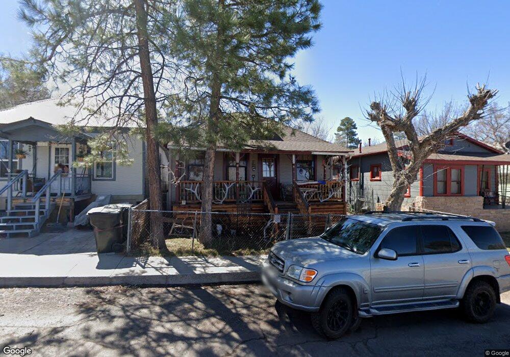
118 E Sheridan Ave Williams, AZ 86046
Estimated Value: $274,635 - $380,000
--
Bed
1
Bath
1,265
Sq Ft
$257/Sq Ft
Est. Value
About This Home
This home is located at 118 E Sheridan Ave, Williams, AZ 86046 and is currently estimated at $325,159, approximately $257 per square foot. 118 E Sheridan Ave is a home located in Coconino County with nearby schools including Williams Elementary/Middle School, Williams High School, and Heritage Elementary - Williams.
Ownership History
Date
Name
Owned For
Owner Type
Purchase Details
Closed on
Jul 17, 2012
Sold by
Thompson Linda L
Bought by
Thompson Ray L and Thompson Linda L
Current Estimated Value
Purchase Details
Closed on
May 3, 2010
Sold by
Thompson Ray L and Thompson Linda L
Bought by
Thompson Linda L
Home Financials for this Owner
Home Financials are based on the most recent Mortgage that was taken out on this home.
Original Mortgage
$75,000
Interest Rate
4.99%
Mortgage Type
New Conventional
Create a Home Valuation Report for This Property
The Home Valuation Report is an in-depth analysis detailing your home's value as well as a comparison with similar homes in the area
Home Values in the Area
Average Home Value in this Area
Purchase History
| Date | Buyer | Sale Price | Title Company |
|---|---|---|---|
| Thompson Ray L | -- | Pioneer Title Agency Inc | |
| Thompson Linda L | -- | Pioneer Title Agency Inc |
Source: Public Records
Mortgage History
| Date | Status | Borrower | Loan Amount |
|---|---|---|---|
| Closed | Thompson Linda L | $75,000 |
Source: Public Records
Tax History Compared to Growth
Tax History
| Year | Tax Paid | Tax Assessment Tax Assessment Total Assessment is a certain percentage of the fair market value that is determined by local assessors to be the total taxable value of land and additions on the property. | Land | Improvement |
|---|---|---|---|---|
| 2025 | $521 | $18,089 | -- | -- |
| 2024 | $521 | $17,265 | -- | -- |
| 2023 | $504 | $13,067 | $0 | $0 |
| 2022 | $475 | $11,162 | $0 | $0 |
| 2021 | $463 | $10,088 | $0 | $0 |
| 2020 | $452 | $8,963 | $0 | $0 |
| 2019 | $439 | $8,467 | $0 | $0 |
| 2018 | $421 | $7,594 | $0 | $0 |
| 2017 | $416 | $6,116 | $0 | $0 |
| 2016 | $392 | $5,626 | $0 | $0 |
| 2015 | $382 | $5,587 | $0 | $0 |
Source: Public Records
Map
Nearby Homes
- 412 S 1st St
- 106 W Sherman Ave
- 1012 Foothill Rd
- 201 S Slagel St
- 500 W Meade Ave
- 304 S 4th St
- 733 S 3rd St
- 344 E Route 66
- 500 Grand Canyon Ave
- 411 S 6th St
- 215 W Hancock Ave
- 530 W Mcpherson Ave
- 407 S 7th St
- 00 W Fulton Ave
- 410 N Locust St Unit 18
- 911 W Oak St
- 725 N Humbolt St
- 1011 W Sheridan Ave
- 1021 W Sheridan Ave
- 1030 W Hancock Ave
- 122 E Sheridan Ave
- 110 E Sheridan Ave
- 130 E Sheridan Ave
- 401 S 1st St
- 405 S 1st St
- 117 E Sheridan Ave
- 409 S 1st St
- 409 S 1st St
- 408 S Taber St
- 327 S 1st St
- 109 E Hancock Ave
- 402 S 1st St
- 408 S 1st St
- 105 E Hancock Ave
- 109 E Sheridan Ave
- 119 E Hancock Ave
- 111 E Sheridan Ave
- 369 Howard Mesa Phase 1 Ranch Unit 369
- 311 S 1st St
- 450 S 1st St