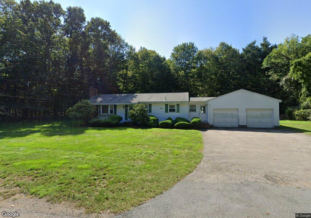
118 Elysium St Wrentham, MA 02093
Estimated Value: $530,000 - $680,000
3
Beds
2
Baths
1,104
Sq Ft
$538/Sq Ft
Est. Value
About This Home
This home is located at 118 Elysium St, Wrentham, MA 02093 and is currently estimated at $594,227, approximately $538 per square foot. 118 Elysium St is a home located in Norfolk County with nearby schools including Delaney Elementary School and Charles E Roderick.
Create a Home Valuation Report for This Property
The Home Valuation Report is an in-depth analysis detailing your home's value as well as a comparison with similar homes in the area
Tax History
| Year | Tax Paid | Tax Assessment Tax Assessment Total Assessment is a certain percentage of the fair market value that is determined by local assessors to be the total taxable value of land and additions on the property. | Land | Improvement |
|---|---|---|---|---|
| 2025 | $5,885 | $507,800 | $278,900 | $228,900 |
| 2024 | $5,452 | $454,300 | $278,900 | $175,400 |
| 2023 | $5,237 | $415,000 | $253,700 | $161,300 |
| 2022 | $5,401 | $395,100 | $246,800 | $148,300 |
| 2021 | $5,231 | $371,800 | $230,600 | $141,200 |
| 2020 | $4,470 | $313,700 | $176,100 | $137,600 |
| 2019 | $4,396 | $311,300 | $176,100 | $135,200 |
| 2018 | $4,534 | $318,400 | $175,900 | $142,500 |
| 2017 | $4,275 | $300,000 | $172,500 | $127,500 |
| 2016 | $4,178 | $292,600 | $167,500 | $125,100 |
| 2015 | $4,018 | $268,200 | $161,000 | $107,200 |
| 2014 | $3,953 | $258,200 | $154,900 | $103,300 |
Source: Public Records
Map
Nearby Homes
- 500 Franklin St
- 12 Earle Stewart Ln
- Lot 1 - Blueberry 2 Car Plan at King Philip Estates
- Lot 8 - Blueberry 2 Car Plan at King Philip Estates
- Lot 5 - Hughes 2 car Plan at King Philip Estates
- Lot 6 - Blueberry 3 Car Plan at King Philip Estates
- 10 Earle Stewart Ln Unit Lot 5
- Lot 2 - Camden 2 Car Plan at King Philip Estates
- Lot 7 - Cedar Plan at King Philip Estates
- Lot 4 - Hemingway 2 Car Plan at King Philip Estates
- Lot 3 - Blueberry 2 Car Plan at King Philip Estates
- Loty 3-14 Earle Stewart Ln
- 11 Earle Stewart Ln
- 440 Chestnut St
- 50 Reed Fulton Ave Unit Lot 61
- 287 Park St
- 0 Fall Ln
- 955 Summer St
- 10 Nature View Dr
- 15 Nature View Dr
Your Personal Tour Guide
Ask me questions while you tour the home.