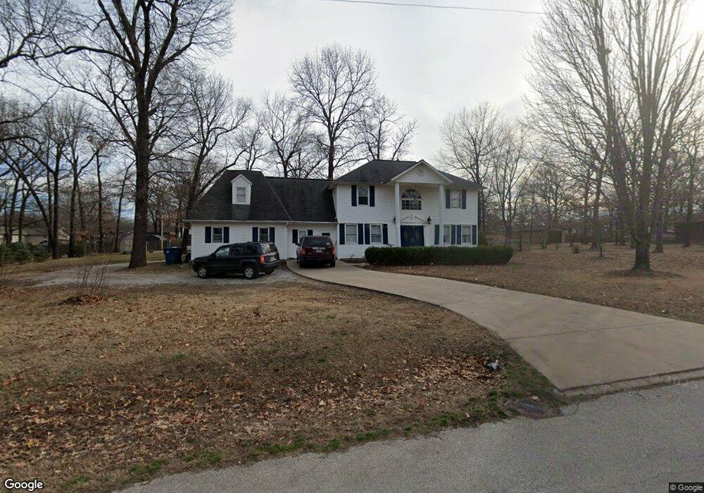
118 Forest Dr Unit 1 Carl Junction, MO 64834
Estimated Value: $302,000 - $328,000
3
Beds
3
Baths
2,380
Sq Ft
$132/Sq Ft
Est. Value
About This Home
This home is located at 118 Forest Dr Unit 1, Carl Junction, MO 64834 and is currently estimated at $314,394, approximately $132 per square foot. 118 Forest Dr Unit 1 is a home located in Jasper County with nearby schools including Carl Junction Primary School (K-1), Carl Junction Intermediate School, and Carl Junction Primary School (2-3).
Ownership History
Date
Name
Owned For
Owner Type
Purchase Details
Closed on
Jan 11, 2023
Sold by
Goodwin Daniel A and Goodwin Leslee J
Bought by
Miner Brycen and Miner Christian P
Current Estimated Value
Home Financials for this Owner
Home Financials are based on the most recent Mortgage that was taken out on this home.
Original Mortgage
$257,900
Outstanding Balance
$249,485
Interest Rate
6.49%
Mortgage Type
VA
Estimated Equity
$64,909
Purchase Details
Closed on
Dec 3, 2020
Sold by
Hoskinson Jeffrey and Hoskinson Michele L
Bought by
Goodwin Daniel A and Goodwin Leslee J
Home Financials for this Owner
Home Financials are based on the most recent Mortgage that was taken out on this home.
Original Mortgage
$217,000
Interest Rate
2.7%
Mortgage Type
New Conventional
Purchase Details
Closed on
Sep 7, 2018
Sold by
Gateway Mtg Group Llc
Bought by
Hoskinson Jeffrey L and Hoskinson Michele L
Home Financials for this Owner
Home Financials are based on the most recent Mortgage that was taken out on this home.
Original Mortgage
$84,800
Interest Rate
4.6%
Mortgage Type
Unknown
Purchase Details
Closed on
Jul 9, 2018
Sold by
Gateway Mortgage Group
Bought by
Hoskinson Jeffrey L and Hoskinson Michelle L
Home Financials for this Owner
Home Financials are based on the most recent Mortgage that was taken out on this home.
Original Mortgage
$84,800
Interest Rate
4.6%
Mortgage Type
Unknown
Purchase Details
Closed on
Apr 29, 2015
Sold by
Carrier Josh A and Carrier Amy D
Bought by
Castlebury Stephanie L
Home Financials for this Owner
Home Financials are based on the most recent Mortgage that was taken out on this home.
Original Mortgage
$161,224
Interest Rate
3.74%
Mortgage Type
New Conventional
Purchase Details
Closed on
Apr 30, 2010
Sold by
Sloniker Joseph S and Sloniker Linda K
Bought by
Carrier Josh A and Carrier Amy D
Home Financials for this Owner
Home Financials are based on the most recent Mortgage that was taken out on this home.
Original Mortgage
$156,887
Interest Rate
4.91%
Mortgage Type
FHA
Create a Home Valuation Report for This Property
The Home Valuation Report is an in-depth analysis detailing your home's value as well as a comparison with similar homes in the area
Purchase History
| Date | Buyer | Sale Price | Title Company |
|---|---|---|---|
| Miner Brycen | -- | -- | |
| Goodwin Daniel A | -- | None Available | |
| Hoskinson Jeffrey L | -- | -- | |
| Hoskinson Jeffrey L | -- | -- | |
| Castlebury Stephanie L | -- | Fatco | |
| Carrier Josh A | -- | Complete Title |
Source: Public Records
Mortgage History
| Date | Status | Borrower | Loan Amount |
|---|---|---|---|
| Open | Miner Brycen | $257,900 | |
| Previous Owner | Goodwin Daniel A | $217,000 | |
| Previous Owner | Hoskinson Jeffrey L | $84,800 | |
| Previous Owner | Castlebury Stephanie L | $161,224 | |
| Previous Owner | Carrier Josh A | $156,887 |
Source: Public Records
Tax History
| Year | Tax Paid | Tax Assessment Tax Assessment Total Assessment is a certain percentage of the fair market value that is determined by local assessors to be the total taxable value of land and additions on the property. | Land | Improvement |
|---|---|---|---|---|
| 2025 | $2,014 | $37,870 | $9,830 | $28,040 |
| 2024 | $2,026 | $34,420 | $9,830 | $24,590 |
| 2023 | $2,026 | $34,420 | $9,830 | $24,590 |
| 2022 | $2,079 | $35,220 | $9,830 | $25,390 |
| 2021 | $1,784 | $35,220 | $9,830 | $25,390 |
| 2020 | $1,548 | $30,050 | $9,830 | $20,220 |
| 2019 | $1,470 | $30,050 | $9,830 | $20,220 |
| 2018 | $1,541 | $31,580 | $0 | $0 |
| 2016 | $1,611 | $33,230 | $0 | $0 |
Source: Public Records
Map
Nearby Homes
- 121 Forest Dr
- 112 Red Oak Dr
- 123 Rocky Ln
- 401 Dogwood Trails Loop
- 25122 Gum Rd
- 6548 Mo-171
- 128 Par Ln
- 306 Lakeview Ln
- 107 Foursome Ln
- XXX Lone Elm
- 710 Briarbrook Dr
- 9130 Missouri 171
- 232 Hickory Place
- 328 Briarbrook Dr
- Lot 1B Hwy 171 & Fir Rd
- Lot 1A Hwy 171 & Fir Rd
- 25452 Leffen Ln
- LOT 4C Hwy 171 & Fir Rd Unit 4C
- Lot 1 Hwy 171 & Fir Rd
- 106 Victoria Ln
- 118 Forest Dr
- 118 W Forest Dr
- 120 Forest Dr
- 133 Red Oak Dr Unit 1
- 131 Red Oak Dr
- 116 Forest Dr
- 135 Red Oak Dr
- 137 Red Oak Dr
- 129 Red Oak Dr
- Xx Red Oak Dr
- X Red Oak Dr
- 127 Red Oak Dr
- 127 Red Oak Dr Unit 1
- 139 Red Oak Dr
- 117 Forest Dr
- 114 Forest Dr
- 134 Red Oak Dr
- 125 Red Oak Dr
- 132 Red Oak Dr
- 130 Red Oak Dr
Your Personal Tour Guide
Ask me questions while you tour the home.