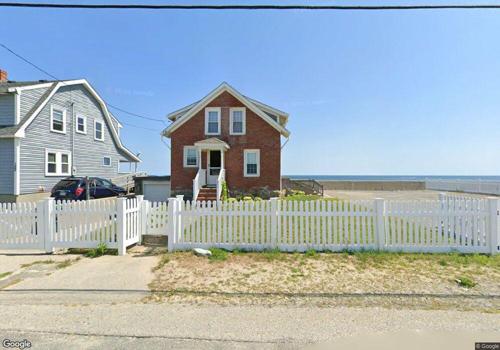
118 Foster Ave Marshfield, MA 02050
Ocean Bluff-Brant Rock NeighborhoodEstimated Value: $639,000 - $1,143,000
2
Beds
2
Baths
975
Sq Ft
$969/Sq Ft
Est. Value
About This Home
This home is located at 118 Foster Ave, Marshfield, MA 02050 and is currently estimated at $944,309, approximately $968 per square foot. 118 Foster Ave is a home with nearby schools including Daniel Webster, Furnace Brook Middle School, and Marshfield High School.
Create a Home Valuation Report for This Property
The Home Valuation Report is an in-depth analysis detailing your home's value as well as a comparison with similar homes in the area
Home Values in the Area
Average Home Value in this Area
Tax History Compared to Growth
Tax History
| Year | Tax Paid | Tax Assessment Tax Assessment Total Assessment is a certain percentage of the fair market value that is determined by local assessors to be the total taxable value of land and additions on the property. | Land | Improvement |
|---|---|---|---|---|
| 2025 | $10,833 | $1,094,200 | $839,800 | $254,400 |
| 2024 | $10,258 | $987,300 | $759,800 | $227,500 |
| 2023 | $9,174 | $913,300 | $719,800 | $193,500 |
| 2022 | $9,174 | $708,400 | $549,800 | $158,600 |
| 2021 | $8,208 | $622,300 | $469,900 | $152,400 |
| 2020 | $7,813 | $586,100 | $439,900 | $146,200 |
| 2019 | $7,759 | $579,900 | $439,900 | $140,000 |
| 2018 | $7,753 | $579,900 | $439,900 | $140,000 |
| 2017 | $7,845 | $571,800 | $439,900 | $131,900 |
| 2016 | $7,869 | $566,900 | $439,900 | $127,000 |
| 2015 | $8,553 | $643,600 | $519,800 | $123,800 |
| 2014 | $7,912 | $595,300 | $479,900 | $115,400 |
Source: Public Records
Map
Nearby Homes
- 122 Foster Ave
- 122 Foster Ave Unit 1
- 128 Foster Ave
- Lot 2 Strawberry Farm Rd
- 119 Foster Ave
- 108 Foster Ave
- 117 Foster Ave
- 117 Foster Ave Unit 1
- 109 Foster Ave
- 109 Foster Ave Unit 1
- 109 Foster Ave
- 0 2nd Rd
- 17 3rd Rd
- 104 Foster Ave
- 105 Foster Ave
- 17 2nd Rd
- 22 2nd Rd
- 22 2nd Rd (Winter Rental) Unit 22
- 135 Foster Ave
- 19 3rd Rd