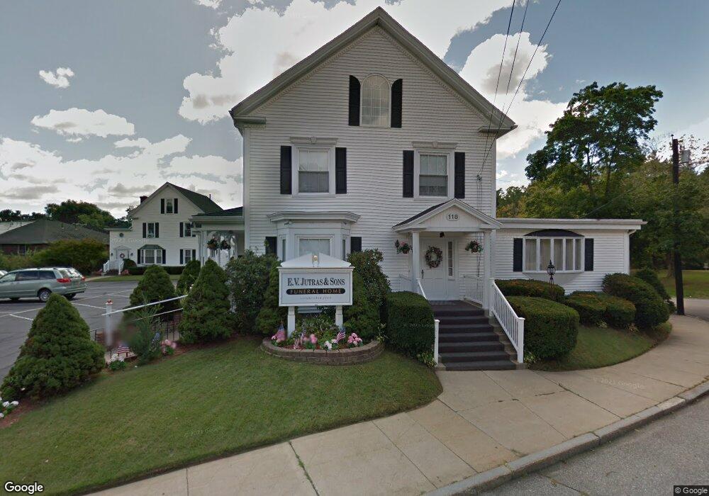
118 Friend St Amesbury, MA 01913
4
Beds
3
Baths
4,746
Sq Ft
0.34
Acres
About This Home
This home is located at 118 Friend St, Amesbury, MA 01913. 118 Friend St is a home located in Essex County with nearby schools including Amesbury High School and Amesbury Seventh-Day Adventist School.
Ownership History
Date
Name
Owned For
Owner Type
Purchase Details
Closed on
Feb 17, 2012
Sold by
Jutras Norman E
Bought by
Jutras Norman E and Jutras Jenna I
Purchase Details
Closed on
Oct 28, 2009
Sold by
Jutras Coleen A
Bought by
Jutras Norman E
Purchase Details
Closed on
Jul 13, 2004
Sold by
Jutras Norman E
Bought by
Jutras Coleen A
Create a Home Valuation Report for This Property
The Home Valuation Report is an in-depth analysis detailing your home's value as well as a comparison with similar homes in the area
Home Values in the Area
Average Home Value in this Area
Purchase History
| Date | Buyer | Sale Price | Title Company |
|---|---|---|---|
| Jutras Norman E | -- | -- | |
| Jutras Norman E | -- | -- | |
| Jutras Coleen A | -- | -- |
Source: Public Records
Mortgage History
| Date | Status | Borrower | Loan Amount |
|---|---|---|---|
| Previous Owner | Jutras Coleen A | $200,000 | |
| Previous Owner | Jutras Coleen A | $26,000 | |
| Previous Owner | Jutras Coleen A | $61,000 |
Source: Public Records
Tax History Compared to Growth
Tax History
| Year | Tax Paid | Tax Assessment Tax Assessment Total Assessment is a certain percentage of the fair market value that is determined by local assessors to be the total taxable value of land and additions on the property. | Land | Improvement |
|---|---|---|---|---|
| 2025 | $13,143 | $859,000 | $194,100 | $664,900 |
| 2024 | $13,263 | $848,000 | $183,100 | $664,900 |
| 2023 | $12,866 | $787,400 | $157,700 | $629,700 |
| 2022 | $13,382 | $756,500 | $157,700 | $598,800 |
| 2021 | $13,335 | $730,700 | $157,700 | $573,000 |
| 2020 | $12,265 | $713,900 | $157,700 | $556,200 |
| 2019 | $12,503 | $680,600 | $150,200 | $530,400 |
| 2018 | $12,664 | $666,900 | $136,500 | $530,400 |
| 2017 | $13,199 | $661,600 | $131,200 | $530,400 |
| 2016 | $12,000 | $591,700 | $125,500 | $466,200 |
| 2015 | $11,751 | $572,100 | $125,500 | $446,600 |
| 2014 | $11,997 | $572,100 | $125,500 | $446,600 |
Source: Public Records
Map
Nearby Homes
- 19 Perkins St
- 129 Friend St
- 15 Sparhawk St Unit 3
- 17 Lincoln Ct
- 13 Lincoln Ct
- 31 Whitter Meadows Dr Unit 31
- 81 High St Unit 27
- 37 Millyard Unit 204
- 49 W Greenwood St
- 24 Aubin St Unit 2
- 43 Aubin St Unit 1
- 4 Greenwood St
- 179 Lions Mouth Rd
- 48 Orchard St
- 53 Market St
- 6 Wells Ave Unit C
- 36 Hillside Ave
- 188 Lions Mouth Rd
- 5 Richs Ct Unit 3
- 97 Elm St
- 114 Friend St
- 28 Perkins St
- 23 Perkins St
- 23 Perkins St Unit 2
- 26 Perkins St
- 110 Friend St
- 141-R Friend St
- 30 Perkins St
- 999 Friend St
- 108 Friend St
- 108 - 112 Friend St
- 6 Perkins St
- 109 Friend St
- 122 Friend St
- 106 Friend St
- 8 1/2 Greenleaf St
- 8 Greenleaf St
- 113 Friend St
- 2 Whitehall Rd
- 107 Friend St