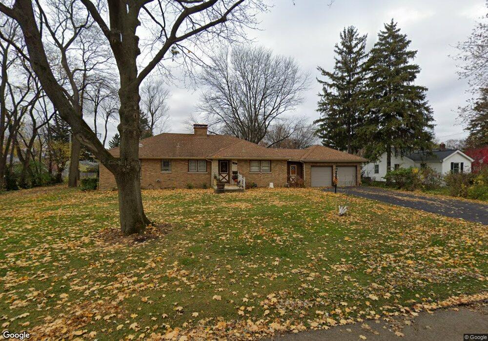
118 Grant Ave Geneva, IL 60134
Northwest Central Geneva NeighborhoodEstimated Value: $462,872 - $559,000
3
Beds
2
Baths
1,464
Sq Ft
$350/Sq Ft
Est. Value
About This Home
This home is located at 118 Grant Ave, Geneva, IL 60134 and is currently estimated at $512,968, approximately $350 per square foot. 118 Grant Ave is a home located in Kane County with nearby schools including Williamsburg Elementary School, Geneva Community High School, and Kensington School - Geneva.
Ownership History
Date
Name
Owned For
Owner Type
Purchase Details
Closed on
Aug 22, 2022
Sold by
Liesen Mary M
Bought by
Liesen Mary M and Liesen Kenneth J
Current Estimated Value
Purchase Details
Closed on
Mar 8, 2013
Sold by
Liesen Gerald J
Bought by
Liesen Gerald J and Liesen Mary M
Purchase Details
Closed on
Dec 10, 1998
Sold by
Liesen Gerald J and Liesen Mary M
Bought by
Liesen Gerald J and The Gerald J Liesen Declaration Of Trust
Create a Home Valuation Report for This Property
The Home Valuation Report is an in-depth analysis detailing your home's value as well as a comparison with similar homes in the area
Home Values in the Area
Average Home Value in this Area
Purchase History
| Date | Buyer | Sale Price | Title Company |
|---|---|---|---|
| Liesen Mary M | -- | None Listed On Document | |
| Liesen Gerald J | -- | Chicago Title Insurance Comp | |
| Liesen Gerald J | -- | -- |
Source: Public Records
Tax History
| Year | Tax Paid | Tax Assessment Tax Assessment Total Assessment is a certain percentage of the fair market value that is determined by local assessors to be the total taxable value of land and additions on the property. | Land | Improvement |
|---|---|---|---|---|
| 2024 | $8,177 | $123,465 | $43,508 | $79,957 |
| 2023 | $7,896 | $112,241 | $39,553 | $72,688 |
| 2022 | $7,659 | $102,728 | $36,752 | $65,976 |
| 2021 | $7,414 | $98,910 | $35,386 | $63,524 |
| 2020 | $7,321 | $97,400 | $34,846 | $62,554 |
| 2019 | $7,291 | $95,556 | $34,186 | $61,370 |
| 2018 | $6,924 | $91,418 | $34,186 | $57,232 |
| 2017 | $6,831 | $88,980 | $33,274 | $55,706 |
| 2016 | $6,697 | $85,989 | $32,824 | $53,165 |
| 2015 | -- | $81,754 | $31,207 | $50,547 |
| 2014 | -- | $77,931 | $31,207 | $46,724 |
| 2013 | -- | $77,931 | $31,207 | $46,724 |
Source: Public Records
Map
Nearby Homes
- 1201 Ford St
- 1211 James St
- 1011 James St
- 301 Country Club Place
- 2753 Stone Cir
- 2749 Stone Cir
- 2719 Stone Cir
- 2747 Stone Cir
- 2751 Stone Cir
- 412 Richards St
- 1736 Kaneville Rd
- 629 N Lincoln Ave
- 518 Illinois St
- 422 Hamilton St
- 1919 Sheffield Ln
- 524 Bradbury Ln
- 523 Eklund Ave
- 413 Cheever Ave
- 1326 Elm St
- 10 Ford St Unit 306
- 126 Grant Ave
- 1319 W State St
- 1315 W State St
- 115 Charles St
- 125 Charles St
- 1329 W State St
- 115 Grant Ave
- 117 Grant Ave
- 107 Grant Ave
- 1222 Peyton St
- 202 Grant Ave
- 1221 W State St
- 1321 Peyton St
- 1318 1/2 W State St
- 201 Charles St
- 1215 W State St
- 212 Grant Ave
- 1225 Peyton St
- 1302 W State St Unit 2S
- 1302 W State St