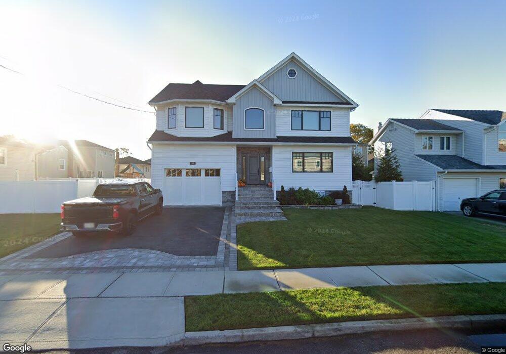
118 Hampton Way Merrick, NY 11566
Estimated Value: $1,016,000 - $1,046,424
3
Beds
1
Bath
2,474
Sq Ft
$417/Sq Ft
Est. Value
About This Home
This home is located at 118 Hampton Way, Merrick, NY 11566 and is currently estimated at $1,031,212, approximately $416 per square foot. 118 Hampton Way is a home located in Nassau County with nearby schools including Merrick Avenue Middle School, John F. Kennedy High School, and St. Elizabeth Ann Seton Regional School.
Ownership History
Date
Name
Owned For
Owner Type
Purchase Details
Closed on
Mar 11, 2019
Sold by
Hampton Way Corp
Bought by
Bachas Peter and Bachas Koula
Current Estimated Value
Purchase Details
Closed on
Jan 4, 2017
Sold by
General Builders Inc
Bought by
Hampton Way Corp
Purchase Details
Closed on
Jul 24, 2013
Sold by
Anchor Pamela M and Anchor Gloria E
Bought by
General Builders Inc
Create a Home Valuation Report for This Property
The Home Valuation Report is an in-depth analysis detailing your home's value as well as a comparison with similar homes in the area
Home Values in the Area
Average Home Value in this Area
Purchase History
| Date | Buyer | Sale Price | Title Company |
|---|---|---|---|
| Bachas Peter | $412,000 | First American Title | |
| Hampton Way Corp | -- | The Seaport Title Agency Ltd | |
| General Builders Inc | $255,000 | -- |
Source: Public Records
Tax History
| Year | Tax Paid | Tax Assessment Tax Assessment Total Assessment is a certain percentage of the fair market value that is determined by local assessors to be the total taxable value of land and additions on the property. | Land | Improvement |
|---|---|---|---|---|
| 2025 | $8,591 | $680 | $246 | $434 |
| 2024 | $2,378 | $796 | $288 | $508 |
Source: Public Records
Map
Nearby Homes
- 110 Hampton Way
- 109 Elliot St
- 2072 Brighton Way
- 2794 Lincoln Blvd
- 2829 Frankel Blvd
- 2070 Beverly Way
- 2845 Whaleneck Dr
- 2066 Holland Way
- 2077 Byron Rd
- 2038 Berfond Ct
- 2884 Bay Dr
- 23 Bay St
- 217 Bayview Ave
- 2863 Harbor Rd
- 3042 Cheryl Rd
- 2729 Shore Dr
- 2074 Ellen Dr
- 2043 Ripley Ln
- 2858 Shore Rd
- 140 Frankel Blvd
- 116 Hampton Way
- 2150 Hampton Way
- 2768 Wynsum Ave
- 119 Shoreham Way
- 117 Shoreham Way
- 114 Hampton Way
- 2149 Shoreham Way
- 119 Hampton Way
- 117 Hampton Way
- 115 Shoreham Way
- 2754 Wynsum Ave
- 115 Hampton Way
- 112 Hampton Way
- 113 Shoreham Way
- 113 Hampton Way
- 2759 Wynsum Ave
- 2765 Wynsum Ave
- 2771 Wynsum Ave
- 112 Elliot St
- 110 Elliot St
Your Personal Tour Guide
Ask me questions while you tour the home.