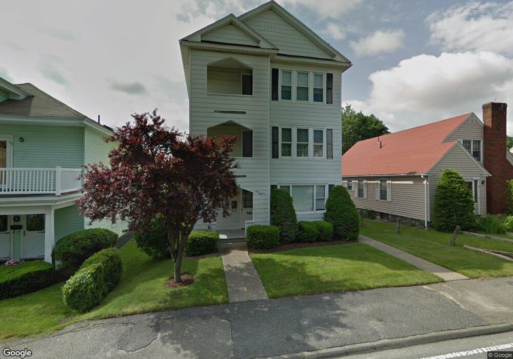
118 Heywood St Unit 1 Worcester, MA 01604
Union HIll NeighborhoodEstimated Value: $586,137 - $750,000
3
Beds
1
Bath
700
Sq Ft
$1,001/Sq Ft
Est. Value
About This Home
This home is located at 118 Heywood St Unit 1, Worcester, MA 01604 and is currently estimated at $701,034, approximately $1,001 per square foot. 118 Heywood St Unit 1 is a home located in Worcester County with nearby schools including Jacob Hiatt Magnet School, Chandler Magnet, and Rice Square Elementary School.
Ownership History
Date
Name
Owned For
Owner Type
Purchase Details
Closed on
Dec 15, 2014
Sold by
118 Heywood Street Rt
Bought by
Ward Matthew
Current Estimated Value
Home Financials for this Owner
Home Financials are based on the most recent Mortgage that was taken out on this home.
Original Mortgage
$263,023
Outstanding Balance
$205,695
Interest Rate
4.5%
Mortgage Type
FHA
Estimated Equity
$495,339
Purchase Details
Closed on
Feb 14, 2011
Sold by
Romano Janice L
Bought by
118 Heywood Street Rt
Purchase Details
Closed on
Dec 22, 2003
Sold by
Abysalh George and Romano Janice L
Bought by
Abysalh Jonathan C
Create a Home Valuation Report for This Property
The Home Valuation Report is an in-depth analysis detailing your home's value as well as a comparison with similar homes in the area
Home Values in the Area
Average Home Value in this Area
Purchase History
| Date | Buyer | Sale Price | Title Company |
|---|---|---|---|
| Ward Matthew | $275,000 | -- | |
| 118 Heywood Street Rt | -- | -- | |
| Abysalh Jonathan C | -- | -- |
Source: Public Records
Mortgage History
| Date | Status | Borrower | Loan Amount |
|---|---|---|---|
| Open | Ward Matthew | $263,023 |
Source: Public Records
Tax History Compared to Growth
Tax History
| Year | Tax Paid | Tax Assessment Tax Assessment Total Assessment is a certain percentage of the fair market value that is determined by local assessors to be the total taxable value of land and additions on the property. | Land | Improvement |
|---|---|---|---|---|
| 2025 | $9,722 | $737,100 | $97,600 | $639,500 |
| 2024 | $8,946 | $650,600 | $97,600 | $553,000 |
| 2023 | $8,577 | $598,100 | $84,800 | $513,300 |
| 2022 | $7,470 | $491,100 | $67,900 | $423,200 |
| 2021 | $7,085 | $435,200 | $54,300 | $380,900 |
| 2020 | $5,593 | $329,000 | $53,900 | $275,100 |
| 2019 | $5,578 | $309,900 | $47,000 | $262,900 |
| 2018 | $5,446 | $288,000 | $47,000 | $241,000 |
| 2017 | $5,101 | $265,400 | $47,000 | $218,400 |
| 2016 | $4,868 | $236,200 | $33,200 | $203,000 |
| 2015 | $3,926 | $195,600 | $33,200 | $162,400 |
| 2014 | $3,822 | $195,600 | $33,200 | $162,400 |
Source: Public Records
Map
Nearby Homes
- 4 Everton Ave
- 8 Beaumont Rd
- 247 Pilgrim Ave
- 36,38,38.5 Houghton St
- 26 Derby St
- 47 Acton St
- 17 Plantation St
- 91 Standish St
- 94 Massasoit Rd
- 10 Lamar Ave
- 423 Grafton St Unit 7
- 573 Grafton St
- 10 Rutledge St Unit 3G
- 62 Allston Ave
- 58 Granite St
- 55 Standish St
- 42 Bridgeport St
- 55 Mendon St
- 169 Fairmont Ave
- 8 Taunton St
- 118 Heywood St
- 112 Heywood St
- 120 Heywood St
- 1 Dearborn St
- 85 Kenberma Rd
- 85 Kenberma Rd Unit 1
- 85 Kenberma Rd Unit 2
- 122 Heywood St
- 87 Kenberma Rd
- 124 Heywood St
- 124 Heywood St Unit 2
- 4 Dearborn St
- 89 Kenberma Rd
- 110 Heywood St
- 119 Heywood St
- 115 Heywood St
- 126 Heywood St
- 91 Kenberma Rd
- 123 Heywood St
- 108 Heywood St