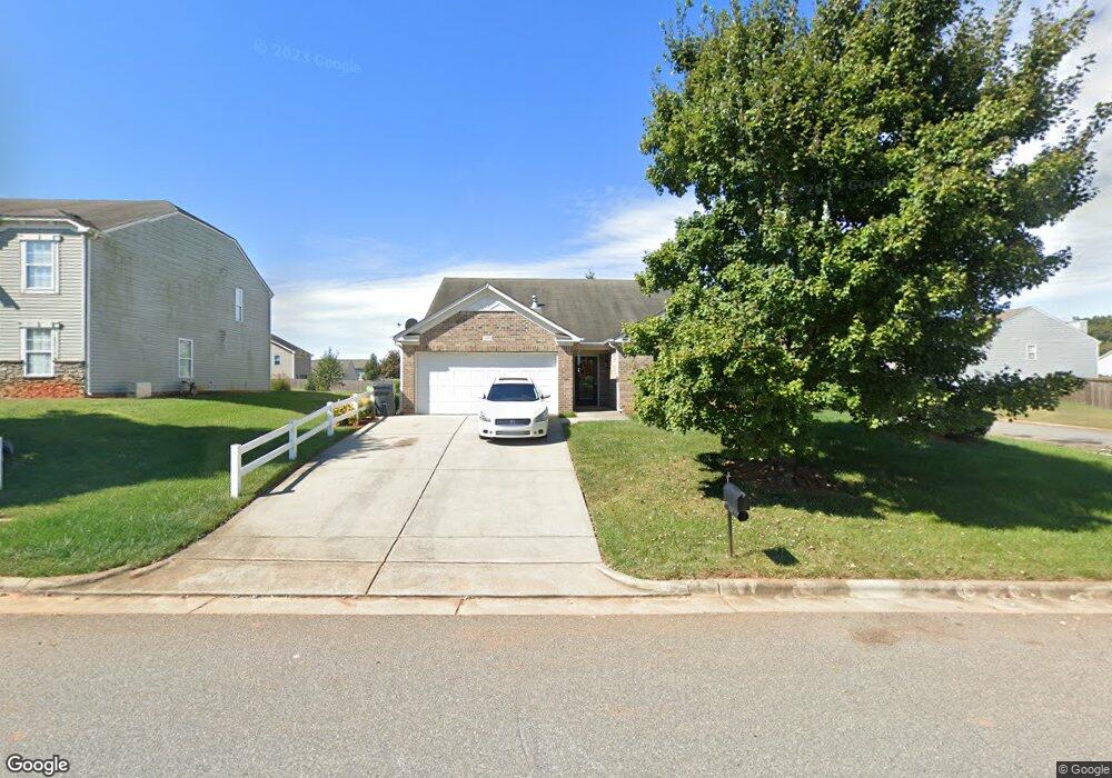
118 Kingsgate Ct Statesville, NC 28625
Estimated Value: $301,000 - $327,000
3
Beds
2
Baths
1,824
Sq Ft
$173/Sq Ft
Est. Value
About This Home
This home is located at 118 Kingsgate Ct, Statesville, NC 28625 and is currently estimated at $315,453, approximately $172 per square foot. 118 Kingsgate Ct is a home located in Iredell County with nearby schools including Cloverleaf Elementary School, East Iredell Middle School, and Statesville High School.
Ownership History
Date
Name
Owned For
Owner Type
Purchase Details
Closed on
Sep 24, 2012
Sold by
Blastick Michael and Blastick Tara A
Bought by
Thompson Lakeya M
Current Estimated Value
Home Financials for this Owner
Home Financials are based on the most recent Mortgage that was taken out on this home.
Original Mortgage
$111,224
Outstanding Balance
$77,633
Interest Rate
3.68%
Mortgage Type
New Conventional
Estimated Equity
$237,820
Purchase Details
Closed on
Apr 4, 2007
Sold by
Cp Morgan Communities Of Charlotte Llc
Bought by
Blastick Michael
Home Financials for this Owner
Home Financials are based on the most recent Mortgage that was taken out on this home.
Original Mortgage
$108,210
Interest Rate
6.18%
Mortgage Type
Purchase Money Mortgage
Create a Home Valuation Report for This Property
The Home Valuation Report is an in-depth analysis detailing your home's value as well as a comparison with similar homes in the area
Home Values in the Area
Average Home Value in this Area
Purchase History
| Date | Buyer | Sale Price | Title Company |
|---|---|---|---|
| Thompson Lakeya M | $109,000 | None Available | |
| Blastick Michael | $144,500 | None Available |
Source: Public Records
Mortgage History
| Date | Status | Borrower | Loan Amount |
|---|---|---|---|
| Open | Thompson Lakeya M | $111,224 | |
| Previous Owner | Blastick Michael | $108,210 | |
| Previous Owner | Blastick Michael | $21,700 |
Source: Public Records
Tax History Compared to Growth
Tax History
| Year | Tax Paid | Tax Assessment Tax Assessment Total Assessment is a certain percentage of the fair market value that is determined by local assessors to be the total taxable value of land and additions on the property. | Land | Improvement |
|---|---|---|---|---|
| 2024 | $1,929 | $316,810 | $60,000 | $256,810 |
| 2023 | $1,929 | $316,810 | $60,000 | $256,810 |
| 2022 | $1,022 | $153,370 | $15,000 | $138,370 |
| 2021 | $1,018 | $153,370 | $15,000 | $138,370 |
| 2020 | $1,018 | $153,370 | $15,000 | $138,370 |
| 2019 | $1,003 | $153,370 | $15,000 | $138,370 |
| 2018 | $823 | $129,070 | $15,000 | $114,070 |
| 2017 | $823 | $129,070 | $15,000 | $114,070 |
| 2016 | $823 | $129,070 | $15,000 | $114,070 |
| 2015 | $823 | $129,070 | $15,000 | $114,070 |
| 2014 | $821 | $138,530 | $19,000 | $119,530 |
Source: Public Records
Map
Nearby Homes
- 141 Altondale Dr
- 105 Rock Ave
- 139 Valencia Ln
- 160 Tarrington Dr
- 109 Oconee Trail
- Lawson Plan at Sullivan Farm
- Frost Plan at Sullivan Farm
- Dickenson Plan at Sullivan Farm
- Whitman Plan at Sullivan Farm
- Crane Plan at Sullivan Farm
- Emerson Plan at Sullivan Farm
- 201 Tarrington Dr
- 145 Oconee Trail
- 150 Oconee Trail
- 142 Catawba Walk Way
- 472 Turnersburg Hwy
- 495&501 Turnersburg Hwy
- 136 Rimmer Rd
- 678 Turnersburg Hwy
- 350 Turnersburg Hwy
- 122 Kingsgate Ct
- 109 Boiling Brook Dr
- 112 Kingsgate Ct
- 126 Kingsgate Ct
- 126 Kingsgate Ct Unit 79
- 116 Altondale Dr
- 108 Boiling Brook Dr
- 119 Kingsgate Ct
- 113 Boiling Brook Dr Unit 83
- 115 Kingsgate Ct
- 123 Kingsgate Ct
- 108 Kingsgate Ct
- 120 Altondale Dr
- 112 Boiling Brook Dr
- 111 Kingsgate Ct
- 127 Kingsgate Ct
- 117 Boiling Brook Dr
- 107 Kingsgate Ct
- 116 Boiling Brook Dr
- 124 Altondale Dr