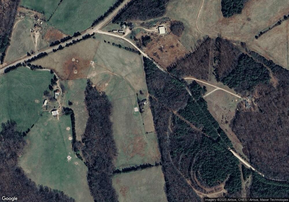
118 Lazy b Dr Hartwell, GA 30643
Estimated Value: $70,000 - $170,000
2
Beds
1
Bath
1,163
Sq Ft
$99/Sq Ft
Est. Value
About This Home
This home is located at 118 Lazy b Dr, Hartwell, GA 30643 and is currently estimated at $114,856, approximately $98 per square foot. 118 Lazy b Dr is a home located in Hart County with nearby schools including Hart County High School.
Ownership History
Date
Name
Owned For
Owner Type
Purchase Details
Closed on
Feb 27, 2024
Sold by
Deveau Jennifer
Bought by
Terry Allen Dale
Current Estimated Value
Purchase Details
Closed on
Apr 15, 2011
Sold by
Stephen James Michael
Bought by
Terry Allen Dale
Purchase Details
Closed on
Mar 1, 2011
Sold by
Terry Allen Dale
Bought by
Terry Allen Dale
Purchase Details
Closed on
Mar 1, 2003
Purchase Details
Closed on
Oct 1, 2002
Purchase Details
Closed on
Jun 1, 2000
Create a Home Valuation Report for This Property
The Home Valuation Report is an in-depth analysis detailing your home's value as well as a comparison with similar homes in the area
Home Values in the Area
Average Home Value in this Area
Purchase History
| Date | Buyer | Sale Price | Title Company |
|---|---|---|---|
| Terry Allen Dale | -- | -- | |
| Terry Allen Dale | $25,050 | -- | |
| Terry Allen Dale | -- | -- | |
| Terry Allen Dale | -- | -- | |
| -- | -- | -- | |
| -- | $25,100 | -- | |
| -- | -- | -- | |
| -- | $44,000 | -- |
Source: Public Records
Tax History Compared to Growth
Tax History
| Year | Tax Paid | Tax Assessment Tax Assessment Total Assessment is a certain percentage of the fair market value that is determined by local assessors to be the total taxable value of land and additions on the property. | Land | Improvement |
|---|---|---|---|---|
| 2024 | $490 | $31,713 | $11,389 | $20,324 |
| 2023 | $440 | $26,404 | $9,163 | $17,242 |
| 2022 | $398 | $23,922 | $8,078 | $15,844 |
| 2021 | $347 | $18,695 | $4,359 | $14,336 |
| 2020 | $351 | $18,124 | $4,242 | $13,882 |
| 2019 | $342 | $17,512 | $4,242 | $13,270 |
| 2018 | $357 | $18,034 | $4,242 | $13,792 |
| 2017 | $355 | $17,854 | $4,242 | $13,612 |
| 2016 | $351 | $17,135 | $3,186 | $13,949 |
| 2015 | $350 | $17,958 | $3,954 | $14,004 |
| 2014 | $322 | $16,192 | $2,393 | $13,799 |
| 2013 | -- | $16,779 | $2,393 | $14,386 |
Source: Public Records
Map
Nearby Homes
- 63 Lazy b Dr
- 0 Moore Rd Unit 10552577
- 0 Whippoorwill Trail Unit 7595209
- 0 Whippoorwill Trail Unit 10540460
- 01866 Whippoorwill Trail
- 1866 Whippoorwill Trail
- 141 Utz Ln
- 0 Jacks Hat Rd Unit 10614621
- 0 Jacks Hat Rd Unit 24288811
- 0 Jacks Hat Rd Unit 10597905
- 0 Jacks Hat Rd Unit 7657227
- 1049 Jaybird Rd
- 0 Hornets Bridge Rd Unit 10523059
- 0 Hornets Bridge Rd Unit 10523061
- 0 Hornets Bridge Rd Unit 10601215
- 0 Hornets Bridge Rd Unit 2 10295928
- 127 Georgia Dr
- 108 Wakefield Rd
- 63 Lake Point Ln
- 151 S Pointe Dr
- 743 Saint James Rd
- 1283 Cokesbury Hwy
- 0 Lazy b Dr
- 0 Lazy b Dr Unit 7332691
- 931 Cokesbury Hwy
- 1244 Cokesbury Hwy
- 31 Pepsi Rd
- 1336 Cokesbury Hwy
- 850 Cokesbury Hwy
- 1439 Cokesbury Hwy
- 601 Lazy b Dr
- 130 Pepsi Rd
- 1198 Craft Rd
- 669 Lazy b Dr
- 690 Cokesbury Hwy
- 471 St James Rd
- 471 Saint James Rd
- 845 Cokesbury Hwy
- 550 Cokesbury Hwy
- 591 Saint James Rd
