Estimated Value: $520,828 - $629,000
3
Beds
2
Baths
2,087
Sq Ft
$270/Sq Ft
Est. Value
About This Home
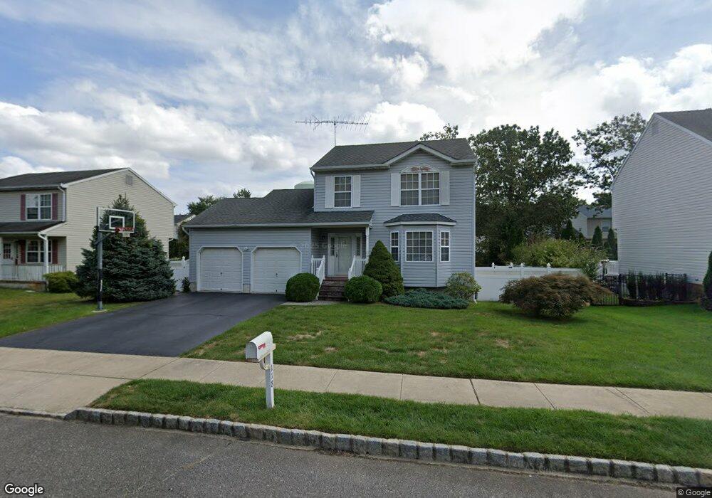
This home is located at 118 Linnea Ln, Brick, NJ 08724 and is currently estimated at $563,957, approximately $270 per square foot. 118 Linnea Ln is a home located in Ocean County with nearby schools including Veterans Memorial Elementary School, Veterans Memorial Middle School, and Brick Township Memorial High School.
Ownership History
Date
Name
Owned For
Owner Type
Purchase Details
Closed on
Nov 22, 2003
Sold by
Mcclung John M
Bought by
Mcclung John M and Tsim Victoria
Current Estimated Value
Home Financials for this Owner
Home Financials are based on the most recent Mortgage that was taken out on this home.
Original Mortgage
$98,219
Outstanding Balance
$45,819
Interest Rate
6.09%
Estimated Equity
$518,138
Purchase Details
Closed on
Mar 1, 1994
Sold by
Arya Properties
Bought by
Mcclung John
Home Financials for this Owner
Home Financials are based on the most recent Mortgage that was taken out on this home.
Original Mortgage
$131,000
Interest Rate
6.9%
Mortgage Type
VA
Create a Home Valuation Report for This Property
The Home Valuation Report is an in-depth analysis detailing your home's value as well as a comparison with similar homes in the area
Home Values in the Area
Average Home Value in this Area
Purchase History
| Date | Buyer | Sale Price | Title Company |
|---|---|---|---|
| Mcclung John M | -- | -- | |
| Mcclung John | $131,500 | -- |
Source: Public Records
Mortgage History
| Date | Status | Borrower | Loan Amount |
|---|---|---|---|
| Open | Mcclung John M | $98,219 | |
| Previous Owner | Mcclung John | $131,000 |
Source: Public Records
Tax History Compared to Growth
Tax History
| Year | Tax Paid | Tax Assessment Tax Assessment Total Assessment is a certain percentage of the fair market value that is determined by local assessors to be the total taxable value of land and additions on the property. | Land | Improvement |
|---|---|---|---|---|
| 2025 | $7,793 | $298,600 | $165,000 | $133,600 |
| 2024 | $7,396 | $298,600 | $165,000 | $133,600 |
| 2023 | $7,289 | $298,600 | $165,000 | $133,600 |
| 2022 | $7,289 | $298,600 | $165,000 | $133,600 |
| 2021 | $7,137 | $298,600 | $165,000 | $133,600 |
| 2020 | $7,044 | $298,600 | $165,000 | $133,600 |
| 2019 | $6,919 | $298,600 | $165,000 | $133,600 |
| 2018 | $6,760 | $298,600 | $165,000 | $133,600 |
| 2017 | $6,578 | $298,600 | $165,000 | $133,600 |
| 2016 | $6,542 | $298,600 | $165,000 | $133,600 |
| 2015 | $6,372 | $298,600 | $165,000 | $133,600 |
| 2014 | $6,318 | $298,600 | $165,000 | $133,600 |
Source: Public Records
Map
Nearby Homes
- 462 Austin Ave
- 291 Prospect Dr
- 270 Westwood Place
- 302 Maxwell Ct
- 405 17th Ave
- 404 Driscol Dr
- 600 Driscol Dr
- 853 Stengel Ave
- 456 Rose Ave
- 384 18th Ave
- 10 Foxwood Ct Unit 93
- 861 Wraight Ave
- 27 Newport Ct Unit 239
- 128 Harding Dr
- 16 English Ln
- 47 Newport Ct Unit 6
- 116 Roosevelt Dr
- 38 Coventry Ct Unit 3
- 174 Glenmore St
- 775 Maple Ave