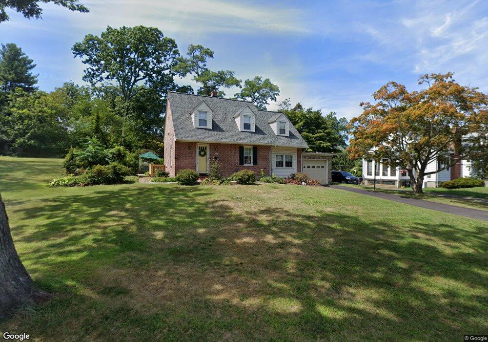
118 Locust Dr Catonsville, MD 21228
Estimated Value: $438,782 - $611,000
--
Bed
2
Baths
1,167
Sq Ft
$438/Sq Ft
Est. Value
About This Home
This home is located at 118 Locust Dr, Catonsville, MD 21228 and is currently estimated at $511,696, approximately $438 per square foot. 118 Locust Dr is a home located in Baltimore County with nearby schools including Hillcrest Elementary School, Catonsville Middle School, and Catonsville High School.
Ownership History
Date
Name
Owned For
Owner Type
Purchase Details
Closed on
Mar 17, 2003
Sold by
English Paul M
Bought by
Jan Buxton and Jan Truffer
Current Estimated Value
Purchase Details
Closed on
Nov 10, 1994
Sold by
Zahn Richard S
Bought by
English Paul M
Home Financials for this Owner
Home Financials are based on the most recent Mortgage that was taken out on this home.
Original Mortgage
$127,500
Interest Rate
8.78%
Purchase Details
Closed on
Sep 8, 1971
Sold by
Forthuber Alice Margaret
Bought by
Zahn Richard S
Create a Home Valuation Report for This Property
The Home Valuation Report is an in-depth analysis detailing your home's value as well as a comparison with similar homes in the area
Home Values in the Area
Average Home Value in this Area
Purchase History
| Date | Buyer | Sale Price | Title Company |
|---|---|---|---|
| Jan Buxton | $285,000 | -- | |
| English Paul M | $164,000 | -- | |
| Zahn Richard S | $30,000 | -- |
Source: Public Records
Mortgage History
| Date | Status | Borrower | Loan Amount |
|---|---|---|---|
| Previous Owner | English Paul M | $127,500 |
Source: Public Records
Tax History Compared to Growth
Tax History
| Year | Tax Paid | Tax Assessment Tax Assessment Total Assessment is a certain percentage of the fair market value that is determined by local assessors to be the total taxable value of land and additions on the property. | Land | Improvement |
|---|---|---|---|---|
| 2025 | $4,819 | $388,767 | -- | -- |
| 2024 | $4,819 | $359,600 | $152,100 | $207,500 |
| 2023 | $2,327 | $346,233 | $0 | $0 |
| 2022 | $4,436 | $332,867 | $0 | $0 |
| 2021 | $4,163 | $319,500 | $152,100 | $167,400 |
| 2020 | $4,247 | $309,933 | $0 | $0 |
| 2019 | $3,640 | $300,367 | $0 | $0 |
| 2018 | $4,226 | $290,800 | $122,100 | $168,700 |
| 2017 | $6,632 | $287,633 | $0 | $0 |
| 2016 | $3,371 | $284,467 | $0 | $0 |
| 2015 | $3,371 | $281,300 | $0 | $0 |
| 2014 | $3,371 | $281,300 | $0 | $0 |
Source: Public Records
Map
Nearby Homes
- 16 Locust Dr
- 206 S Rolling Rd
- 2 Park Dr
- 1326 Brook Rd
- 127 Bloomsbury Ave
- 2 N Beechwood Ave
- 4 Holmes Ave
- 17 N Beaumont Ave
- 38A Winters Ln
- 1218 Mccurley Ave
- 42 Winters Ln
- 1212 Mccurley Ave
- 8 Seminole Ave
- 14 Glenwood Ave
- 609 Wallerson Rd
- 27 Glenwood Ave
- 0 Melvin Ave
- 602 Arlewood Rd
- 133 Wesley Ave
- 214 Shady Nook Ct