Estimated Value: $770,304 - $910,000
About This Home
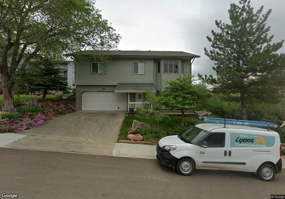
This home is located at 118 Longs Peak Dr, Lyons, CO 80540 and is currently estimated at $841,826, approximately $606 per square foot. 118 Longs Peak Dr is a home with nearby schools including Lyons Elementary School and Lyons Middle/Senior High School.
Ownership History
We collect this data history from publicly available records. To have your information removed, we recommend requesting removal directly through your county’s website.
Purchase Details
Purchase Details
Purchase Details
Purchase Details
Purchase History
We collect this data history from publicly available records. To have your information removed, we recommend requesting removal directly through your county’s website.
| Date | Buyer | Sale Price | Title Company |
|---|---|---|---|
| $15,000 | -- | ||
| $14,900 | -- | ||
| -- | -- | ||
| $24,000 | -- |
Tax History
We collect this data history from publicly available records. To have your information removed, we recommend requesting removal directly through your county’s website.
| Year | Tax Paid | Tax Assessment Tax Assessment Total Assessment is a certain percentage of the fair market value that is determined by local assessors to be the total taxable value of land and additions on the property. | Land | Improvement |
|---|---|---|---|---|
| 2026 | $5,731 | $52,625 | $4,134 | $48,491 |
| 2025 | $5,731 | $52,625 | $4,134 | $48,491 |
| 2024 | $5,595 | $48,369 | $3,800 | $44,569 |
| 2023 | $5,520 | $53,747 | $3,531 | $53,902 |
| 2022 | $4,080 | $40,046 | $3,232 | $36,814 |
| 2021 | $4,031 | $41,199 | $3,325 | $37,874 |
| 2020 | $4,239 | $35,478 | $8,437 | $27,041 |
| 2019 | $4,155 | $35,478 | $8,437 | $27,041 |
| 2018 | $3,643 | $31,730 | $8,496 | $23,234 |
| 2017 | $3,583 | $35,080 | $9,393 | $25,687 |
| 2016 | $3,563 | $30,718 | $8,199 | $22,519 |
| 2015 | $3,387 | $29,142 | $4,378 | $24,764 |
| 2014 | $3,021 | $29,142 | $4,378 | $24,764 |
Map
- 926 4th Ave
- 814 Mountain View Dr
- 1040 5th Ave 2 and 4
- 1040 5th Ave 5
- 240 Main St
- 421 Stickney Ave
- 1012 Steamboat Valley Rd
- 1285 Eagle Ridge Rd
- 2450 Eagle Ridge Rd
- 17667 Route 7
- 317 3rd Ave
- 217 Park St
- 2615 Eagle Ridge Rd
- 215 Ewald Ave
- 217 5th Ave
- 223 Stone Canyon Rd
- 123 Falcon Ln
- 4033 Ute Hwy
- 2685 Eagle Ridge Rd
- 9 Eagle Nest Ln
- 120 Longs Peak Dr
- 116 Longs Peak Dr
- 114 Longs Peak Dr
- 121 Longs Peak Dr
- 119 Longs Peak Dr
- 123 Longs Peak Dr
- 117 Longs Peak Dr
- 124 Longs Peak Dr
- 115 Longs Peak Dr
- 110 Longs Peak Dr
- 113 Longs Peak Dr
- 127 Longs Peak Dr
- 108 Longs Peak Dr
- 111 Longs Peak Dr
- 129 Longs Peak Dr
- 106 Longs Peak Dr
- 109 Longs Peak Dr
- 104 Longs Peak Dr
- 107 Longs Peak Dr
- 832 3rd Ave
Ask me questions while you tour the home.