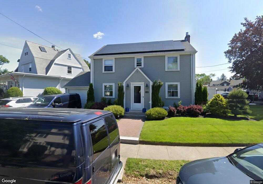
118 Loring Rd Winthrop, MA 02152
Court Park NeighborhoodEstimated Value: $877,000 - $1,013,000
3
Beds
2
Baths
2,140
Sq Ft
$446/Sq Ft
Est. Value
About This Home
This home is located at 118 Loring Rd, Winthrop, MA 02152 and is currently estimated at $953,790, approximately $445 per square foot. 118 Loring Rd is a home located in Suffolk County with nearby schools including William P. Gorman/Fort Banks Elementary School, Arthur T. Cummings Elementary School, and Winthrop Middle School.
Ownership History
Date
Name
Owned For
Owner Type
Purchase Details
Closed on
Dec 10, 2010
Sold by
Jackson William L and Jackson Rita A
Bought by
Cole Craig C and Cole Nicole W
Current Estimated Value
Home Financials for this Owner
Home Financials are based on the most recent Mortgage that was taken out on this home.
Original Mortgage
$434,153
Outstanding Balance
$294,472
Interest Rate
4.75%
Mortgage Type
FHA
Estimated Equity
$659,318
Create a Home Valuation Report for This Property
The Home Valuation Report is an in-depth analysis detailing your home's value as well as a comparison with similar homes in the area
Home Values in the Area
Average Home Value in this Area
Purchase History
| Date | Buyer | Sale Price | Title Company |
|---|---|---|---|
| Cole Craig C | $465,000 | -- |
Source: Public Records
Mortgage History
| Date | Status | Borrower | Loan Amount |
|---|---|---|---|
| Open | Cole Craig C | $434,153 |
Source: Public Records
Tax History Compared to Growth
Tax History
| Year | Tax Paid | Tax Assessment Tax Assessment Total Assessment is a certain percentage of the fair market value that is determined by local assessors to be the total taxable value of land and additions on the property. | Land | Improvement |
|---|---|---|---|---|
| 2025 | $9,048 | $876,700 | $437,600 | $439,100 |
| 2024 | $8,846 | $848,900 | $420,600 | $428,300 |
| 2023 | $8,325 | $778,000 | $385,000 | $393,000 |
| 2022 | $7,929 | $674,200 | $343,800 | $330,400 |
| 2021 | $7,959 | $627,700 | $307,000 | $320,700 |
| 2020 | $7,922 | $627,700 | $307,000 | $320,700 |
| 2019 | $7,836 | $594,500 | $282,900 | $311,600 |
| 2018 | $7,527 | $531,600 | $242,900 | $288,700 |
| 2017 | $7,202 | $499,800 | $231,600 | $268,200 |
| 2016 | $7,043 | $458,200 | $201,400 | $256,800 |
| 2015 | $6,388 | $445,500 | $195,500 | $250,000 |
| 2014 | $6,310 | $405,000 | $150,400 | $254,600 |
Source: Public Records
Map
Nearby Homes
- 191 Court Rd Unit 3
- 66 Lowell Rd
- 62 Lowell Rd
- 105 Circuit Rd
- 47 Bellevue Ave
- 191 Cottage Park Rd
- 170 Cottage Park Rd
- 35 Somerset Ave Unit 6
- 10 Somerset Ave Unit 405
- 10 Somerset Ave Unit 403
- 10 Somerset Ave Unit 404
- 10 Somerset Ave Unit 408
- 10 Somerset Ave Unit 201
- 10 Somerset Ave Unit 211
- 10 Somerset Ave Unit 206
- 142 Pleasant St Unit 12
- 142 Pleasant St Unit 2
- 220 Woodside Ave Unit 1
- 16 Woodside Park
- 92 Plummer Ave