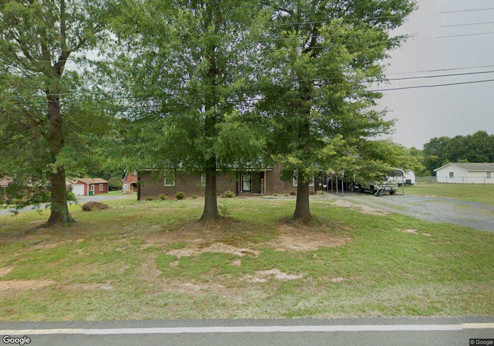
118 Lowder Rd Albemarle, NC 28001
Estimated Value: $285,000 - $314,000
4
Beds
2
Baths
1,636
Sq Ft
$181/Sq Ft
Est. Value
About This Home
This home is located at 118 Lowder Rd, Albemarle, NC 28001 and is currently estimated at $295,456, approximately $180 per square foot. 118 Lowder Rd is a home located in Stanly County with nearby schools including Badin Elementary School, North Stanly Middle School, and North Stanly High School.
Ownership History
Date
Name
Owned For
Owner Type
Purchase Details
Closed on
Apr 17, 2014
Sold by
Reynolds Brian C and Reynolds Naomi L
Bought by
Byrd Brandy Bebber and Byrd David A
Current Estimated Value
Home Financials for this Owner
Home Financials are based on the most recent Mortgage that was taken out on this home.
Original Mortgage
$101,850
Outstanding Balance
$77,512
Interest Rate
4.37%
Mortgage Type
New Conventional
Estimated Equity
$217,944
Create a Home Valuation Report for This Property
The Home Valuation Report is an in-depth analysis detailing your home's value as well as a comparison with similar homes in the area
Home Values in the Area
Average Home Value in this Area
Purchase History
| Date | Buyer | Sale Price | Title Company |
|---|---|---|---|
| Byrd Brandy Bebber | $105,000 | None Available |
Source: Public Records
Mortgage History
| Date | Status | Borrower | Loan Amount |
|---|---|---|---|
| Open | Byrd Brandy Bebber | $101,850 | |
| Closed | Byrd Brandy Bebber | $2,037 |
Source: Public Records
Tax History Compared to Growth
Tax History
| Year | Tax Paid | Tax Assessment Tax Assessment Total Assessment is a certain percentage of the fair market value that is determined by local assessors to be the total taxable value of land and additions on the property. | Land | Improvement |
|---|---|---|---|---|
| 2025 | $1,796 | $160,353 | $24,031 | $136,322 |
| 2024 | $1,507 | $123,508 | $14,419 | $109,089 |
| 2023 | $1,507 | $123,508 | $14,419 | $109,089 |
| 2022 | $1,507 | $123,508 | $14,419 | $109,089 |
| 2021 | $1,507 | $123,508 | $14,419 | $109,089 |
| 2020 | $1,308 | $100,835 | $12,816 | $88,019 |
| 2019 | $1,321 | $100,835 | $12,816 | $88,019 |
| 2018 | $1,321 | $100,835 | $12,816 | $88,019 |
| 2017 | $1,271 | $100,835 | $12,816 | $88,019 |
| 2016 | $1,103 | $87,517 | $12,015 | $75,502 |
| 2015 | $1,114 | $87,517 | $12,015 | $75,502 |
| 2014 | $1,373 | $87,517 | $12,015 | $75,502 |
Source: Public Records
Map
Nearby Homes
- 2812 Highway 52
- 36433 Azalea Cir
- 2411 Brookmeade Dr
- 2810 Greenwood Park Cir
- 2808 Murdock Ln
- 2011 Mountain Creek Rd
- 38430 Airport Rd
- 700 Valleyview Dr Unit 1
- Lot 486 Skyline Dr
- 514 Crestview Dr
- 36984 B&C Carter Rd
- 38899 Dalton Ln
- 38037 Mountain Creek Rd
- 35209 Beth Rd
- 217 Circle Dr
- 1811 Continental Dr
- 37108 Melton Rd
- 36048 Palestine Rd
- 38692 Smoke Ridge Rd
- 1713 Wildwood Dr
- 122 Lowder Rd
- 116 Lowder Rd
- 119 Lowder Rd
- 117 Lowder Rd
- 121 Lowder Rd
- 000 Holt Rd
- 125 Lowder Rd
- 128 Lowder Rd
- 129 Lowder Rd
- 134 Lowder Rd
- 2831 Us Highway 52 N
- 135 Lowder Rd
- 37621 Us Highway 52 N
- 37621 U S 52
- 2827 U S 52
- 2827 Us-52
- 2827 Us Highway 52 N
- 37609 Us Highway 52 N
- 138 Lowder Rd
- 0 Carter Rd Unit 45 3148561