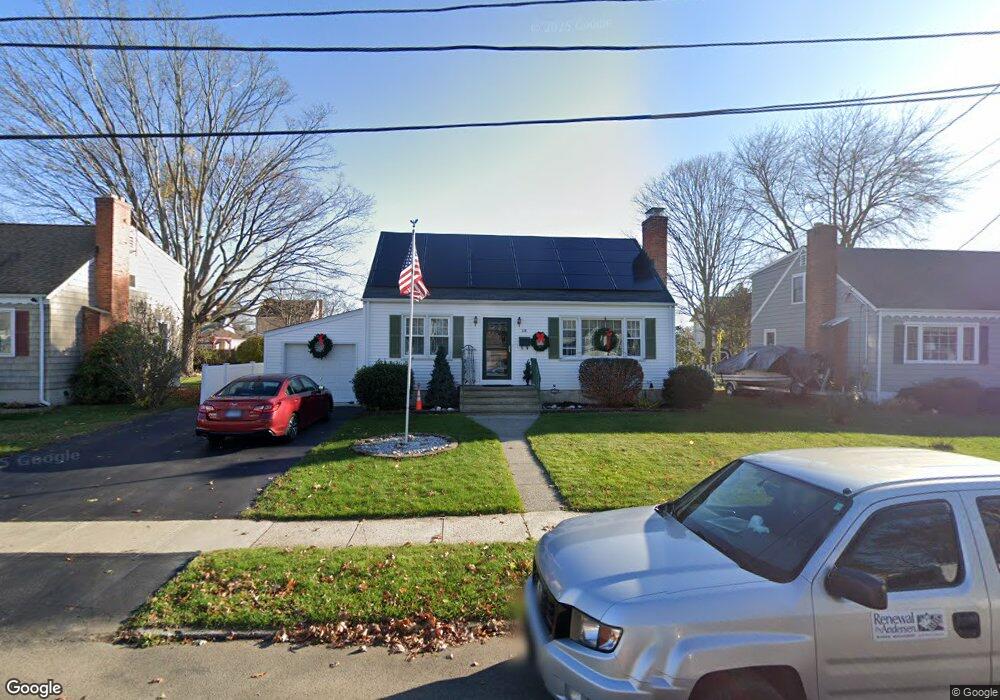
118 Lynncrest Dr Stratford, CT 06614
Estimated Value: $462,000 - $484,000
3
Beds
2
Baths
1,403
Sq Ft
$337/Sq Ft
Est. Value
About This Home
This home is located at 118 Lynncrest Dr, Stratford, CT 06614 and is currently estimated at $472,761, approximately $336 per square foot. 118 Lynncrest Dr is a home located in Fairfield County with nearby schools including Nichols Elementary School, David Wooster Middle School, and Stratford High School.
Ownership History
Date
Name
Owned For
Owner Type
Purchase Details
Closed on
Feb 10, 2006
Sold by
Anderson Gary and Anderson Susan
Bought by
Dorio Frank and Dorio Anne
Current Estimated Value
Home Financials for this Owner
Home Financials are based on the most recent Mortgage that was taken out on this home.
Original Mortgage
$263,920
Outstanding Balance
$149,192
Interest Rate
6.27%
Estimated Equity
$323,569
Create a Home Valuation Report for This Property
The Home Valuation Report is an in-depth analysis detailing your home's value as well as a comparison with similar homes in the area
Home Values in the Area
Average Home Value in this Area
Purchase History
| Date | Buyer | Sale Price | Title Company |
|---|---|---|---|
| Dorio Frank | $329,900 | -- |
Source: Public Records
Mortgage History
| Date | Status | Borrower | Loan Amount |
|---|---|---|---|
| Open | Dorio Frank | $263,920 | |
| Previous Owner | Dorio Frank | $55,000 |
Source: Public Records
Tax History Compared to Growth
Tax History
| Year | Tax Paid | Tax Assessment Tax Assessment Total Assessment is a certain percentage of the fair market value that is determined by local assessors to be the total taxable value of land and additions on the property. | Land | Improvement |
|---|---|---|---|---|
| 2025 | $6,447 | $160,370 | $77,070 | $83,300 |
| 2024 | $6,447 | $160,370 | $77,070 | $83,300 |
| 2023 | $6,447 | $160,370 | $77,070 | $83,300 |
| 2022 | $6,328 | $160,370 | $77,070 | $83,300 |
| 2021 | $6,288 | $159,320 | $77,070 | $82,250 |
| 2020 | $6,315 | $159,320 | $77,070 | $82,250 |
| 2019 | $6,271 | $157,290 | $77,700 | $79,590 |
| 2018 | $6,276 | $157,290 | $77,700 | $79,590 |
| 2017 | $6,287 | $157,290 | $77,700 | $79,590 |
| 2016 | $6,133 | $157,290 | $77,700 | $79,590 |
| 2015 | $5,817 | $157,290 | $77,700 | $79,590 |
| 2014 | $5,704 | $160,090 | $75,530 | $84,560 |
Source: Public Records
Map
Nearby Homes
- 140 Spring St
- 83 William St
- 1867 Broadbridge Ave
- 145 Wiebe Ave
- 123 Klondike St
- 702 King St
- 1700 Broadbridge Ave Unit C26
- 1700 Broadbridge Ave Unit A16
- 1700 Broadbridge Ave Unit B17
- 810 Nichols Ave
- 202 Canaan Rd
- 309 Freeman Ave
- 90 Mercer St
- 204 California St
- 424 Light St
- 152 Stonybrook Rd
- 422 Swanson Ave
- 45 Albright Ave
- 141 Franklin Ave
- 58 Auburn St
- 132 Lynncrest Dr
- 106 Lynncrest Dr
- 146 Lynncrest Dr
- 92 Lynncrest Dr
- 295 Johnson Ave
- 117 Lynncrest Dr
- 303 Johnson Ave
- 285 Johnson Ave
- 105 Lynncrest Dr
- 281 Johnson Ave
- 313 Johnson Ave
- 145 Lynncrest Dr
- 289 Johnson Ave
- LOT 3A Lynncrest Dr
- 165 Lynncrest Dr
- 91 Lynncrest Dr
- 317 Johnson Ave
- 80 Lynncrest Dr
- 277 Johnson Ave
- 277 Johnson Ave Unit 2