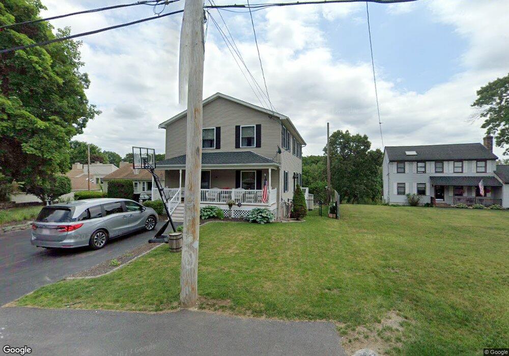
118 Macarthur Dr Millbury, MA 01527
Estimated Value: $840,000 - $971,694
4
Beds
4
Baths
2,408
Sq Ft
$378/Sq Ft
Est. Value
About This Home
This home is located at 118 Macarthur Dr, Millbury, MA 01527 and is currently estimated at $909,424, approximately $377 per square foot. 118 Macarthur Dr is a home located in Worcester County with nearby schools including Elmwood Street Elementary School, Raymond E. Shaw Elementary School, and Millbury Junior/Senior High School.
Ownership History
Date
Name
Owned For
Owner Type
Purchase Details
Closed on
May 26, 2006
Sold by
Frederico Kelly A and Frederico Kelly E
Bought by
Parmelee Nathaniel and Buturlia Nicole
Current Estimated Value
Purchase Details
Closed on
Sep 7, 2001
Sold by
Roy Jack
Bought by
Frederico Steven M and Frederico Kelley A
Purchase Details
Closed on
Mar 27, 1996
Sold by
Strzelecki Anthony Est and Strzelecki
Bought by
Roy Jack
Create a Home Valuation Report for This Property
The Home Valuation Report is an in-depth analysis detailing your home's value as well as a comparison with similar homes in the area
Home Values in the Area
Average Home Value in this Area
Purchase History
We collect this data history from publicly available records. To have your information removed, we recommend requesting removal directly through your county’s website.
| Date | Buyer | Sale Price | Title Company |
|---|---|---|---|
| Parmelee Nathaniel | $450,000 | -- | |
| Parmelee Nathaniel | $450,000 | -- | |
| Frederico Steven M | $80,000 | -- | |
| Frederico Steven M | $80,000 | -- | |
| Roy Jack | $30,500 | -- | |
| Roy Jack | $30,500 | -- |
Source: Public Records
Mortgage History
We collect this data history from publicly available records. To have your information removed, we recommend requesting removal directly through your county’s website.
| Date | Status | Borrower | Loan Amount |
|---|---|---|---|
| Open | Roy Jack | $280,000 | |
| Closed | Roy Jack | $283,000 |
Source: Public Records
Tax History
| Year | Tax Paid | Tax Assessment Tax Assessment Total Assessment is a certain percentage of the fair market value that is determined by local assessors to be the total taxable value of land and additions on the property. | Land | Improvement |
|---|---|---|---|---|
| 2025 | $12,310 | $919,365 | $335,665 | $583,700 |
| 2024 | $11,287 | $853,160 | $310,760 | $542,400 |
| 2023 | $9,285 | $642,590 | $160,990 | $481,600 |
| 2022 | $8,452 | $563,490 | $160,990 | $402,500 |
| 2021 | $5,487 | $542,490 | $160,990 | $381,500 |
| 2020 | $14,690 | $461,600 | $134,100 | $327,500 |
| 2019 | $7,359 | $464,300 | $121,900 | $342,400 |
| 2018 | $4,161 | $447,600 | $121,900 | $325,700 |
| 2017 | $5,610 | $407,300 | $121,900 | $285,400 |
| 2016 | $6,745 | $409,800 | $121,900 | $287,900 |
| 2015 | $6,648 | $403,900 | $129,700 | $274,200 |
| 2014 | $5,677 | $332,000 | $94,000 | $238,000 |
Source: Public Records
Map
Nearby Homes
- 23 Upton St
- 2 Wilson Rd Unit B
- 121 Millbury Ave
- 8 Alstead Path
- 102 Lordvale Blvd
- 19 Marion Ave
- 42 John Dr Unit 42
- 9 Robert Cir Unit 9
- 20 Lordvale Blvd Unit 202
- 41 Westview Ave
- 59 Samuel Dr
- 63 Miles St
- 27 A-B Grafton St
- 22 Wildwood Rd
- 10 Logan's Run Unit 10
- 14 Amherst St
- 1260 Grafton St
- 11 Park Hill Rd
- 122 Elm St
- 7 Miscoe Rd
- 120 Macarthur Dr
- 116 Macarthur Dr
- 124 Macarthur Dr
- 112 Macarthur Dr
- 117 Macarthur Dr
- 111 Macarthur Dr
- 126 Macarthur Dr
- 108 Macarthur Dr
- 128 Macarthur Dr
- 87 Macarthur Dr
- 127 Macarthur Dr
- 91 Macarthur Dr
- 104 Macarthur Dr
- 132 Macarthur Dr
- 85 Macarthur Dr
- 100 Macarthur Dr
- 77 Macarthur Dr
- 131 Macarthur Dr
- 86 Macarthur Dr
- 86 Macarthur Dr Unit left side
Your Personal Tour Guide
Ask me questions while you tour the home.