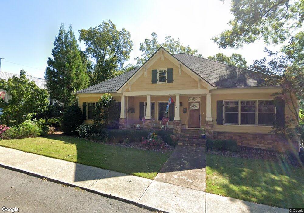
118 Martin St Dahlonega, GA 30533
Estimated Value: $318,000 - $945,000
--
Bed
1
Bath
228
Sq Ft
$3,015/Sq Ft
Est. Value
About This Home
This home is located at 118 Martin St, Dahlonega, GA 30533 and is currently estimated at $687,508, approximately $3,015 per square foot. 118 Martin St is a home located in Lumpkin County with nearby schools including Clay County Middle School and Lumpkin County High School.
Ownership History
Date
Name
Owned For
Owner Type
Purchase Details
Closed on
Jan 14, 2022
Sold by
Seng Erin M
Bought by
Erin M Seng Living Trust
Current Estimated Value
Purchase Details
Closed on
Jun 19, 2007
Sold by
Not Provided
Bought by
Seng Erin M
Purchase Details
Closed on
Jun 14, 2007
Sold by
Not Provided
Bought by
Seng Erin M
Purchase Details
Closed on
Mar 27, 1996
Sold by
Liggin Gibbs W
Bought by
Liggin Gibbs W
Purchase Details
Closed on
Jul 1, 1987
Bought by
Gibbs Ligon
Create a Home Valuation Report for This Property
The Home Valuation Report is an in-depth analysis detailing your home's value as well as a comparison with similar homes in the area
Home Values in the Area
Average Home Value in this Area
Purchase History
| Date | Buyer | Sale Price | Title Company |
|---|---|---|---|
| Erin M Seng Living Trust | -- | -- | |
| Seng Erin M | -- | -- | |
| Seng Erin M | $385,000 | -- | |
| Liggin Gibbs W | -- | -- | |
| Gibbs Ligon | -- | -- | |
| Patton Merle H | -- | -- | |
| Liggin Gibbs W | -- | -- |
Source: Public Records
Tax History Compared to Growth
Tax History
| Year | Tax Paid | Tax Assessment Tax Assessment Total Assessment is a certain percentage of the fair market value that is determined by local assessors to be the total taxable value of land and additions on the property. | Land | Improvement |
|---|---|---|---|---|
| 2024 | $5,055 | $286,717 | $20,264 | $266,453 |
| 2023 | $4,387 | $267,670 | $20,264 | $247,406 |
| 2022 | $5,200 | $265,932 | $20,264 | $245,668 |
| 2021 | $3,915 | $215,279 | $20,264 | $195,015 |
| 2020 | $3,864 | $209,276 | $20,264 | $189,012 |
| 2019 | $3,892 | $209,276 | $20,264 | $189,012 |
| 2018 | $3,363 | $186,730 | $20,264 | $166,466 |
| 2017 | $3,068 | $176,731 | $20,264 | $156,467 |
| 2016 | $2,585 | $161,576 | $20,264 | $141,312 |
| 2015 | $2,114 | $161,577 | $20,264 | $141,312 |
| 2014 | $2,114 | $163,261 | $20,264 | $142,997 |
| 2013 | -- | $163,646 | $20,264 | $143,382 |
Source: Public Records
Map
Nearby Homes
- 1392 S Chestatee St
- 0 Highway 19 N Unit 10594984
- 120 Riley Rd
- 0 S Chestatee St Unit 10619536
- 329 Morrison Moore Pkwy E
- 6480A Highway 52
- 95 Jones St
- 0 Highway 60 Unit 7241582
- 315 Church St
- 168 W Main St
- 0 Highway 9 S Unit 10487179
- 0 Highway 9 S Unit 7548614
- 399 N Chestatee St
- 0 Calhoun Rd Unit 7643314
- 0 Calhoun Rd Unit 10598012
- 00 Calhoun Rd
- 0 Alicia Ln
- 502 Wimpy Mill Rd
- 0 Crown Mountain Unit 7682225
- 0 Crown Mountain Unit 10644759
- 174 S Grove St
- 134 Martin St
- 106 Martin St
- 0 S Grove St Unit 3122764
- 0 S Grove St Unit 7291048
- 161 S Grove St
- 105 Martin St
- 115 Arcadia St
- 202 S Grove St
- 177 S Park St
- 85 Arcadia St
- 89 Martin St
- S S Grove St
- 121 S Grove St
- 145 Arcadia St
- 16 Riley Rd
- 195 S Park St
- 129 S Park St
- 184 Maple St
- 93 S Grove St