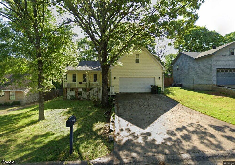
118 Mayfair Cove Sherwood, AR 72120
Estimated Value: $205,884 - $214,000
--
Bed
2
Baths
1,781
Sq Ft
$118/Sq Ft
Est. Value
About This Home
This home is located at 118 Mayfair Cove, Sherwood, AR 72120 and is currently estimated at $209,971, approximately $117 per square foot. 118 Mayfair Cove is a home located in Pulaski County with nearby schools including Sylvan Hills Elementary School, Sylvan Hills Middle School, and Sylvan Hills High School.
Ownership History
Date
Name
Owned For
Owner Type
Purchase Details
Closed on
Oct 3, 2012
Sold by
Cross Brenda A and Estate Of James C Cross Jr
Bought by
Cross Brenda A
Current Estimated Value
Purchase Details
Closed on
Feb 21, 2007
Sold by
Bruff Stephanie
Bought by
Cross James
Home Financials for this Owner
Home Financials are based on the most recent Mortgage that was taken out on this home.
Original Mortgage
$132,692
Outstanding Balance
$79,521
Interest Rate
6.17%
Mortgage Type
VA
Estimated Equity
$130,450
Purchase Details
Closed on
May 29, 1998
Sold by
Valli Sandra C
Bought by
Bruff Stephanie A
Home Financials for this Owner
Home Financials are based on the most recent Mortgage that was taken out on this home.
Original Mortgage
$80,750
Interest Rate
7.2%
Mortgage Type
Purchase Money Mortgage
Create a Home Valuation Report for This Property
The Home Valuation Report is an in-depth analysis detailing your home's value as well as a comparison with similar homes in the area
Home Values in the Area
Average Home Value in this Area
Purchase History
| Date | Buyer | Sale Price | Title Company |
|---|---|---|---|
| Cross Brenda A | -- | None Available | |
| Cross James | $130,000 | American Abstract & Title Co | |
| Bruff Stephanie A | $85,000 | Standard Abstract & Title Co |
Source: Public Records
Mortgage History
| Date | Status | Borrower | Loan Amount |
|---|---|---|---|
| Open | Cross James | $132,692 | |
| Previous Owner | Bruff Stephanie A | $80,750 |
Source: Public Records
Tax History Compared to Growth
Tax History
| Year | Tax Paid | Tax Assessment Tax Assessment Total Assessment is a certain percentage of the fair market value that is determined by local assessors to be the total taxable value of land and additions on the property. | Land | Improvement |
|---|---|---|---|---|
| 2025 | $1,734 | $33,784 | $5,200 | $28,584 |
| 2024 | $1,589 | $33,784 | $5,200 | $28,584 |
| 2023 | $1,589 | $33,784 | $5,200 | $28,584 |
| 2022 | $1,696 | $33,784 | $5,200 | $28,584 |
| 2021 | $1,582 | $27,720 | $5,100 | $22,620 |
| 2020 | $1,200 | $27,720 | $5,100 | $22,620 |
| 2019 | $1,200 | $27,720 | $5,100 | $22,620 |
| 2018 | $1,575 | $27,720 | $5,100 | $22,620 |
| 2017 | $1,470 | $27,720 | $5,100 | $22,620 |
| 2016 | $1,347 | $23,620 | $4,100 | $19,520 |
| 2015 | $1,200 | $23,620 | $4,100 | $19,520 |
| 2014 | $1,200 | $23,620 | $4,100 | $19,520 |
Source: Public Records
Map
Nearby Homes
- 104 Mayfair Cove
- 8222 Mark Ave
- 00 Highway 107
- 2410 Crown Ct
- 8100 Coleridge Dr
- 8109 Oak Ridge Rd
- 00 E Kiehl Ave
- 3073 Woodruff Creek Dr
- 7909 Coleridge Dr
- 135 W Lee Ave
- 7901 Coleridge Dr
- 4690 Hollyridge Cove
- 2100 Covington Dr
- 208 E Kiehl Ave Unit out parcel
- 125 Almond Cove
- 1901 Osceola Dr
- 7605 Toltec Dr
- 222 Gragson Ave
- 1904 Osceola Dr
- 1808 Osceola Dr
- 116 Mayfair Cove
- 120 Mayfair Cove
- 0 Mayfair Cove Unit 17028275
- 114 Mayfair Cove
- 119 Mayfair Cove
- 117 Mayfair Cove
- 112 Mayfair Cove
- 115 Mayfair Cove
- 817 Tabor Ave
- 113 Mayfair Cove
- 110 Mayfair Cove
- 111 Mayfair Cove
- 1712 Whitehave Dr
- 826 Tabor Ave
- 108 Mayfair Cove
- 117 Audubon Cove
- 119 Audubon Cove
- 115 Audubon Cove
- 121 Audubon Cove
- 0 Audubon Cove