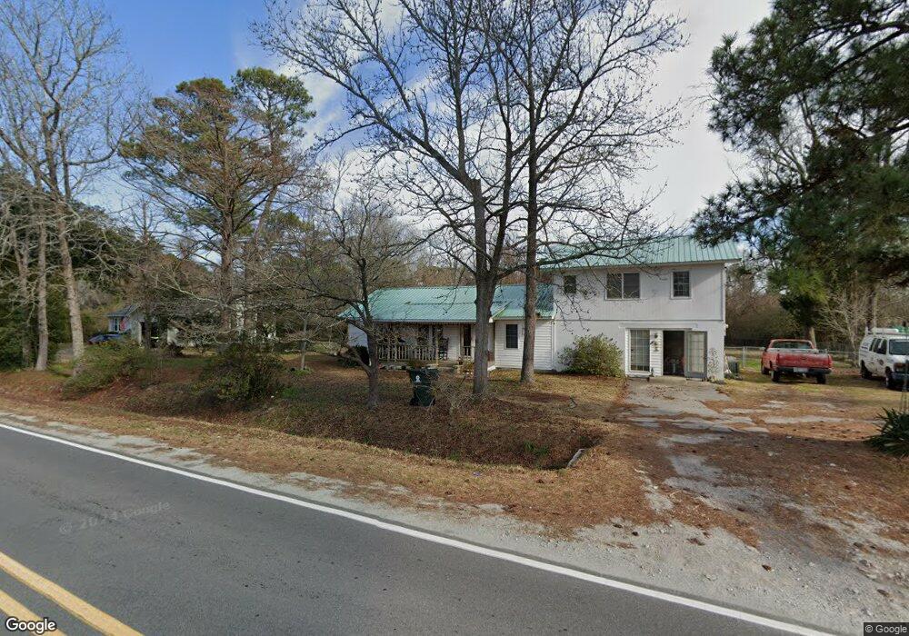
118 Norris Rd Swansboro, NC 28584
Estimated Value: $265,914 - $374,000
3
Beds
2
Baths
2,112
Sq Ft
$153/Sq Ft
Est. Value
About This Home
This home is located at 118 Norris Rd, Swansboro, NC 28584 and is currently estimated at $323,229, approximately $153 per square foot. 118 Norris Rd is a home located in Onslow County with nearby schools including Swansboro Elementary School, Swansboro Middle School, and Swansboro High School.
Ownership History
Date
Name
Owned For
Owner Type
Purchase Details
Closed on
Jun 13, 2019
Sold by
Sloan Tina
Bought by
Sloan Michael Darren
Current Estimated Value
Home Financials for this Owner
Home Financials are based on the most recent Mortgage that was taken out on this home.
Original Mortgage
$25,000
Outstanding Balance
$16,403
Interest Rate
4.1%
Mortgage Type
New Conventional
Estimated Equity
$306,826
Purchase Details
Closed on
Apr 3, 2008
Sold by
Partlow Frederick A and Partlow Judy Lane
Bought by
Sloan Michael Darren and Sloan Tina
Create a Home Valuation Report for This Property
The Home Valuation Report is an in-depth analysis detailing your home's value as well as a comparison with similar homes in the area
Home Values in the Area
Average Home Value in this Area
Purchase History
| Date | Buyer | Sale Price | Title Company |
|---|---|---|---|
| Sloan Michael Darren | -- | None Available | |
| Sloan Michael Darren | -- | None Available |
Source: Public Records
Mortgage History
| Date | Status | Borrower | Loan Amount |
|---|---|---|---|
| Open | Sloan Michael Darren | $25,000 |
Source: Public Records
Tax History
| Year | Tax Paid | Tax Assessment Tax Assessment Total Assessment is a certain percentage of the fair market value that is determined by local assessors to be the total taxable value of land and additions on the property. | Land | Improvement |
|---|---|---|---|---|
| 2025 | $568 | $86,719 | $31,810 | $54,909 |
| 2024 | $568 | $86,719 | $31,810 | $54,909 |
| 2023 | $568 | $86,719 | $31,810 | $54,909 |
| 2022 | $568 | $86,719 | $31,810 | $54,909 |
| 2021 | $534 | $75,740 | $27,830 | $47,910 |
| 2020 | $534 | $75,740 | $27,830 | $47,910 |
| 2019 | $534 | $75,740 | $27,830 | $47,910 |
| 2018 | $534 | $75,740 | $27,830 | $47,910 |
| 2017 | $544 | $80,640 | $27,830 | $52,810 |
| 2016 | $544 | $80,640 | $0 | $0 |
| 2015 | $544 | $80,640 | $0 | $0 |
| 2014 | $544 | $80,640 | $0 | $0 |
Source: Public Records
Map
Nearby Homes
- 1223 W Corbett Ave
- 30 Outrigger Dr
- 604 Spoleto Ct
- 4 Catalina Cir
- 12 Catalina Cir
- 36 Catalina Cir
- 42 Catalina Cir
- 84 Crush Ct
- 109 Forest Ln
- 425 Whistling Heron Way
- 195 Queens Creek Rd
- 1476 W Corbett Ave
- 274 Norris Rd
- 120 Cormorant Dr
- 161 Howard Ln
- 1261 Hammocks Beach Rd
- Lot 14 Hammocks Beach Rd
- 107 Cormorant Dr
- 1229 Hammock Beach Rd
- 215 Knightheads Dr
- 114 Norris Rd
- 124 Norris Rd
- 112 Norris Rd
- 000 Highway Unit 24
- 108 Norris Rd
- 132 Norris Rd
- 1120 W Corbett Ave
- 133 Norris Rd
- 103 Norris Rd
- 1116 W Corbett Ave
- 110 Viola Ct
- 140 Norris Rd
- 1121 W Corbett Ave
- 1112 W Corbett Ave
- 111 Viola Ct
- 1218 W Corbett Ave
- 182 Richard Riggs Rd
- 166 Richard Riggs Rd
- 182 Richard Riggs Rd
- 149 Norris Rd
Your Personal Tour Guide
Ask me questions while you tour the home.