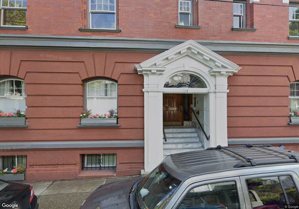
118 NW King (#52) Ave Portland, OR 97210
Northwest District NeighborhoodEstimated Value: $214,000 - $338,000
1
Bed
1
Bath
576
Sq Ft
$434/Sq Ft
Est. Value
About This Home
This home is located at 118 NW King (#52) Ave, Portland, OR 97210 and is currently estimated at $249,726, approximately $433 per square foot. 118 NW King (#52) Ave is a home located in Multnomah County with nearby schools including Chapman Elementary School, West Sylvan Middle School, and Lincoln High School.
Ownership History
Date
Name
Owned For
Owner Type
Purchase Details
Closed on
May 11, 2017
Sold by
Wielkopolski Lindsay R and Hayward Lindsay R
Bought by
Aluzri Ahmed Yousif
Current Estimated Value
Home Financials for this Owner
Home Financials are based on the most recent Mortgage that was taken out on this home.
Original Mortgage
$171,000
Outstanding Balance
$85,795
Interest Rate
3.39%
Mortgage Type
New Conventional
Estimated Equity
$163,931
Purchase Details
Closed on
Jun 5, 2007
Sold by
King Davis Condominiums Llc
Bought by
Hayward Lindsay R
Home Financials for this Owner
Home Financials are based on the most recent Mortgage that was taken out on this home.
Original Mortgage
$220,800
Interest Rate
6.12%
Mortgage Type
Purchase Money Mortgage
Create a Home Valuation Report for This Property
The Home Valuation Report is an in-depth analysis detailing your home's value as well as a comparison with similar homes in the area
Home Values in the Area
Average Home Value in this Area
Purchase History
| Date | Buyer | Sale Price | Title Company |
|---|---|---|---|
| Aluzri Ahmed Yousif | $305,000 | Fidelity National Title | |
| Hayward Lindsay R | $276,000 | Chicago Title Insurance Comp |
Source: Public Records
Mortgage History
| Date | Status | Borrower | Loan Amount |
|---|---|---|---|
| Open | Aluzri Ahmed Yousif | $171,000 | |
| Previous Owner | Hayward Lindsay R | $220,800 | |
| Previous Owner | Hayward Lindsay R | $27,300 |
Source: Public Records
Tax History Compared to Growth
Tax History
| Year | Tax Paid | Tax Assessment Tax Assessment Total Assessment is a certain percentage of the fair market value that is determined by local assessors to be the total taxable value of land and additions on the property. | Land | Improvement |
|---|---|---|---|---|
| 2025 | $4,827 | $217,880 | -- | $217,880 |
| 2024 | $4,727 | $211,540 | -- | $211,540 |
| 2023 | $4,727 | $205,380 | $0 | $205,380 |
| 2022 | $4,985 | $199,400 | $0 | $0 |
| 2021 | $4,817 | $193,600 | $0 | $0 |
| 2020 | $4,680 | $187,970 | $0 | $0 |
| 2019 | $4,621 | $182,500 | $0 | $0 |
| 2018 | $4,485 | $177,190 | $0 | $0 |
| 2017 | $4,299 | $172,030 | $0 | $0 |
| 2016 | $3,934 | $167,020 | $0 | $0 |
| 2015 | $3,831 | $162,160 | $0 | $0 |
| 2014 | $3,773 | $157,440 | $0 | $0 |
Source: Public Records
Map
Nearby Homes
- 2141 NW Davis St Unit 302
- 2176 NW Everett St Unit 1
- 2137 NW Everett St Unit B
- 333 NW 20th Ave Unit 2
- 2233 NW Flanders St
- 2015 NW Flanders St Unit 214
- 2211 SW Park Place Unit 202
- 2211 SW Park Place Unit 903
- 2211 SW Park Place Unit 403
- 2245 SW Park Place Unit 3A
- 2323 SW Park Place Unit 1006
- 2323 SW Park Place Unit 302
- 2323 SW Park Place Unit 502
- 839 SW Green Ave
- 2324 SW Cactus Dr
- 1926 W Burnside St Unit 1602
- 1926 W Burnside St Unit 301
- 1926 W Burnside St Unit 1412
- 1926 W Burnside St Unit 906
- 1926 W Burnside St Unit 1401
- 118 NW King Ave
- 118 NW King Ave Unit 53
- 118 NW King Ave Unit 52
- 118 NW King Ave Unit 51
- 118 NW King Ave Unit 43
- 118 NW King Ave Unit 42
- 118 NW King Ave Unit 33
- 118 NW King Ave Unit 32
- 118 NW King Ave Unit 31
- 118 NW King Ave Unit 23
- 118 NW King Ave Unit 22
- 118 NW King Ave Unit 21
- 118 NW King Ave Unit 3
- 118 NW King Ave Unit 2
- 118 NW King Ave
- 110 NW King Ave
- 117 NW King Ave
- 2141 NW Davis St
- 2141 NW Davis St Unit 701
- 2141 NW Davis St Unit 702