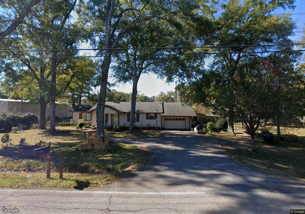
118 Old Airport Rd Lagrange, GA 30240
Estimated Value: $190,000 - $215,000
3
Beds
2
Baths
1,426
Sq Ft
$140/Sq Ft
Est. Value
About This Home
This home is located at 118 Old Airport Rd, Lagrange, GA 30240 and is currently estimated at $200,264, approximately $140 per square foot. 118 Old Airport Rd is a home located in Troup County with nearby schools including Ethel W. Kight Elementary School, Hollis Hand Elementary School, and Franklin Forest Elementary School.
Ownership History
Date
Name
Owned For
Owner Type
Purchase Details
Closed on
Oct 25, 2019
Sold by
Crews Juanita
Bought by
Dh & A Properties Llc
Current Estimated Value
Home Financials for this Owner
Home Financials are based on the most recent Mortgage that was taken out on this home.
Original Mortgage
$129,000
Outstanding Balance
$51,890
Interest Rate
3.6%
Mortgage Type
Commercial
Estimated Equity
$148,374
Purchase Details
Closed on
Sep 1, 2005
Sold by
Crews James
Bought by
Crews Juanita
Purchase Details
Closed on
Dec 18, 2003
Sold by
Jim L Moore
Bought by
James Crews
Purchase Details
Closed on
Apr 12, 2002
Sold by
Lucille Darden
Bought by
Jim L Moore
Purchase Details
Closed on
Jul 15, 1997
Sold by
Frank Darden
Bought by
Lucille Darden
Purchase Details
Closed on
Mar 15, 1977
Bought by
Frank Darden
Create a Home Valuation Report for This Property
The Home Valuation Report is an in-depth analysis detailing your home's value as well as a comparison with similar homes in the area
Home Values in the Area
Average Home Value in this Area
Purchase History
| Date | Buyer | Sale Price | Title Company |
|---|---|---|---|
| Dh & A Properties Llc | $125,000 | -- | |
| Crews Juanita | -- | -- | |
| James Crews | $66,000 | -- | |
| Jim L Moore | $90,000 | -- | |
| Lucille Darden | -- | -- | |
| Frank Darden | -- | -- |
Source: Public Records
Mortgage History
| Date | Status | Borrower | Loan Amount |
|---|---|---|---|
| Open | Dh & A Properties Llc | $129,000 |
Source: Public Records
Tax History Compared to Growth
Tax History
| Year | Tax Paid | Tax Assessment Tax Assessment Total Assessment is a certain percentage of the fair market value that is determined by local assessors to be the total taxable value of land and additions on the property. | Land | Improvement |
|---|---|---|---|---|
| 2024 | $1,791 | $65,672 | $11,160 | $54,512 |
| 2023 | $1,677 | $61,472 | $11,160 | $50,312 |
| 2022 | $1,631 | $58,432 | $11,160 | $47,272 |
| 2021 | $1,328 | $44,040 | $7,280 | $36,760 |
| 2020 | $1,328 | $44,040 | $7,280 | $36,760 |
| 2019 | $1,165 | $40,616 | $6,800 | $33,816 |
| 2018 | $1,073 | $37,568 | $6,800 | $30,768 |
| 2017 | $1,073 | $37,568 | $6,800 | $30,768 |
| 2016 | $1,041 | $36,503 | $6,800 | $29,703 |
| 2015 | $1,043 | $36,503 | $6,800 | $29,703 |
| 2014 | $713 | $25,531 | $6,800 | $18,731 |
| 2013 | -- | $25,958 | $6,800 | $19,158 |
Source: Public Records
Map
Nearby Homes
- 167 S Kight Dr
- 141 Avery Dr
- 101 Crown St Unit LOT 5
- The Rhodes Plan at Crown Street Cottages
- The Truitt Plan at Crown Street Cottages
- The Callaway Plan at Crown Street Cottages
- 102 Crown St Unit LOT 1
- 205 Grady St
- 802 Monroe St
- 0 Unit 10514554
- 119 Jones St
- 608 Wilburn Ave
- 610 Wilburn Ave
- 107 Clark St
- 202 Parker Ln
- 212 Aster Way
- 109 Garfield St
- 102 Parker St
- 211 Moores Hill
- 0 Moores Hill
- 122 Airport Rd
- 122 Old Airport Rd
- 130 Old Airport Rd
- 108 Old Airport Rd
- 125 Old Airport Rd
- 177 New Airport Rd
- 0 New Airport Rd Unit 7448048
- 0 New Airport Rd Unit 7327139
- 0 New Airport Rd Unit 7330303
- 0 New Airport Rd Unit 3202694
- 0 New Airport Rd Unit 8643329
- 0 New Airport Rd Unit 8454810
- 0 New Airport Rd Unit 8731644
- 0 New Airport Rd Unit 8900420
- 0 New Airport Rd Unit 8946209
- 0 New Airport Rd Unit 8865091
- 161 New Airport Rd
- 158 New Airport Rd
- 128 Gordon Commercial Dr
- 126 Gordon Commercial Dr