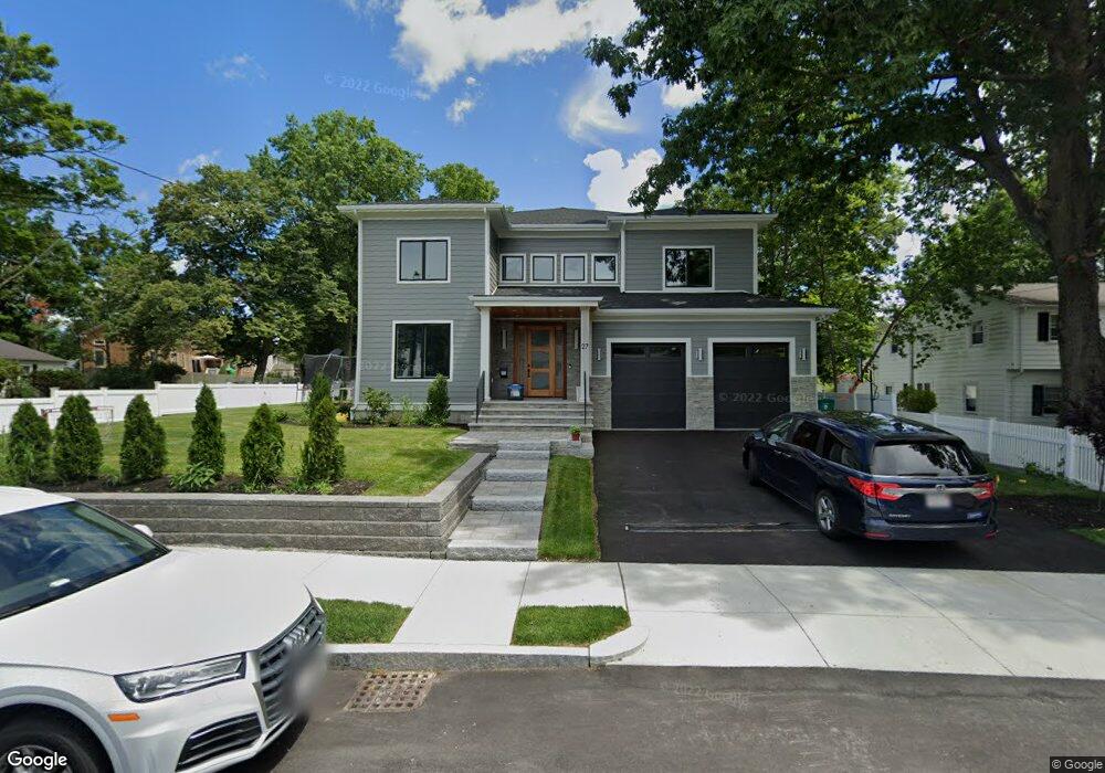
118 Osborne Path Newton Center, MA 02459
Mount Ida NeighborhoodEstimated Value: $2,652,207 - $3,507,000
3
Beds
1
Bath
1,104
Sq Ft
$2,734/Sq Ft
Est. Value
About This Home
This home is located at 118 Osborne Path, Newton Center, MA 02459 and is currently estimated at $3,017,802, approximately $2,733 per square foot. 118 Osborne Path is a home located in Middlesex County with nearby schools including Memorial Spaulding Elementary School, Oak Hill Middle School, and Newton South High School.
Ownership History
Date
Name
Owned For
Owner Type
Purchase Details
Closed on
Jul 21, 2021
Sold by
Tsay Forng-Geng F and Hsiung-Tsay Rita
Bought by
27 Eldur Is Llc
Current Estimated Value
Home Financials for this Owner
Home Financials are based on the most recent Mortgage that was taken out on this home.
Original Mortgage
$1,657,500
Outstanding Balance
$1,505,301
Interest Rate
2.96%
Mortgage Type
Purchase Money Mortgage
Estimated Equity
$1,512,501
Purchase Details
Closed on
Aug 1, 2017
Sold by
Lee Rem-Loong and Chang-Lee Long J
Bought by
Forng-Geng Frank T and Hsiung-Tsay Rita
Purchase Details
Closed on
Feb 16, 2017
Sold by
Chang-Lee Long J
Bought by
Lee Rem-Loong and Chang-Lee Long J
Purchase Details
Closed on
Oct 28, 2010
Sold by
Lee Rem-Iloong and Lee Long Jane Chang
Bought by
Lee Long Jane Chang
Purchase Details
Closed on
Aug 1, 1984
Bought by
Lee-Long Jane Chang
Create a Home Valuation Report for This Property
The Home Valuation Report is an in-depth analysis detailing your home's value as well as a comparison with similar homes in the area
Home Values in the Area
Average Home Value in this Area
Purchase History
| Date | Buyer | Sale Price | Title Company |
|---|---|---|---|
| 27 Eldur Is Llc | $910,000 | None Available | |
| Forng-Geng Frank T | $430,000 | -- | |
| Lee Rem-Loong | -- | -- | |
| Lee Long Jane Chang | -- | -- | |
| Lee-Long Jane Chang | $105,500 | -- |
Source: Public Records
Mortgage History
| Date | Status | Borrower | Loan Amount |
|---|---|---|---|
| Open | 27 Eldur Is Llc | $1,657,500 |
Source: Public Records
Tax History Compared to Growth
Tax History
| Year | Tax Paid | Tax Assessment Tax Assessment Total Assessment is a certain percentage of the fair market value that is determined by local assessors to be the total taxable value of land and additions on the property. | Land | Improvement |
|---|---|---|---|---|
| 2025 | $26,442 | $2,698,200 | $731,300 | $1,966,900 |
| 2024 | $25,567 | $2,619,600 | $710,000 | $1,909,600 |
| 2023 | $10,252 | $1,007,100 | $491,200 | $515,900 |
| 2022 | $7,786 | $740,100 | $591,300 | $148,800 |
| 2021 | $5,242 | $487,200 | $429,100 | $58,100 |
| 2020 | $5,086 | $487,200 | $429,100 | $58,100 |
| 2019 | $4,943 | $473,000 | $416,600 | $56,400 |
| 2018 | $4,666 | $431,200 | $377,700 | $53,500 |
| 2017 | $4,524 | $406,800 | $356,300 | $50,500 |
| 2016 | $4,327 | $380,200 | $333,000 | $47,200 |
| 2015 | $4,125 | $355,300 | $311,200 | $44,100 |
Source: Public Records
Map
Nearby Homes
- 30 K Roadway
- 22 Nightingale Path
- 141 Spiers Rd
- 544 Saw Mill Brook Pkwy
- 30 Esty Farm Rd
- 210 Nahanton St Unit 404
- 36 Ober Rd
- 207 Nahanton St Unit 207
- 21 Lovett Rd
- 44 Lovett Rd
- 579 Baker St Unit 579
- 577 Baker St Unit 577
- 931 Lagrange St
- 1206 Lagrange St Unit 1206
- 135 Hartman Rd
- 845 Lagrange St Unit 4
- 701 Greendale Ave
- 41 Juniper Ln
- 883 Greendale Ave
- 17 Tirrell Crescent
- 21 Van Roosen Rd
- 112 Osborne Path
- 15 Van Roosen Rd
- 26 Van Roosen Rd
- 32 Van Roosen Rd
- 32 Van Roosen Rd Unit 1
- 18 Van Roosen Rd
- 104 Osborne Path
- 105 Osborne Path
- 43 Van Roosen Rd
- 40 Van Roosen Rd
- 10 K Roadway
- 24 Timson Path
- 18 Timson Path
- 99 Osborne Path Unit path
- 99 Osborne Path
- 99 Osborne Path
- 99 Osborne Path
- 10 Van Roosen Rd
- 98 Osborne Path