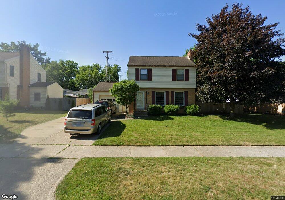
118 Pershing Dr NE Grand Rapids, MI 49505
Creston NeighborhoodEstimated Value: $294,000 - $344,000
3
Beds
2
Baths
1,242
Sq Ft
$257/Sq Ft
Est. Value
About This Home
This home is located at 118 Pershing Dr NE, Grand Rapids, MI 49505 and is currently estimated at $319,396, approximately $257 per square foot. 118 Pershing Dr NE is a home located in Kent County with nearby schools including Riverside Middle School, Union High School, and ISJ Academy.
Ownership History
Date
Name
Owned For
Owner Type
Purchase Details
Closed on
Dec 13, 2006
Sold by
Vereecken Robert John and Staszewski Andrea
Bought by
Hsbc Mortgage Services Inc
Current Estimated Value
Purchase Details
Closed on
Dec 6, 2006
Sold by
Vereecken Robert John and Staszewski Andrea
Bought by
Hsbc Mortgage Services Inc
Purchase Details
Closed on
Dec 28, 2004
Sold by
Dodge Judy K and The Judy K Dodge Living Trust
Bought by
Vereecken Robert and Staszewski Andrea
Home Financials for this Owner
Home Financials are based on the most recent Mortgage that was taken out on this home.
Original Mortgage
$112,800
Interest Rate
6.3%
Mortgage Type
Purchase Money Mortgage
Purchase Details
Closed on
Oct 9, 2000
Sold by
Dodge Dodge R R and Dodge J
Bought by
Bultman Steven
Create a Home Valuation Report for This Property
The Home Valuation Report is an in-depth analysis detailing your home's value as well as a comparison with similar homes in the area
Home Values in the Area
Average Home Value in this Area
Purchase History
| Date | Buyer | Sale Price | Title Company |
|---|---|---|---|
| Hsbc Mortgage Services Inc | $125,246 | None Available | |
| Hsbc Mortgage Services Inc | $3,700 | None Available | |
| Vereecken Robert | $141,000 | -- | |
| Bultman Steven | -- | -- |
Source: Public Records
Mortgage History
| Date | Status | Borrower | Loan Amount |
|---|---|---|---|
| Previous Owner | Vereecken Robert | $112,800 | |
| Closed | Vereecken Robert | $28,200 |
Source: Public Records
Tax History Compared to Growth
Tax History
| Year | Tax Paid | Tax Assessment Tax Assessment Total Assessment is a certain percentage of the fair market value that is determined by local assessors to be the total taxable value of land and additions on the property. | Land | Improvement |
|---|---|---|---|---|
| 2025 | $2,011 | $132,900 | $0 | $0 |
| 2024 | $2,011 | $124,200 | $0 | $0 |
| 2023 | $2,041 | $106,100 | $0 | $0 |
| 2022 | $1,937 | $96,800 | $0 | $0 |
| 2021 | $1,894 | $86,300 | $0 | $0 |
| 2020 | $1,811 | $80,200 | $0 | $0 |
| 2019 | $1,831 | $75,100 | $0 | $0 |
| 2018 | $1,831 | $71,000 | $0 | $0 |
| 2017 | $1,783 | $63,700 | $0 | $0 |
| 2016 | $1,805 | $58,000 | $0 | $0 |
| 2015 | $1,678 | $58,000 | $0 | $0 |
| 2013 | -- | $51,900 | $0 | $0 |
Source: Public Records
Map
Nearby Homes
- 2624 Monroe Ave NE
- 2480 Lafayette Ave NE
- 122 Bowne St NE
- 68 Bowne St NE
- 2630 Oakwood Ave NE
- 240 Eleanor St NE
- 16 Graceland St NE
- 2107 Prospect Ave NE
- 2060 Swensberg Ave NE
- 518 Russwood St NE
- 465 Kenwood St NE
- 483 Kenwood St NE
- 1922 Coit Ave NE
- 22 Elmwood St NE
- 648 Russwood St NE
- 225 Burr Oak St NE
- 661 Conger St NE
- 142 Burr Oak St NE
- 143 Dean St NE
- 2550 Borglum Ave NE
- 138 Pershing Dr NE
- 110 Pershing Dr NE
- 117 Katherine Dr NE
- 131 Katherine Dr NE
- 111 Katherine Dr NE
- 102 Pershing Dr NE
- 137 Katherine Dr NE
- 105 Katherine Dr NE
- 117 Pershing Dr NE
- 135 Pershing Dr NE
- 105 Pershing Dr NE
- 141 Pershing Dr NE
- 143 Katherine Dr NE
- 101 Katherine Dr NE
- 150 Pershing Dr NE
- 48 Pershing Dr NE
- 101 Pershing Dr NE
- 149 Pershing Dr NE
- 45 Katherine Dr NE
- 149 Katherine Dr NE