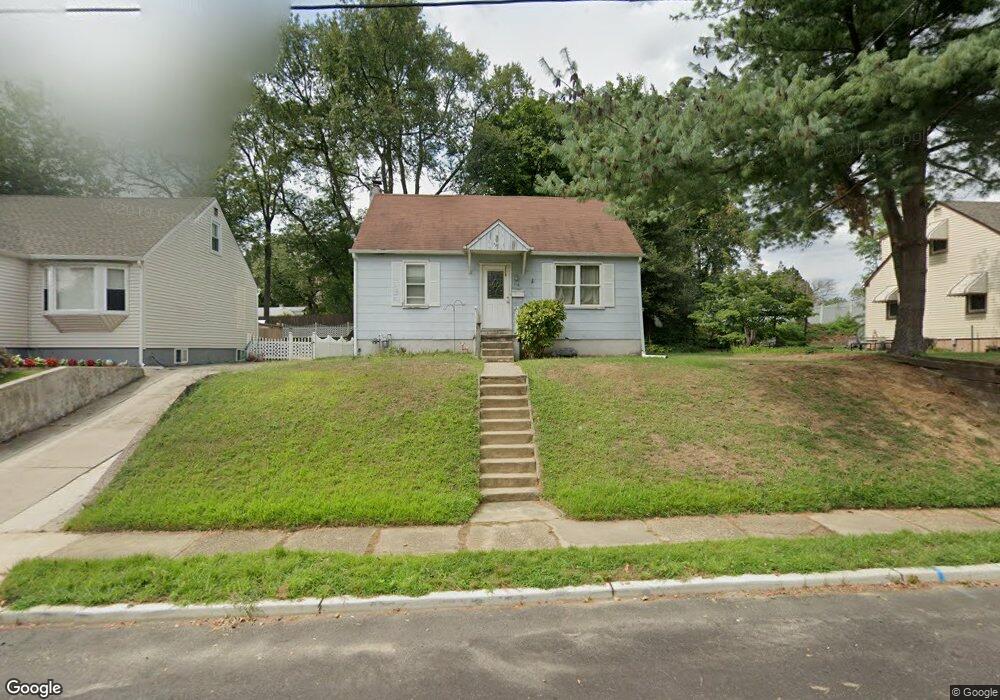
118 Phillips Ave Runnemede, NJ 08078
Estimated Value: $224,614 - $316,000
Studio
--
Bath
1,080
Sq Ft
$252/Sq Ft
Est. Value
About This Home
This home is located at 118 Phillips Ave, Runnemede, NJ 08078 and is currently estimated at $272,154, approximately $251 per square foot. 118 Phillips Ave is a home located in Camden County with nearby schools including Mary E. Volz Elementary School, Bingham Elementary School, and Triton High School.
Ownership History
Date
Name
Owned For
Owner Type
Purchase Details
Closed on
Dec 10, 1999
Sold by
Wick Samuel F
Bought by
Maloney Thomas J and Maloney Kimberly
Current Estimated Value
Home Financials for this Owner
Home Financials are based on the most recent Mortgage that was taken out on this home.
Original Mortgage
$68,814
Outstanding Balance
$21,136
Interest Rate
7.61%
Mortgage Type
FHA
Estimated Equity
$251,018
Create a Home Valuation Report for This Property
The Home Valuation Report is an in-depth analysis detailing your home's value as well as a comparison with similar homes in the area
Home Values in the Area
Average Home Value in this Area
Purchase History
| Date | Buyer | Sale Price | Title Company |
|---|---|---|---|
| Maloney Thomas J | $68,900 | -- |
Source: Public Records
Mortgage History
| Date | Status | Borrower | Loan Amount |
|---|---|---|---|
| Open | Maloney Thomas J | $68,814 |
Source: Public Records
Tax History
| Year | Tax Paid | Tax Assessment Tax Assessment Total Assessment is a certain percentage of the fair market value that is determined by local assessors to be the total taxable value of land and additions on the property. | Land | Improvement |
|---|---|---|---|---|
| 2025 | $5,349 | $118,700 | $43,400 | $75,300 |
| 2024 | $5,186 | $118,700 | $43,400 | $75,300 |
| 2023 | $5,186 | $118,700 | $43,400 | $75,300 |
| 2022 | $5,021 | $118,700 | $43,400 | $75,300 |
| 2021 | $4,902 | $118,700 | $43,400 | $75,300 |
| 2020 | $4,854 | $118,700 | $43,400 | $75,300 |
| 2019 | $4,765 | $118,700 | $43,400 | $75,300 |
| 2018 | $4,673 | $118,700 | $43,400 | $75,300 |
| 2017 | $4,553 | $118,700 | $43,400 | $75,300 |
| 2016 | $4,496 | $118,700 | $43,400 | $75,300 |
| 2015 | $4,509 | $118,700 | $43,400 | $75,300 |
| 2014 | $4,451 | $118,700 | $43,400 | $75,300 |
Source: Public Records
Map
Nearby Homes
- 37 S Read Ave
- 102 W Clements Bridge Rd
- 1050 Woodland Ave
- 60 N Oakland Ave
- 14 E Evesham Rd
- 112 Lindsey Ave
- 30 12th Ave
- 311 Bowers Ave
- 1000 Central Ave
- 408 W 3rd Ave
- 29 W 4th Ave
- 200 Austin Ave
- 535 Roosevelt Ave
- 206 W 5th Ave
- 535 Main St
- 810 Central Ave
- 524 Hirsch Ave
- 38 Robert Dr
- 924 W Evesham Rd
- 411 Center Ave
- 122 Phillips Ave
- 112 Phillips Ave
- 40 S Read Ave
- 106 Phillips Ave
- 117 Phillips Ave
- 34 S Read Ave
- 25 S Oakland Ave
- 119 Phillips Ave
- 105 S Oakland Ave
- 102 Phillips Ave
- 109 S Oakland Ave
- 24 S Read Ave
- 113 S Oakland Ave
- 20 S Read Ave
- 21 S Oakland Ave
- 235 Charles Ave
- 231 Charles Ave
- 33 S Read Ave
- 201 Phillips Ave
- 227 Charles Ave
Your Personal Tour Guide
Ask me questions while you tour the home.