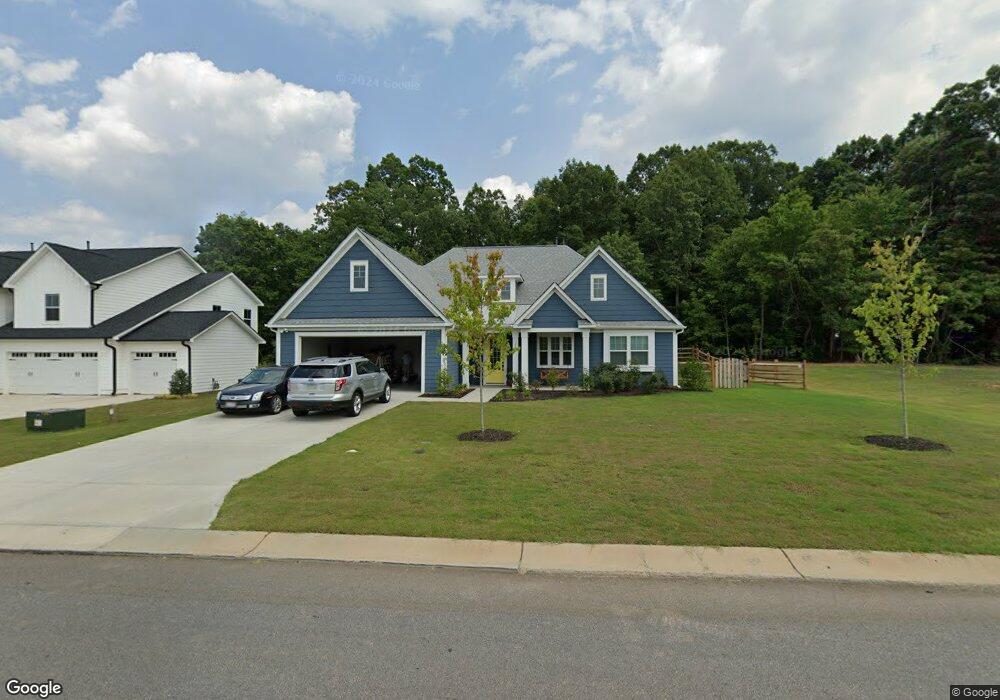
118 Round Rock Rd Unit Lot 116 Troutman, NC 28166
Estimated Value: $470,049 - $562,000
3
Beds
2
Baths
2,474
Sq Ft
$207/Sq Ft
Est. Value
About This Home
This home is located at 118 Round Rock Rd Unit Lot 116, Troutman, NC 28166 and is currently estimated at $512,262, approximately $207 per square foot. 118 Round Rock Rd Unit Lot 116 is a home located in Iredell County with nearby schools including Shepherd Elementary School, Troutman Middle School, and South Iredell High School.
Ownership History
Date
Name
Owned For
Owner Type
Purchase Details
Closed on
Jul 6, 2021
Sold by
Chidester Tray M and Chidester Autumn
Bought by
Daniel F And Sandra D Maclean Liv Tr
Current Estimated Value
Home Financials for this Owner
Home Financials are based on the most recent Mortgage that was taken out on this home.
Original Mortgage
$157,000
Outstanding Balance
$119,991
Interest Rate
2.9%
Mortgage Type
New Conventional
Estimated Equity
$392,271
Purchase Details
Closed on
May 13, 2020
Sold by
Nest Homes Llc
Bought by
Chidester Troy M and Chidester Autumn
Home Financials for this Owner
Home Financials are based on the most recent Mortgage that was taken out on this home.
Original Mortgage
$340,575
Interest Rate
3.3%
Mortgage Type
New Conventional
Purchase Details
Closed on
Feb 28, 2019
Sold by
Sanders Ridge Development Llc
Bought by
Nest Homes Llc
Create a Home Valuation Report for This Property
The Home Valuation Report is an in-depth analysis detailing your home's value as well as a comparison with similar homes in the area
Home Values in the Area
Average Home Value in this Area
Purchase History
| Date | Buyer | Sale Price | Title Company |
|---|---|---|---|
| Daniel F And Sandra D Maclean Liv Tr | $450,000 | None Available | |
| Chidester Troy M | $359,000 | None Available | |
| Nest Homes Llc | $160,000 | None Available |
Source: Public Records
Mortgage History
| Date | Status | Borrower | Loan Amount |
|---|---|---|---|
| Open | Daniel F And Sandra D Maclean Liv Tr | $157,000 | |
| Previous Owner | Chidester Troy M | $340,575 |
Source: Public Records
Tax History Compared to Growth
Tax History
| Year | Tax Paid | Tax Assessment Tax Assessment Total Assessment is a certain percentage of the fair market value that is determined by local assessors to be the total taxable value of land and additions on the property. | Land | Improvement |
|---|---|---|---|---|
| 2024 | $4,496 | $403,250 | $55,000 | $348,250 |
| 2023 | $4,496 | $403,250 | $55,000 | $348,250 |
| 2022 | $3,641 | $309,330 | $30,000 | $279,330 |
| 2021 | $3,606 | $309,330 | $30,000 | $279,330 |
| 2020 | $3,606 | $309,330 | $30,000 | $279,330 |
Source: Public Records
Map
Nearby Homes
- 122 Round Rock Rd
- 658 Houston Rd
- 306 Fesperman Cir
- 682 Houston Rd
- 183 Sugar Hill Rd
- 212 Sugar Hill Rd
- 232 Sugar Hill Rd
- 229 Fesperman Cir
- 204 Fesperman Cir
- 286 Winford Rd
- 294 Winford Rd
- 279 Winford Rd
- 144 Fairfield Dr
- 189 Fesperman Cir
- 108 Fairfield Dr
- 117 Carmine Ct
- 126 Forbes Ln
- 119 Fern Ln
- 170 Parkmont Dr Unit 171
- 154 Winford Rd
- 118 Round Rock Rd
- 122 Round Rock Rd
- 122 Round Rock Rd Unit Lot 115
- 130 Round Rock Rd
- 107 Round Rock Rd
- 115 Leafy Way
- 119 Round Rock Rd Unit 5
- 126 Round Rock Rd
- 115 Round Rock Rd Unit Lot 4
- 123 Round Rock Dr Unit 6
- 123 Round Rock Rd
- 111 Round Rock Rd Unit Lot 3
- 116 Leafy Way
- 127 Round Rock Rd Unit 7
- 107 Leafy Way
- 108 Leafy Way
- 108 Sugar Hill Rd
- 131 Round Rock Rd Unit 21
- 131 Round Rock Rd Unit 8
- 131 Round Rock Rd