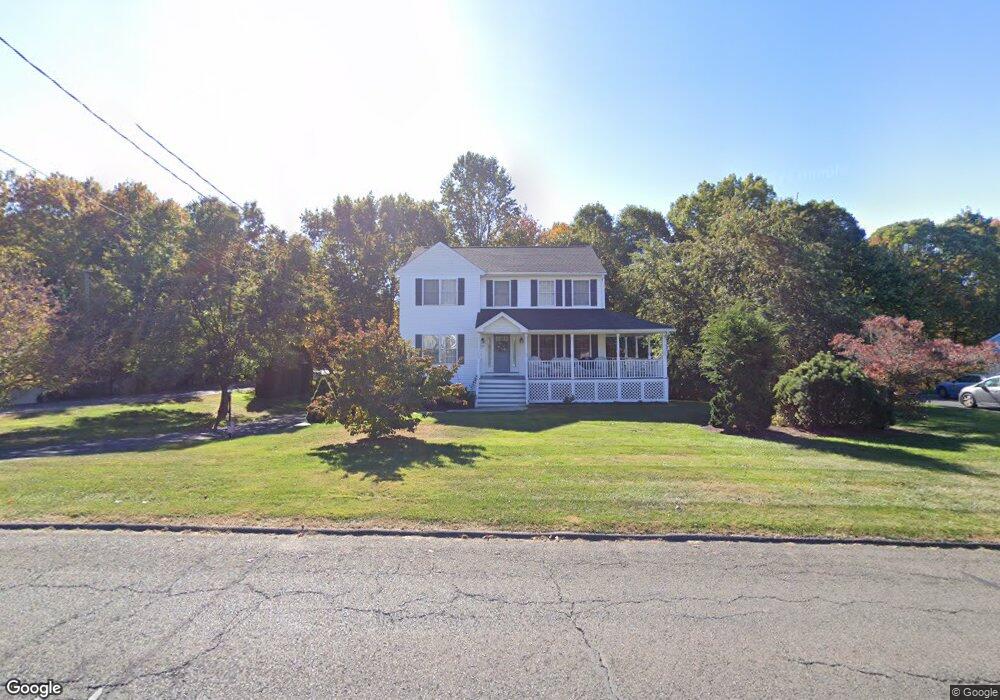
118 S Colman Rd Wolcott, CT 06716
Estimated Value: $554,000 - $794,000
5
Beds
3
Baths
2,608
Sq Ft
$246/Sq Ft
Est. Value
About This Home
This home is located at 118 S Colman Rd, Wolcott, CT 06716 and is currently estimated at $640,831, approximately $245 per square foot. 118 S Colman Rd is a home located in New Haven County with nearby schools including Tyrrell Middle School and Wolcott High School.
Ownership History
Date
Name
Owned For
Owner Type
Purchase Details
Closed on
Jul 5, 2011
Sold by
Fnma
Bought by
Sahbani Kamel and Sahbani Faten
Current Estimated Value
Home Financials for this Owner
Home Financials are based on the most recent Mortgage that was taken out on this home.
Original Mortgage
$248,800
Outstanding Balance
$172,053
Interest Rate
4.62%
Mortgage Type
Purchase Money Mortgage
Estimated Equity
$468,778
Purchase Details
Closed on
Aug 10, 2010
Sold by
Gmac Mortgage Llc
Bought by
Federal National Mortgage Association
Purchase Details
Closed on
Apr 19, 2010
Sold by
Tompkins 2Nd Ronald W
Bought by
Tompkins Cheryl A
Create a Home Valuation Report for This Property
The Home Valuation Report is an in-depth analysis detailing your home's value as well as a comparison with similar homes in the area
Home Values in the Area
Average Home Value in this Area
Purchase History
| Date | Buyer | Sale Price | Title Company |
|---|---|---|---|
| Sahbani Kamel | $311,000 | -- | |
| Federal National Mortgage Association | -- | -- | |
| Gmac Mortgage Llc | -- | -- | |
| Tompkins Cheryl A | -- | -- |
Source: Public Records
Mortgage History
| Date | Status | Borrower | Loan Amount |
|---|---|---|---|
| Open | Tompkins Cheryl A | $248,800 | |
| Previous Owner | Tompkins Cheryl A | $114,000 |
Source: Public Records
Tax History Compared to Growth
Tax History
| Year | Tax Paid | Tax Assessment Tax Assessment Total Assessment is a certain percentage of the fair market value that is determined by local assessors to be the total taxable value of land and additions on the property. | Land | Improvement |
|---|---|---|---|---|
| 2025 | $9,476 | $263,740 | $63,330 | $200,410 |
| 2024 | $8,722 | $263,740 | $63,330 | $200,410 |
| 2023 | $8,405 | $263,740 | $63,330 | $200,410 |
| 2022 | $8,123 | $263,740 | $63,330 | $200,410 |
| 2021 | $8,037 | $242,530 | $59,980 | $182,550 |
| 2020 | $8,037 | $242,530 | $59,980 | $182,550 |
| 2019 | $8,037 | $242,530 | $59,980 | $182,550 |
| 2018 | $7,809 | $242,530 | $59,980 | $182,550 |
| 2017 | $7,584 | $242,530 | $59,980 | $182,550 |
| 2016 | $7,133 | $246,720 | $60,990 | $185,730 |
| 2015 | $6,928 | $246,720 | $60,990 | $185,730 |
| 2014 | $6,703 | $246,720 | $60,990 | $185,730 |
Source: Public Records
Map
Nearby Homes
- 77 S Colman Rd
- 0 Bound Line Rd Unit 170253486
- 2 Old Farms Rd
- 87 Ransom Hall Rd
- 00 Woodtick Rd
- 1209 Woodtick Rd
- 13 Margaret Terrace
- 143 Bound Line Rd
- 124 East St
- 0 Coe Rd
- 0 Woodtick Rd Unit 24119429
- 44 Knollwood Dr
- 0 Central Avenue and Old Bound Line Rd
- 20 Upson Rd
- 2 Andrea Ave
- 245 East St
- 20 Wolf Hill Rd Unit 4D
- 20 Wolf Hill Rd Unit 6F
- 420 Winding Ridge
- 59 Forest Ln
- 124 S Colman Rd
- 112 S Colman Rd
- 106 S Colman Rd
- 130 S Colman Rd
- 38 Colonial Ct
- 14 Colonial Ct
- 20 Colonial Ct
- 100 S Colman Rd
- 8 Colonial Ct
- 26 Colonial Ct
- 125 S Colman Rd
- 119 S Colman Rd
- 2 Colonial Ct
- 136 S Colman Rd
- 113 S Colman Rd
- 44 Colonial Ct
- 94 S Colman Rd
- 32 Colonial Ct
- 131 S Colman Rd
- 31 Colonial Ct