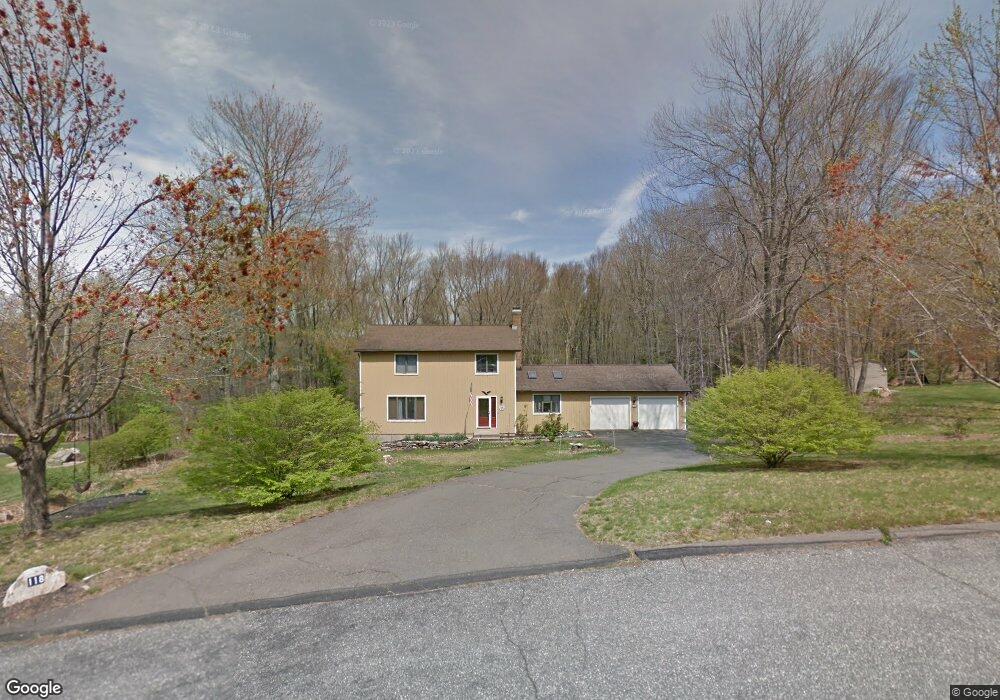
118 Satari Dr Coventry, CT 06238
Estimated Value: $493,000 - $572,000
4
Beds
3
Baths
2,098
Sq Ft
$252/Sq Ft
Est. Value
About This Home
This home is located at 118 Satari Dr, Coventry, CT 06238 and is currently estimated at $528,296, approximately $251 per square foot. 118 Satari Dr is a home located in Tolland County with nearby schools including Coventry Grammar School, George Hersey Robertson School, and Capt. Nathan Hale School.
Ownership History
Date
Name
Owned For
Owner Type
Purchase Details
Closed on
Mar 5, 2024
Sold by
Bullock John R and Bullock Monica M
Bought by
Bullock John R and Bullock Monica M
Current Estimated Value
Purchase Details
Closed on
Feb 18, 2004
Sold by
Krawczyk Robert and Krawczyk Claudine
Bought by
Bullock John
Purchase Details
Closed on
Mar 27, 2001
Sold by
Shaw Michael and Shaw Leslyn
Bought by
Krawczyk Robert and Krawczyk Claudine
Purchase Details
Closed on
Oct 23, 2000
Sold by
Benson John and Benson Sarah
Bought by
Shaw Michael and Shaw Leslyn
Purchase Details
Closed on
Nov 2, 1988
Sold by
Tomko Thomas
Bought by
Benson John
Create a Home Valuation Report for This Property
The Home Valuation Report is an in-depth analysis detailing your home's value as well as a comparison with similar homes in the area
Home Values in the Area
Average Home Value in this Area
Purchase History
| Date | Buyer | Sale Price | Title Company |
|---|---|---|---|
| Bullock John R | -- | None Available | |
| Bullock John R | -- | None Available | |
| Bullock John | $281,500 | -- | |
| Krawczyk Robert | $225,000 | -- | |
| Shaw Michael | $222,000 | -- | |
| Bullock John | $281,500 | -- | |
| Krawczyk Robert | $225,000 | -- | |
| Shaw Michael | $222,000 | -- | |
| Benson John | $220,000 | -- |
Source: Public Records
Mortgage History
| Date | Status | Borrower | Loan Amount |
|---|---|---|---|
| Previous Owner | Benson John | $35,000 | |
| Previous Owner | Benson John | $236,000 |
Source: Public Records
Tax History
| Year | Tax Paid | Tax Assessment Tax Assessment Total Assessment is a certain percentage of the fair market value that is determined by local assessors to be the total taxable value of land and additions on the property. | Land | Improvement |
|---|---|---|---|---|
| 2025 | $6,926 | $291,500 | $63,600 | $227,900 |
| 2024 | $6,555 | $196,800 | $57,800 | $139,000 |
| 2023 | $6,218 | $195,900 | $57,800 | $138,100 |
| 2022 | $6,102 | $195,900 | $57,800 | $138,100 |
| 2021 | $6,102 | $195,900 | $57,800 | $138,100 |
| 2020 | $6,106 | $195,900 | $57,800 | $138,100 |
| 2019 | $6,308 | $195,900 | $57,800 | $138,100 |
| 2018 | $5,909 | $183,500 | $57,800 | $125,700 |
| 2017 | $5,872 | $183,500 | $57,800 | $125,700 |
| 2016 | $5,725 | $183,500 | $57,800 | $125,700 |
| 2015 | $5,725 | $183,500 | $57,800 | $125,700 |
| 2014 | $5,685 | $199,700 | $63,400 | $136,300 |
Source: Public Records
Map
Nearby Homes
- 93 Dockerel Rd
- 0 Mile Hill Rd
- 16 Higgins Way
- 7 Laurelwood Ln Unit Lot 15
- 12 Laurelwood Ln Unit lot 8
- 5 Laurelwood Ln Unit lot 16
- 279 Mark Dr
- 64 Columbine Rd
- 23 Neville St
- 15 Elm Rd
- 720 Bolton Rd
- 0 Boston Turnpike Unit 24128587
- 395 Grant Hill Rd Unit Lot21
- 395 Grant Hill (Mill Race Drive) Lot #21 Rd
- 37 Wolf Hill Rd Unit Lot 40
- 37 Wolf Hill Lot (#40) Rd
- 79 Mile Hill Rd
- 39 Josephine Way
- 38 Josephine Way
- 25 Wolf Hill Rd
Your Personal Tour Guide
Ask me questions while you tour the home.