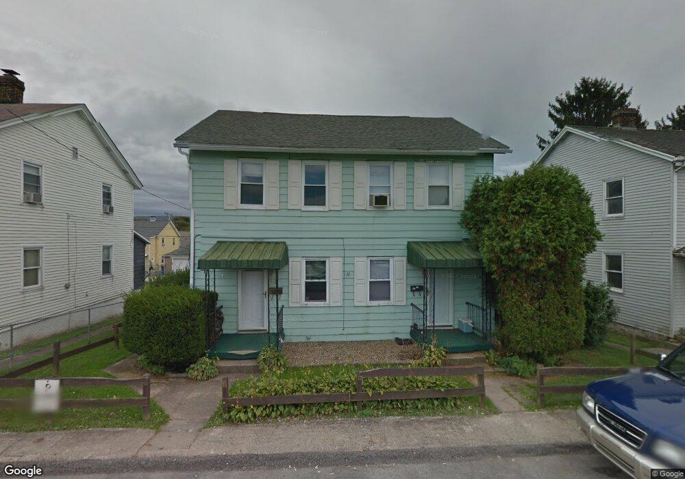
118 Shaffer St Uniontown, PA 15401
Estimated Value: $79,000 - $98,774
4
Beds
1
Bath
1,680
Sq Ft
$50/Sq Ft
Est. Value
About This Home
This home is located at 118 Shaffer St, Uniontown, PA 15401 and is currently estimated at $84,444, approximately $50 per square foot. 118 Shaffer St is a home located in Fayette County with nearby schools including Laurel Highlands Senior High School, St. John the Evangelist School, and Chestnut Ridge Christian Academy.
Ownership History
Date
Name
Owned For
Owner Type
Purchase Details
Closed on
Feb 13, 2025
Sold by
Riggar George and Riggar Kimberly
Bought by
Miller Daneia
Current Estimated Value
Home Financials for this Owner
Home Financials are based on the most recent Mortgage that was taken out on this home.
Original Mortgage
$73,641
Outstanding Balance
$72,993
Interest Rate
7.04%
Mortgage Type
FHA
Estimated Equity
$11,451
Purchase Details
Closed on
Oct 14, 2005
Sold by
Harper Lani and Harper James
Bought by
Riggar George and Riggar Kimberly
Create a Home Valuation Report for This Property
The Home Valuation Report is an in-depth analysis detailing your home's value as well as a comparison with similar homes in the area
Home Values in the Area
Average Home Value in this Area
Purchase History
| Date | Buyer | Sale Price | Title Company |
|---|---|---|---|
| Miller Daneia | $75,000 | None Listed On Document | |
| Riggar George | $35,000 | None Available |
Source: Public Records
Mortgage History
| Date | Status | Borrower | Loan Amount |
|---|---|---|---|
| Open | Miller Daneia | $73,641 |
Source: Public Records
Tax History Compared to Growth
Tax History
| Year | Tax Paid | Tax Assessment Tax Assessment Total Assessment is a certain percentage of the fair market value that is determined by local assessors to be the total taxable value of land and additions on the property. | Land | Improvement |
|---|---|---|---|---|
| 2025 | $548 | $19,195 | $8,820 | $10,375 |
| 2024 | $532 | $19,195 | $8,820 | $10,375 |
| 2023 | $1,024 | $19,195 | $8,820 | $10,375 |
| 2022 | $1,014 | $19,195 | $8,820 | $10,375 |
| 2021 | $986 | $19,195 | $8,820 | $10,375 |
| 2020 | $986 | $19,195 | $8,820 | $10,375 |
| 2019 | $905 | $19,195 | $8,820 | $10,375 |
| 2018 | $878 | $19,195 | $8,820 | $10,375 |
| 2017 | $878 | $19,195 | $8,820 | $10,375 |
| 2016 | -- | $19,195 | $8,820 | $10,375 |
| 2015 | -- | $19,195 | $8,820 | $10,375 |
| 2014 | -- | $38,390 | $17,640 | $20,750 |
Source: Public Records
Map
Nearby Homes
- 120 Shaffer St
- 122 Shaffer St
- 40 Miller Ave
- 26 Coal Lick Run
- 92 Nutt Ave
- 71 Lebanon Ave
- 75 Nutt Ave
- 114 Clarendon Ave
- 124 Clarendon Ave
- 15 Dawson Ave
- 21 Dawson Ave
- 26 Wilmac St
- 354 Braddock Ave
- 220 Clarendon Ave
- 372 Braddock Ave
- 39 Dunkard Ave
- 33 Mccormick Ave
- 83 S Mount Vernon Ave
- 17 Summit Ave
- 2 Mccormick Ave
- 116 Shaffer St
- 112 Shaffer St
- 264 S Mount Vernon Ave
- 266 S Mount Vernon Ave
- 270 S Mount Vernon Ave
- 262 S Mount Vernon Ave
- 258 S Mount Vernon Ave
- 108 Shaffer St
- 276 S Mount Vernon Ave
- 124 Shaffer St
- 106 Shaffer St
- 254 S Mount Vernon Ave
- 257 S Mount Vernon Ave
- 253 S Mount Vernon Ave
- 269 S Mount Vernon Ave
- 255 S Mount Vernon Ave
- 86 Easy St
- 86 1st St
- 86 1st Easy St
- 29 Easy St