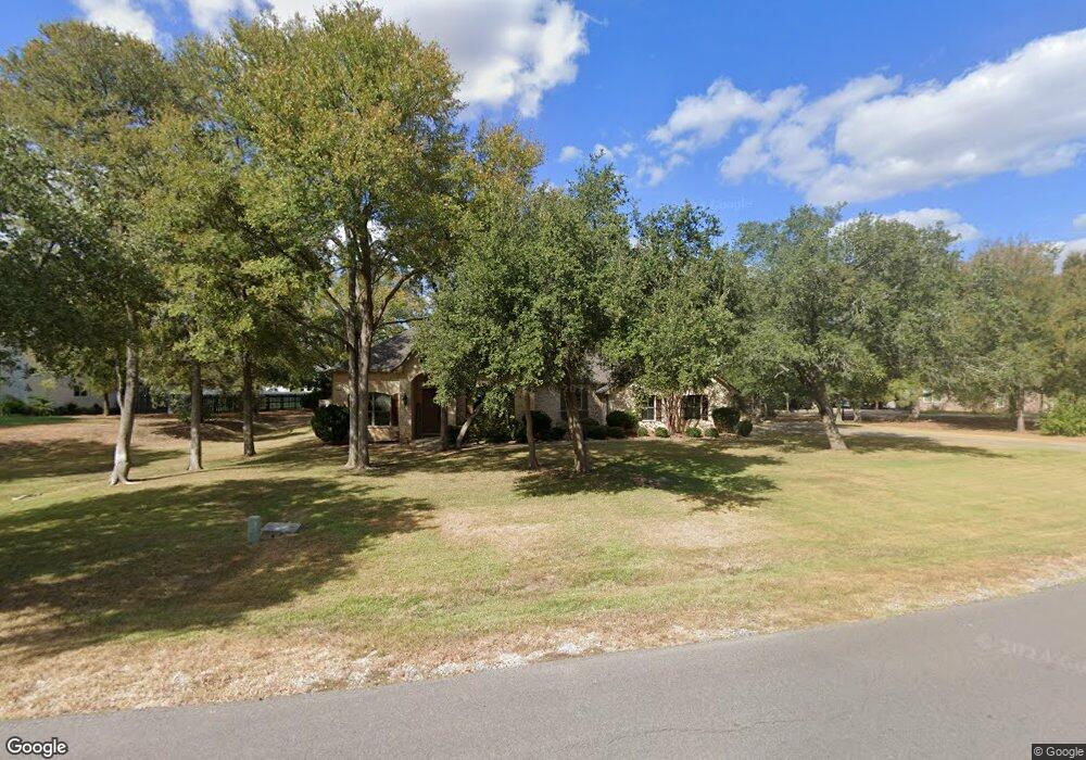
118 Spring Branch Bastrop, TX 78602
Estimated Value: $492,000 - $686,000
--
Bed
--
Bath
2,450
Sq Ft
$241/Sq Ft
Est. Value
About This Home
This home is located at 118 Spring Branch, Bastrop, TX 78602 and is currently estimated at $591,532, approximately $241 per square foot. 118 Spring Branch is a home located in Bastrop County with nearby schools including Mina Elementary School, Bastrop Intermediate School, and Bastrop Middle School.
Ownership History
Date
Name
Owned For
Owner Type
Purchase Details
Closed on
May 12, 2011
Sold by
Ellsworth Jon Brannon
Bought by
Ellsworth Kiley Rachelle
Current Estimated Value
Purchase Details
Closed on
Oct 19, 2005
Sold by
Ellsworth Kerry W
Bought by
Ellsworth Jon Brannon
Purchase Details
Closed on
May 5, 2005
Sold by
Ralph Jeannie M
Bought by
Ellsworth Kerry W
Create a Home Valuation Report for This Property
The Home Valuation Report is an in-depth analysis detailing your home's value as well as a comparison with similar homes in the area
Home Values in the Area
Average Home Value in this Area
Purchase History
| Date | Buyer | Sale Price | Title Company |
|---|---|---|---|
| Ellsworth Kiley Rachelle | -- | None Available | |
| Ellsworth Kiley Rachelle | -- | None Available | |
| Ellsworth Jon Brannon | -- | None Available | |
| Ellsworth Kerry W | -- | None Available |
Source: Public Records
Mortgage History
| Date | Status | Borrower | Loan Amount |
|---|---|---|---|
| Closed | Ellsworth Kiley Rachelle | $0 |
Source: Public Records
Tax History Compared to Growth
Tax History
| Year | Tax Paid | Tax Assessment Tax Assessment Total Assessment is a certain percentage of the fair market value that is determined by local assessors to be the total taxable value of land and additions on the property. | Land | Improvement |
|---|---|---|---|---|
| 2025 | $7,262 | $575,709 | $153,594 | $422,115 |
| 2023 | $7,262 | $482,248 | $0 | $0 |
| 2022 | $6,234 | $386,130 | $0 | $0 |
| 2021 | $6,948 | $369,164 | $59,976 | $309,188 |
| 2020 | $6,513 | $319,115 | $37,887 | $281,228 |
| 2019 | $6,763 | $319,115 | $37,887 | $281,228 |
| 2018 | $7,270 | $341,425 | $37,887 | $303,538 |
| 2017 | $7,176 | $320,722 | $41,676 | $279,046 |
| 2016 | $6,551 | $292,781 | $37,887 | $254,894 |
| 2015 | $5,096 | $256,714 | $37,887 | $218,827 |
| 2014 | $5,096 | $234,816 | $29,151 | $205,665 |
Source: Public Records
Map
Nearby Homes
- 130 Axis Trail
- TBD (27 Acres) Shiloh Rd
- 123 Lone Star Cir
- 206 Pheasant Trail
- 203 Pheasant Trail
- 401 S Hunting Lodge Ln
- 102 Buck Shot Ct
- 102 Thompson Trail
- 341 Bird Dog Bend
- 204 Caliber Cove
- 127 Eleanor Ln
- 235 El Camino River Rd
- 1133 Largemouth Ln
- 709 Bluffview Dr
- 310 Pack Horse Dr
- 217 Baron Creek Trail
- 426 Shiloh Rd
- 132 Brittany Ln
- 410 Watercourse Way
- 708 Shallowford
- 132 Spring Branch
- 110 Spring Branch
- 103 Jacobs Cove
- 121 Spring Branch
- 121 Spring Branch
- 144 Spring Branch
- 115 Spring Branch
- 104 Spring Branch
- 111 Spring Branch
- 101 Jacobs Cove
- 133 Spring Branch
- 137 Spring Branch
- 102 Jacobs Cove
- 128 Spring Meadow
- 150 Spring Branch
- 103 Spring Branch
- 141 Spring Branch
- 110 Bobcat Trail
- 118 Spring Meadow
- 112 Spring Meadow