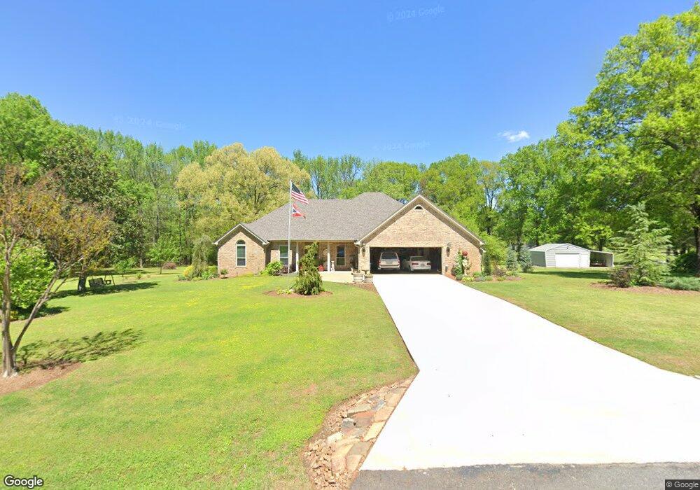
118 Stanford Rd Conway, AR 72032
Estimated Value: $277,000 - $310,431
--
Bed
2
Baths
2,137
Sq Ft
$140/Sq Ft
Est. Value
About This Home
This home is located at 118 Stanford Rd, Conway, AR 72032 and is currently estimated at $298,358, approximately $139 per square foot. 118 Stanford Rd is a home located in Faulkner County with nearby schools including Theodore Jones Elementary School, Conway Junior High School, and Conway High School.
Ownership History
Date
Name
Owned For
Owner Type
Purchase Details
Closed on
Jun 2, 2016
Sold by
Howe William F
Bought by
Howe William F and Howe Megan R
Current Estimated Value
Purchase Details
Closed on
Apr 6, 2006
Bought by
Howe/Simmons Trustees
Purchase Details
Closed on
Mar 29, 2006
Bought by
Howe/Simmons Trustees
Purchase Details
Closed on
Mar 9, 2006
Bought by
Howe
Purchase Details
Closed on
Mar 1, 2006
Bought by
Howe
Create a Home Valuation Report for This Property
The Home Valuation Report is an in-depth analysis detailing your home's value as well as a comparison with similar homes in the area
Home Values in the Area
Average Home Value in this Area
Purchase History
| Date | Buyer | Sale Price | Title Company |
|---|---|---|---|
| Howe William F | -- | None Available | |
| Howe/Simmons Trustees | -- | -- | |
| Howe/Simmons Trustees | -- | -- | |
| Howe | $146,000 | -- | |
| Howe | $146,000 | -- |
Source: Public Records
Tax History Compared to Growth
Tax History
| Year | Tax Paid | Tax Assessment Tax Assessment Total Assessment is a certain percentage of the fair market value that is determined by local assessors to be the total taxable value of land and additions on the property. | Land | Improvement |
|---|---|---|---|---|
| 2025 | $2,069 | $61,020 | $7,500 | $53,520 |
| 2024 | $1,975 | $61,020 | $7,500 | $53,520 |
| 2023 | $1,881 | $45,900 | $4,800 | $41,100 |
| 2022 | $1,524 | $45,900 | $4,800 | $41,100 |
| 2021 | $1,403 | $45,900 | $4,800 | $41,100 |
| 2020 | $1,321 | $35,260 | $3,400 | $31,860 |
| 2019 | $1,321 | $35,260 | $3,400 | $31,860 |
| 2018 | $1,299 | $35,260 | $3,400 | $31,860 |
| 2017 | $1,227 | $35,260 | $3,400 | $31,860 |
| 2016 | $1,154 | $31,130 | $3,400 | $27,730 |
| 2015 | $1,154 | $37,070 | $3,400 | $33,670 |
| 2014 | $1,154 | $37,070 | $3,400 | $33,670 |
Source: Public Records
Map
Nearby Homes
- 104 N Woodland Dr
- 20 Caddo Dr
- Lot 9 J Hawks Dr
- 5 E Cadron Ridge Rd
- 00 Sandlewood Rd
- 13 Sandlewood Rd
- 1950 Shadow Falls Dr
- 3610 Breezy Cir
- 3655 Campfire Cove
- 23 Gapview Rd
- 12 Beaverfork Place
- 000 Hwy 65 Springhill
- 3030 Plateau Dr
- 24 Blue Jay Way
- 1250 Edge Valley Dr N
- 1230 Littlewood Cove
- 13 Loyal Ln
- 0 Hwy 65 Unit 18011955
- 2800 Plateau Dr
- 5 Savage Ln
- 116 Stanford Rd
- 120 Stanford Rd
- 117 Stanford Rd
- 115 James Rd
- 115 Stanford Rd
- 114 Stanford Rd
- 118 James Rd
- 122 Stanford Rd
- 113 James Rd
- 116 James Rd
- 114 James Rd
- 113 Stanford Rd
- 121 Stanford Rd
- 112 Stanford Rd
- 124 Stanford Rd
- 112 James Rd
- 118 N Woodland Dr
- 116 N Woodland Dr
- 125 Stanford Rd
- 111 Stanford Rd